Current Cycle Cycle - 6 h Cycle - 12 h Cycle - 18 h Cycle - 24 h Cycle - 30 h Cycle - 36 h Cycle - 42 h Cycle - 48 h Loop Sea Level Pressure
Analysis Ensemble mean (contours, hPa) and ensemble standard deviation (shading) sea level pressure.2014112000 2014111918 2014111912 2014111906 2014111900 2014111818 2014111812 2014111806 2014111800 Loop Analysis Steering Wind
Analysis ensemble mean (barbs) and vector ensemble standard deviation (shading) of 400-800 hPa layer average wind.2014112000 2014111918 2014111912 2014111906 2014111900 2014111818 2014111812 2014111806 2014111800 Loop Steering Wind Inc.
Background ensemble mean (barbs) and vector increment (shading) 400-800 hPa layer average wind.2014112000 2014111918 2014111912 2014111906 2014111900 2014111818 2014111812 2014111806 2014111800 Loop Analysis Precipitable Water
Analysis ensemble mean (contours, mm) and ensemble standard deviation (shading) precipitable water.2014112000 2014111918 2014111912 2014111906 2014111900 2014111818 2014111812 2014111806 2014111800 Loop Precipitable Water Inc.
Background ensemble-mean (contours, mm) and analysis increment (shading) precipitable water valid at analysis time.2014112000 2014111918 2014111912 2014111906 2014111900 2014111818 2014111812 2014111806 2014111800 Loop Precipitation
Analysis ensemble mean SLP (contours, units hPa) and six hour precipitation (shading, units mm) valid at analysis time.2014112000 2014111918 2014111912 2014111906 2014111900 2014111818 2014111812 2014111806 2014111800 Loop Observations
Distribution of observations ingested into the assimilation system.2014112000 2014111918 2014111912 2014111906 2014111900 2014111818 2014111812 2014111806 2014111800 Loop
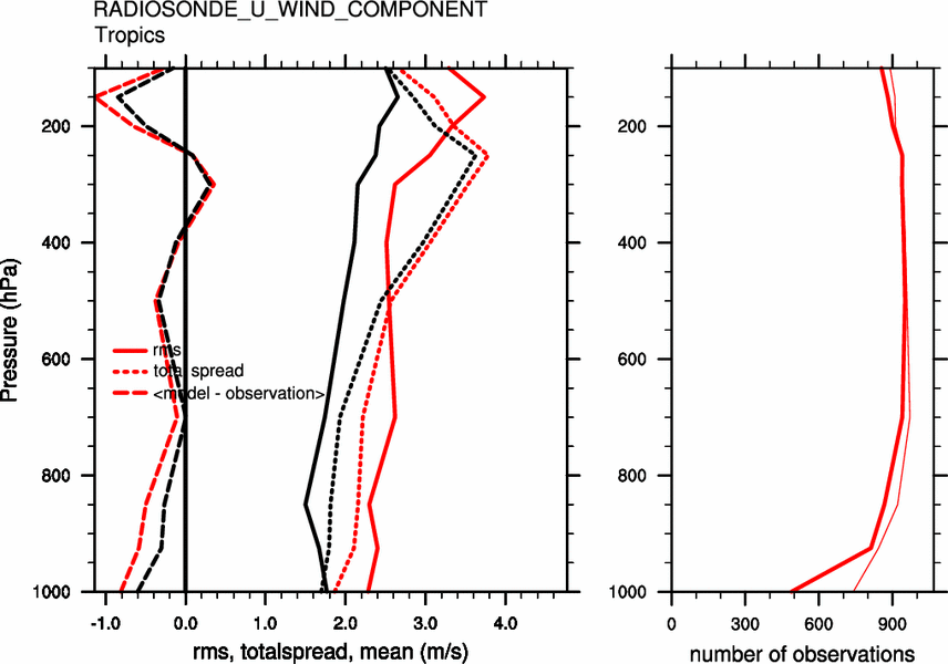
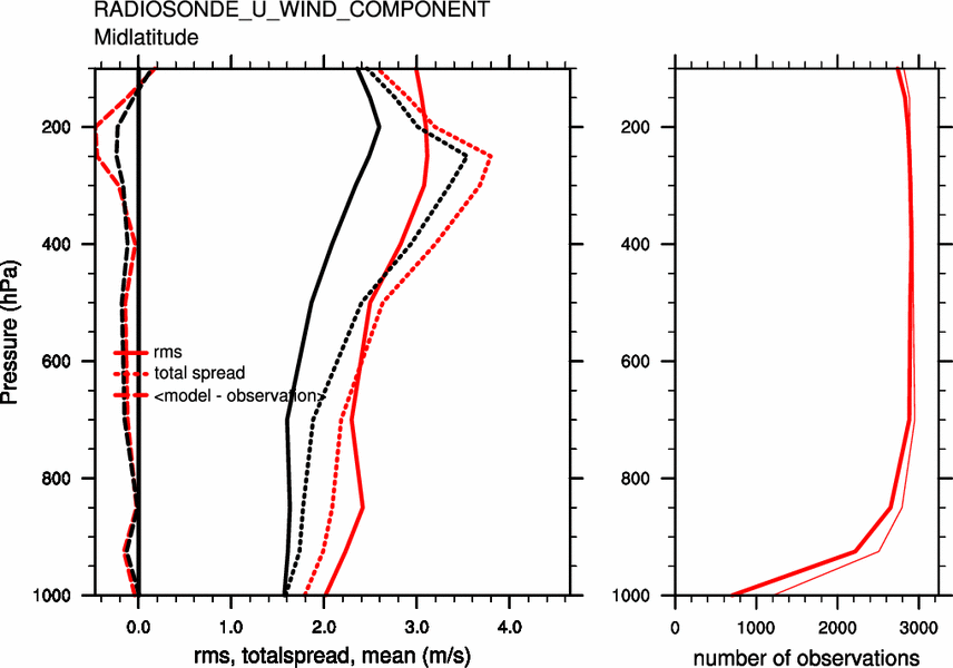
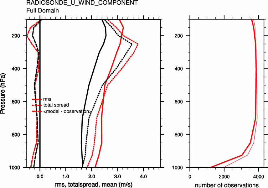
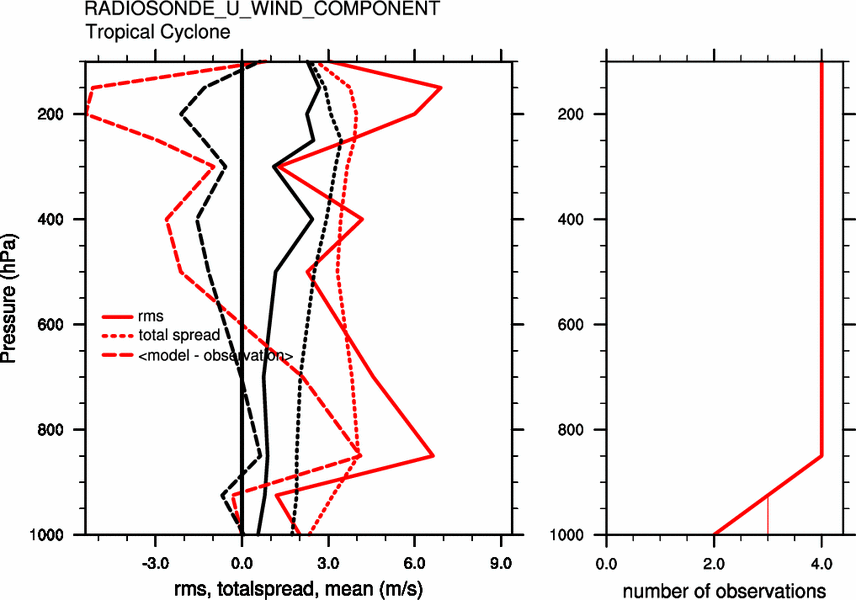
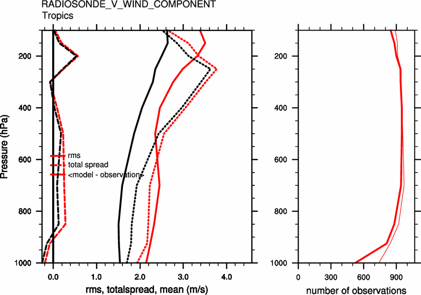
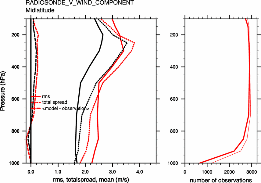
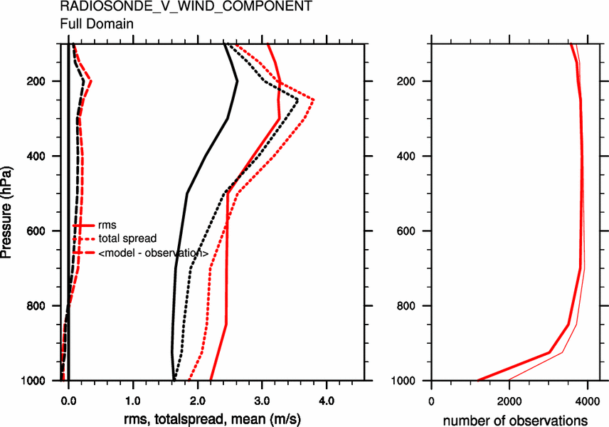
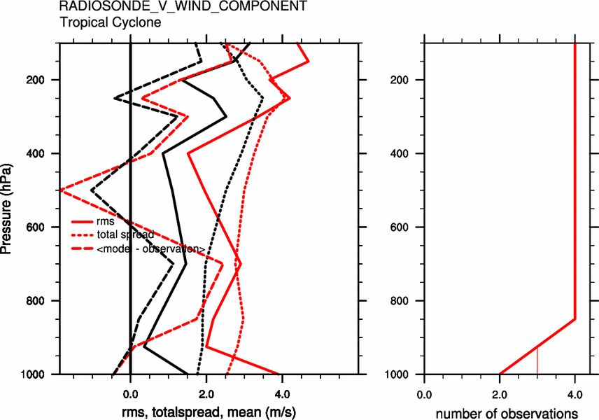
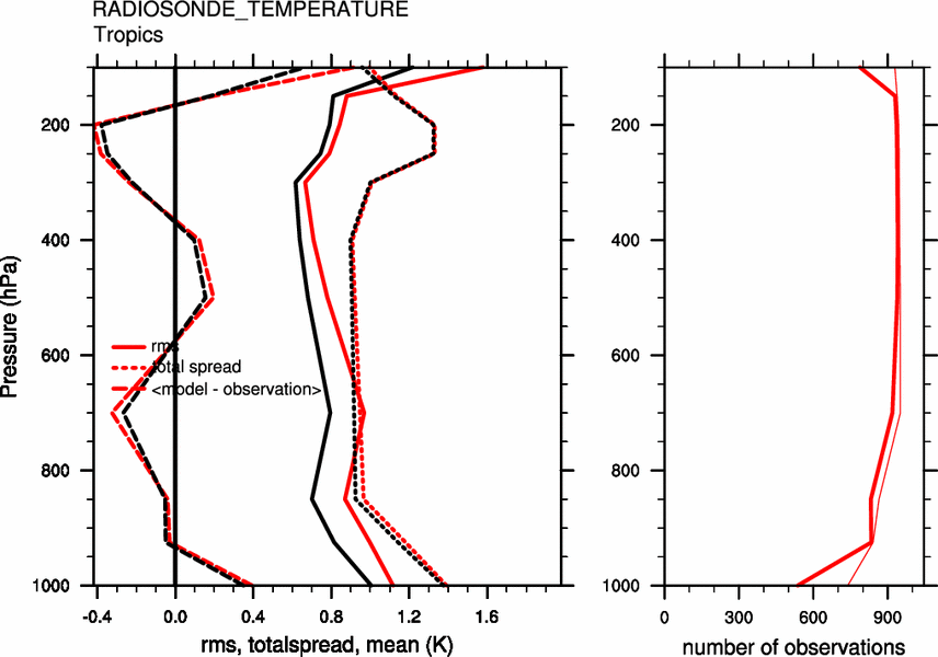
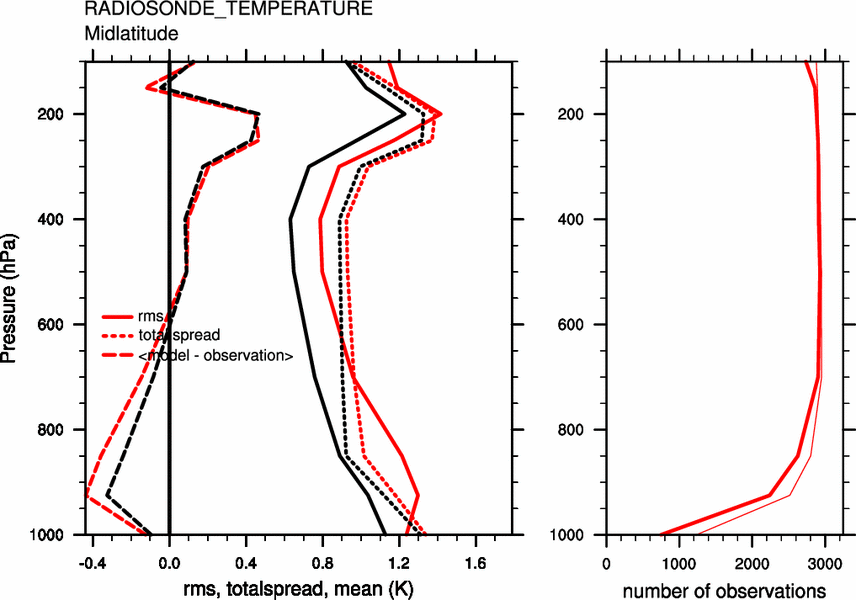
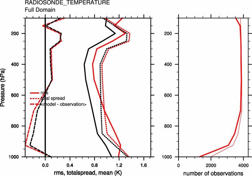
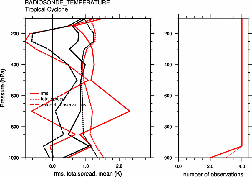
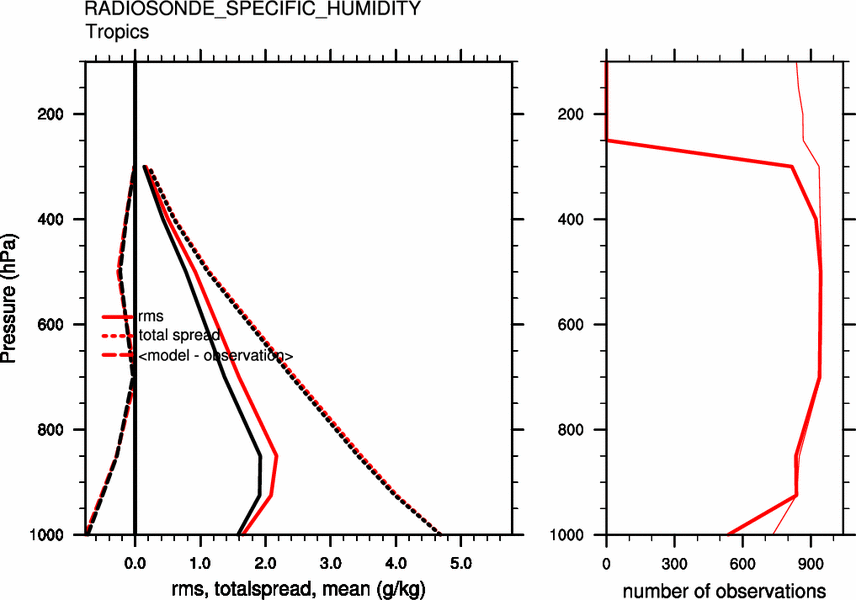
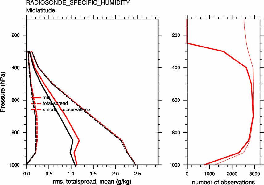
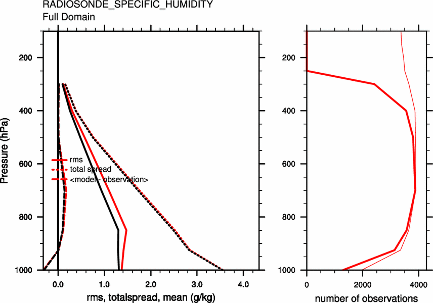
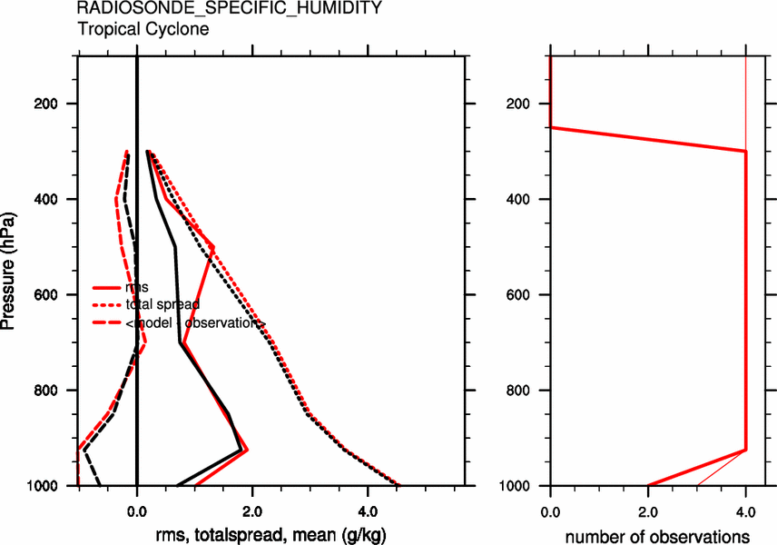
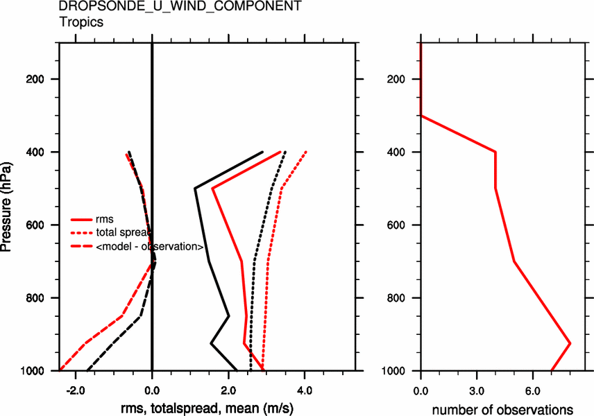
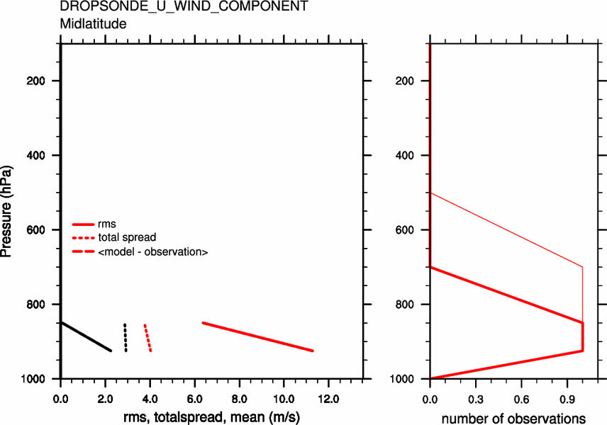
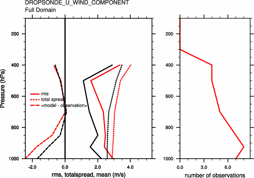
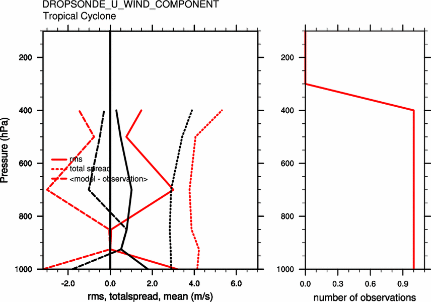
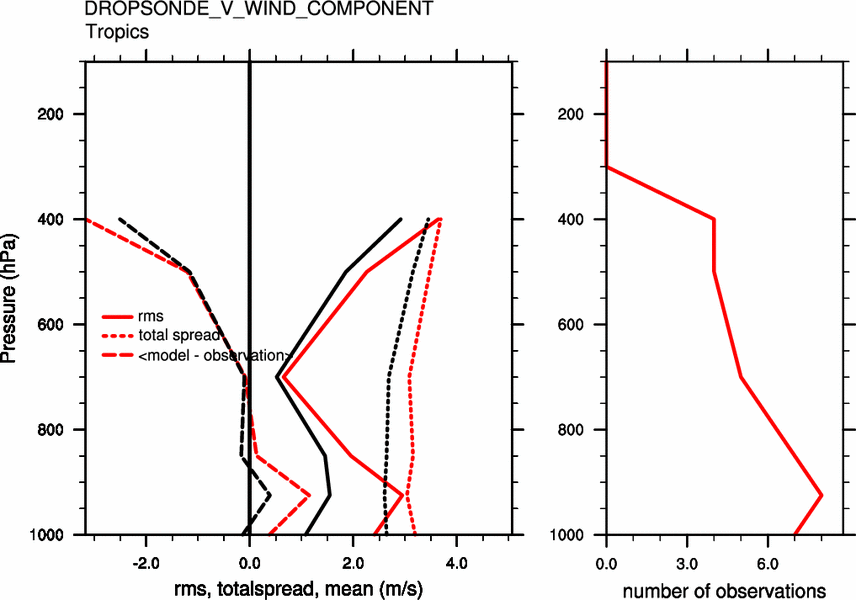
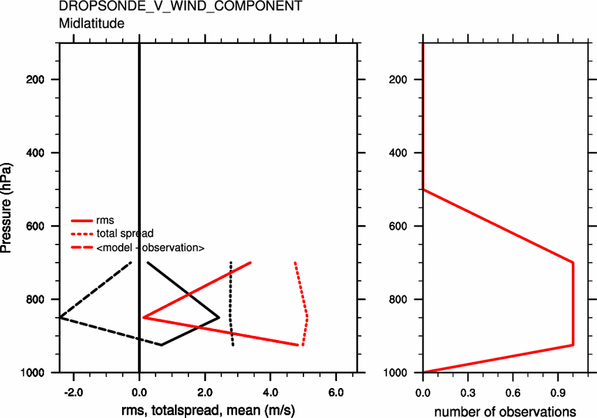
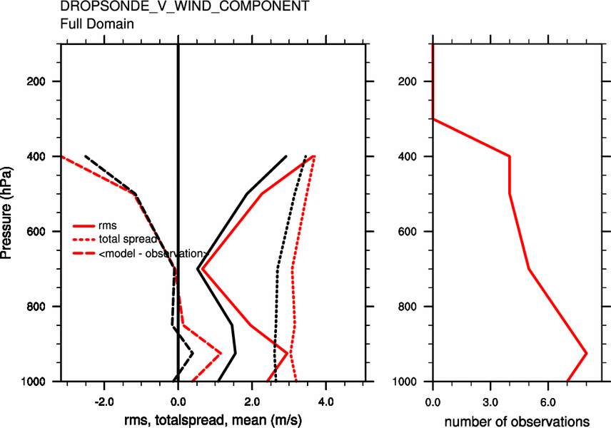
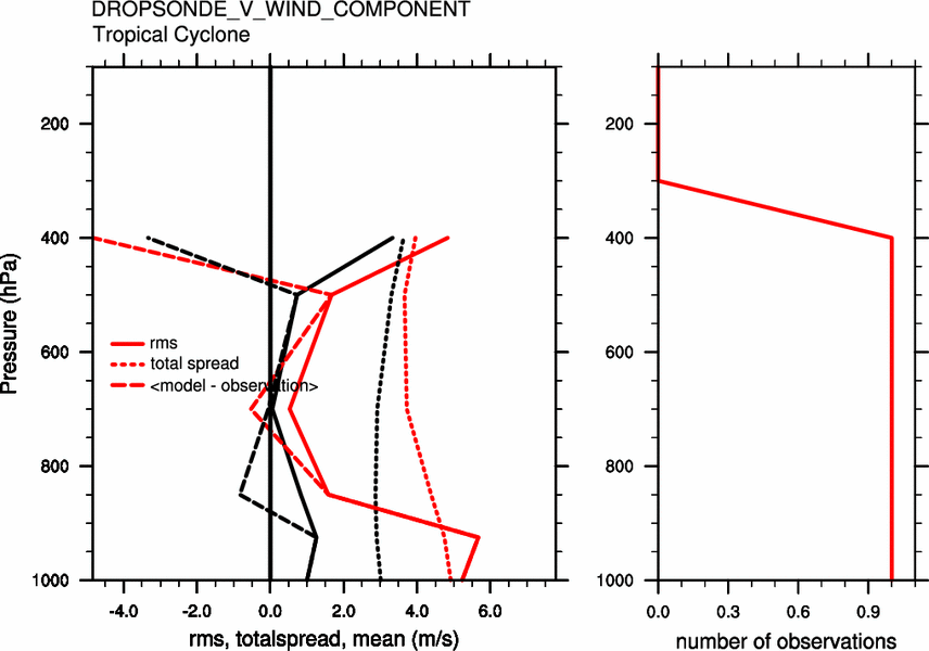
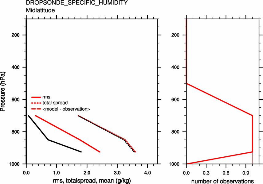
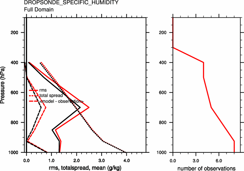
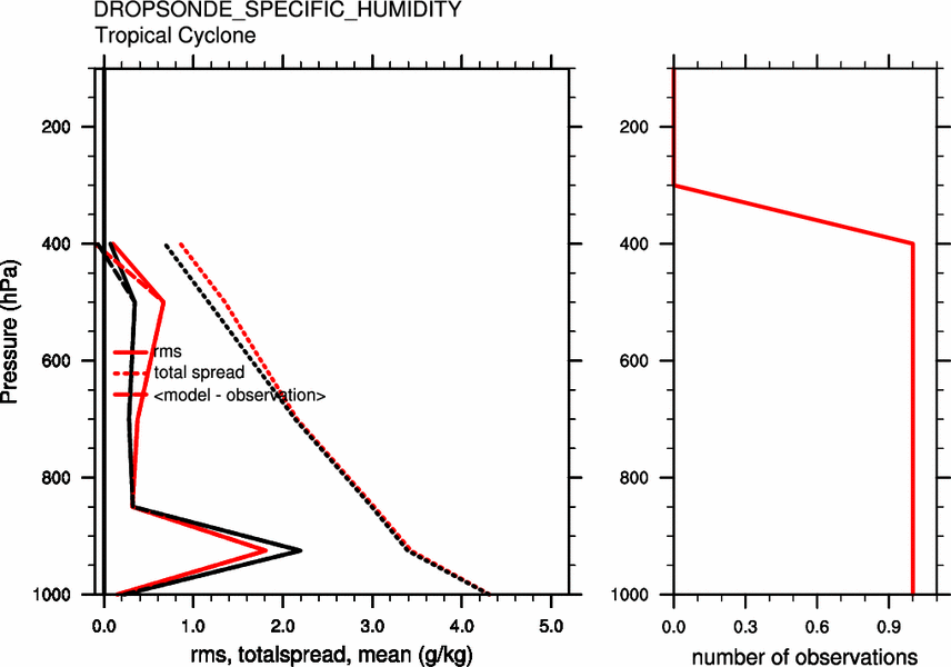
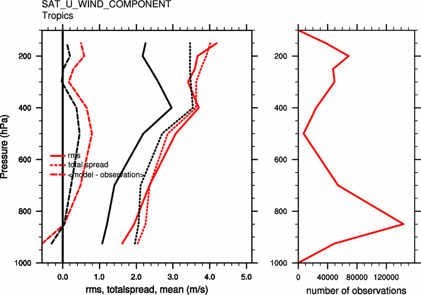
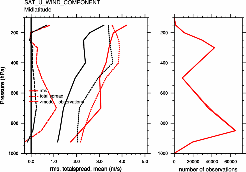
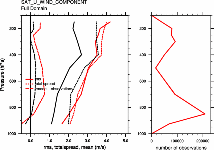
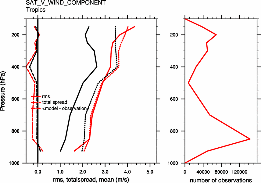
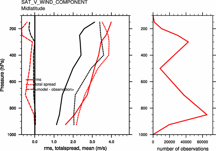
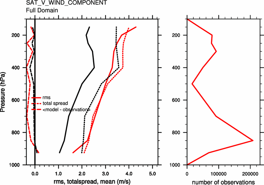
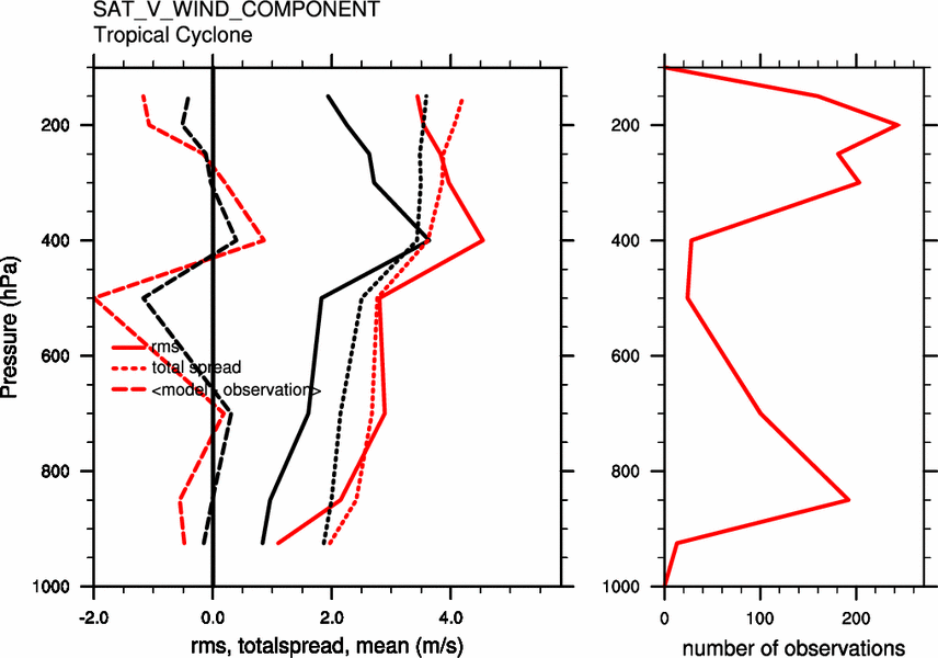
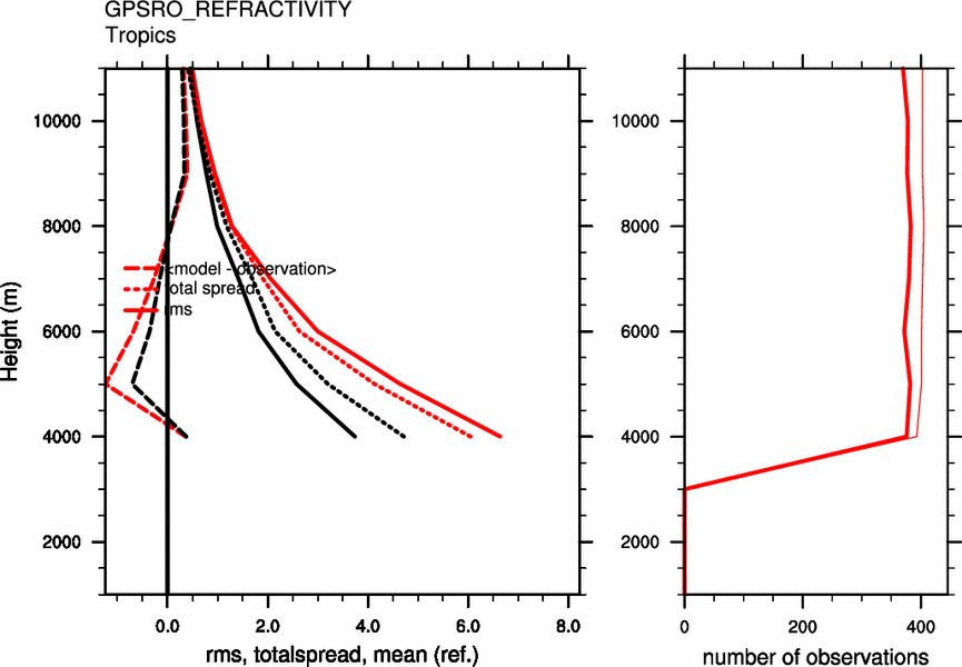
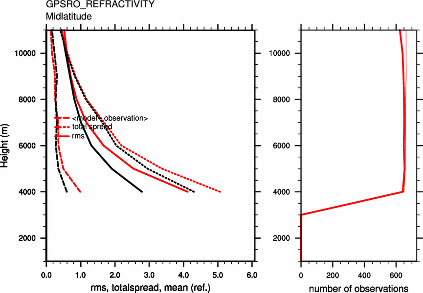
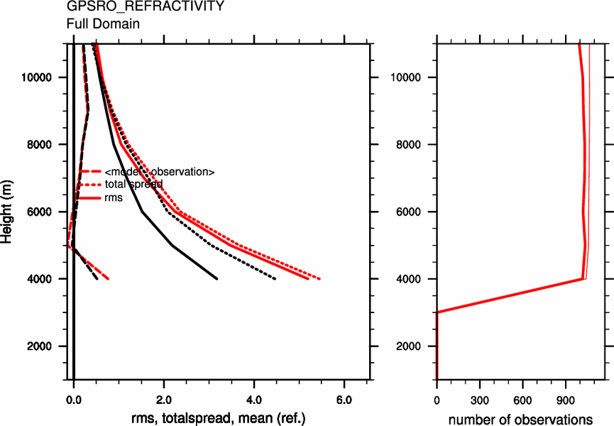
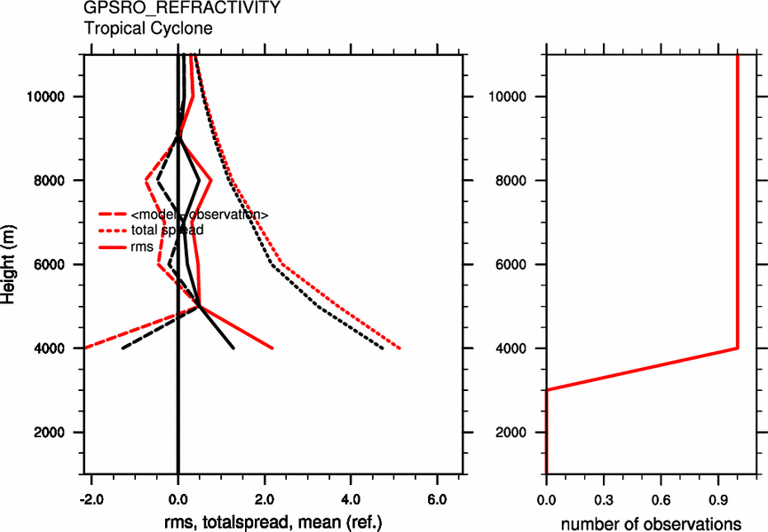
Tropics ( < 30N ) Midlatitude( > 30N ) Full Domain < 500 km of TC Rawinsonde U Wind
Analysis (black) and background (red) errors against rawinsonde zonal wind observations over past 14 days.obs obs obs obs Rawinsonde V Wind
Analysis (black) and background (red) errors against rawinsonde meridional wind observations over past 14 days.obs obs obs obs Rawinsonde Temperature
Analysis (black) and background (red) errors against rawinsonde temperature observations over past 14 days.obs obs obs obs Rawinsonde Specific Humidity
Analysis (black) and background (red) errors against rawinsonde humidity observations over past 14 days.obs obs obs obs Dropsonde U Wind
Analysis (black) and background (red) errors against dropsonde zonal wind observations over past 14 days.obs obs obs obs Dropsonde V Wind
Analysis (black) and background (red) errors against dropsonde meridional wind observations over past 14 days.obs obs obs obs Dropsonde Temperature
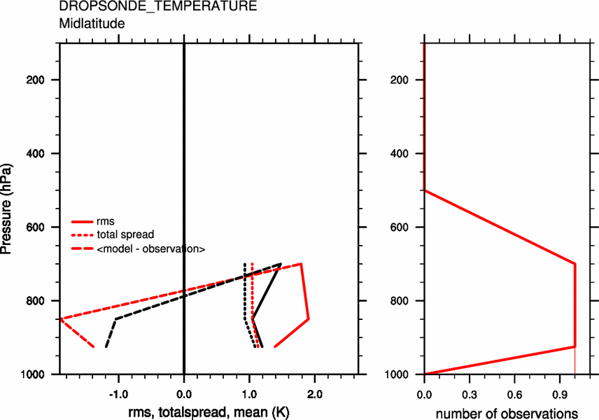
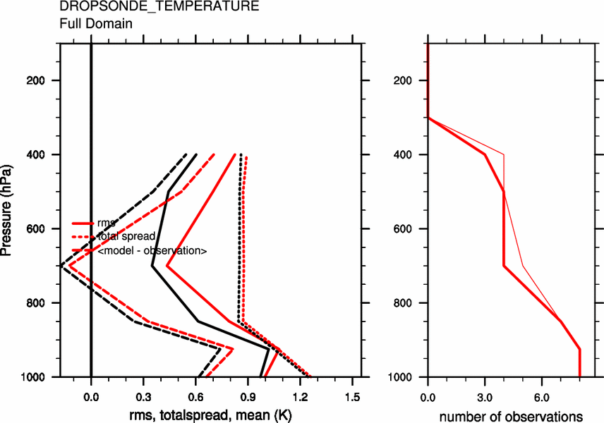
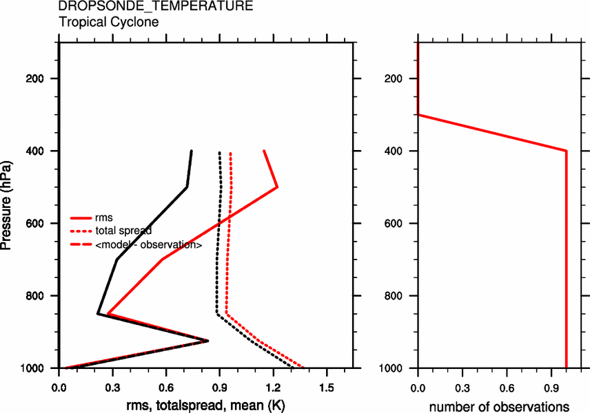
Analysis (black) and background (red) errors against dropsonde temperature observations over past 14 days.obs obs obs obs Dropsonde Specific Humidity
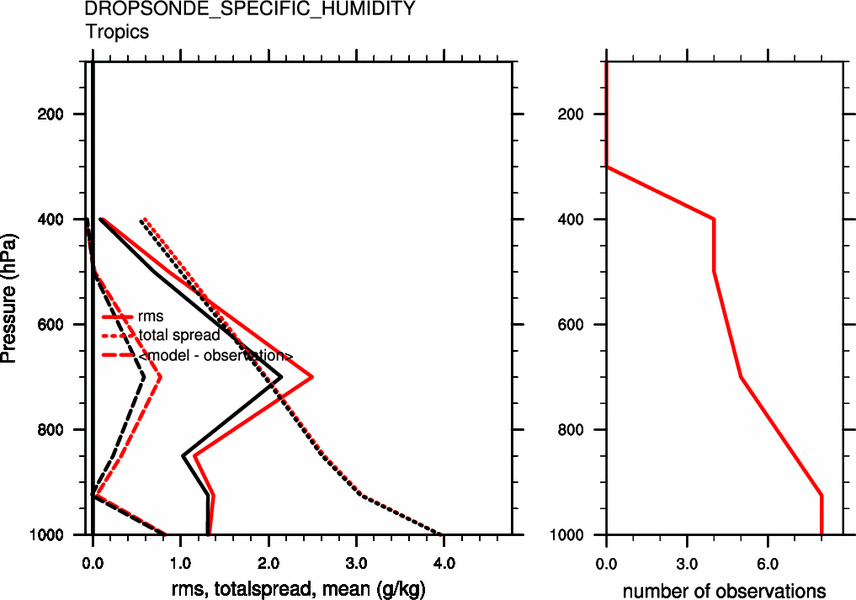
Analysis (black) and background (red) errors against dropsonde humidity observations over past 14 days.obs obs obs obs Satellite U Wind
Analysis (black) and background (red) errors against satellite zonal wind observations over past 14 days.obs obs obs obs Satellite V Wind
Analysis (black) and background (red) errors against satellite meridional wind observations over past 14 days.obs obs obs obs GPS Refractivity
Analysis (black) and background (red) errors against GPS occultation observations over past 14 days.obs obs obs obs
- 96 member WRF-ARW ensemble, 36 km horizontal resolution, 36 vertical levels up to 20 hPa, WSM 6 class microphysics, YSU PBL, NOAH LSM.
- All INVEST and TC have a 12 km fixed-move nest.
- Analyses generated each six hours by assimilating surface pressure, rawinsonde data, dropsonde data, aircraft data, ACARS, cloud winds, TC position and minimum SLP data.
- This work is supported by the NOAA Hurricane Forecast Improvement Project and NSF Grant ATM-0850642.
- Calculations are carried out on NOAA t-jet.