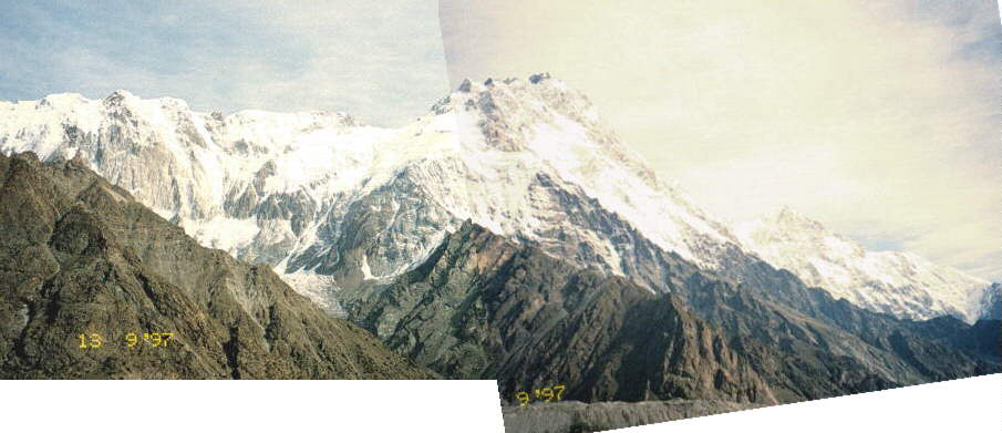
1. Panorama looking north to summit of Nanga Parbat (8143m), 8th highest mountain on Earth. Photo is taken from Shagin Glacier on southern side of Rupal Valley. Nearly 5 km of relief is visible; long moraine ridge at foot of photo is Shaigiri Glacier; Shaigiri village sits at ~3400m. Photo pair clearly shows ~50° NW dipping layer of black gneiss forming upper 400m of summit of Nanga Parbat. Below are thick sequences of migmatitc granitic gneiss with local 100's metres thick leucogranite plutons (e.g. Mazeno Pass Pluton, 1.4 Ma coincident Th-Pb monazite & U-Pb zircon age). The ~1.5 km thick granite pluton seen in the left side of photo pair has not been dated (note large dark biotite-gneiss xenolith!). Extensive, cross-cutting pegmatitic dyke suites (1.2 - 2.4 Ma) are just visible at very bottom right of photo pair. Lower regions (and probably all) of field of view contain numerous ductile to brittle SE-vergent thrust faults, some of which show good evidence for later normal motion.
Image copyright © 1997 M.A. Edwards.
(email
to request permission to use)