AATM 200 Fall 2015
Exam #1 Most Missed Topic Areas
Below is an outline of the
“most missed” topic areas on Exam #1 based on the entire class. These are the areas you need to review/study
for the upcoming Final Exam.
Note: Review all textbook “Study Guide Material” questions marked with the “†” in blue;
also, review all ♦♦ in the notes, as
well as the Youtube video links on the Lecture
Summaries. (For those signed up for Connect Plus,
you might want to review/practice the LearnSmart activities on
these topics.)
”Rule of
70”: allows approximation of doubling
times:
70
Doubling time (in years) = -------------------------
% growth rate/year
Example: what is the expected population after 42
years, with an initial population of 20,000 and an annual growth rate of 5%?
“Rule of 70” = (70 / 5) → population doubles
every 14 years
After first 14 years: 40,000;
after next 14 years: 80,000; after final 14 years: 160,000
Cost-Benefit Decision Making: Uses magnitude,
frequency and return period for a given event.
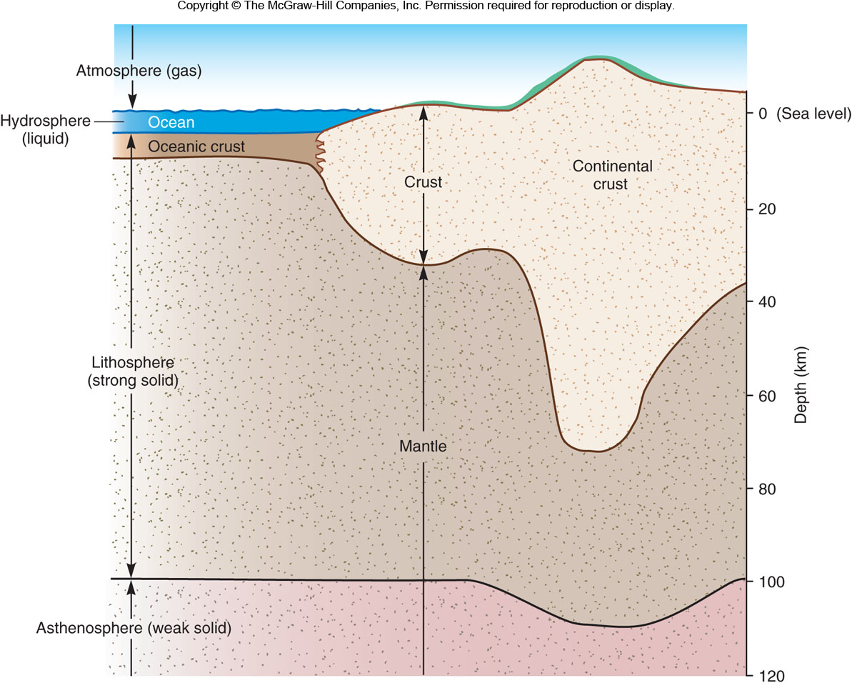
Isostasy:
applies a buoyancy principle to the low
density continents and mountain
ranges that literally float on
the denser mantle below.
Energy Sources of Disasters: (1)
Impact of extraterrestrial bodies; (2) Gravity; (3) Earth’s internal
heat; (4) The Sun (external heat)
Dew point temperature: the
temperature to which an air parcel is cooled at constant pressure to reach
saturation (relative humidity of 100%).
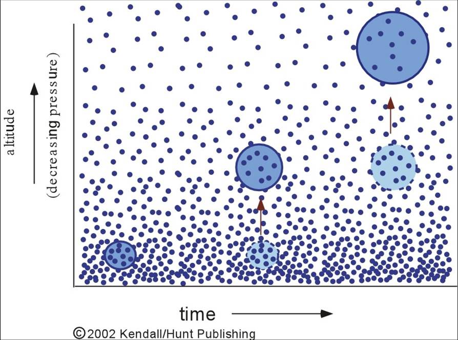
Adiabatic
Process: as air rises, it expands and cools;
as air sinks, it contracts and warms.
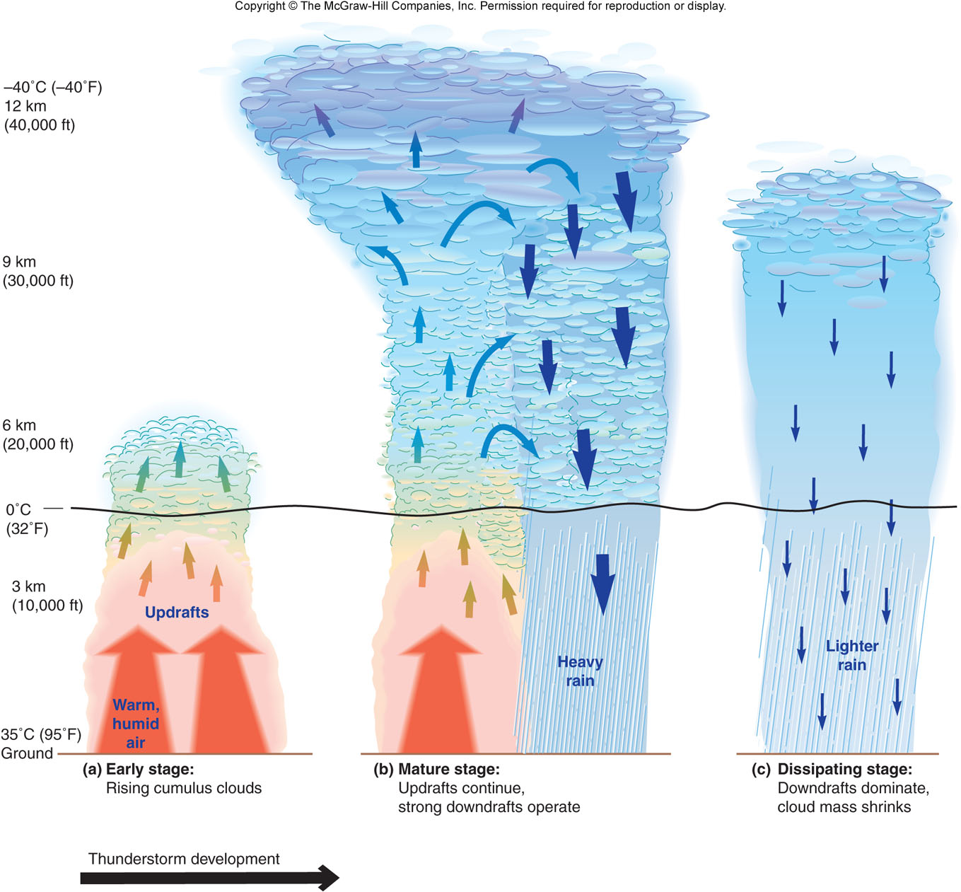
Thunderstorm: the warmer a parcel is than the
surrounding air, the faster it
will rise; thus, an environment primed
for thunderstorms would have warm, moist air near the surface, and
cooler, drier air aloft.
How far away is the thunderstorm? Count the
seconds between seeing the lightning flash and hearing thunder (every second
is a fifth of a mile).
Example: flash to thunder → 10 seconds → 2
miles away from you.
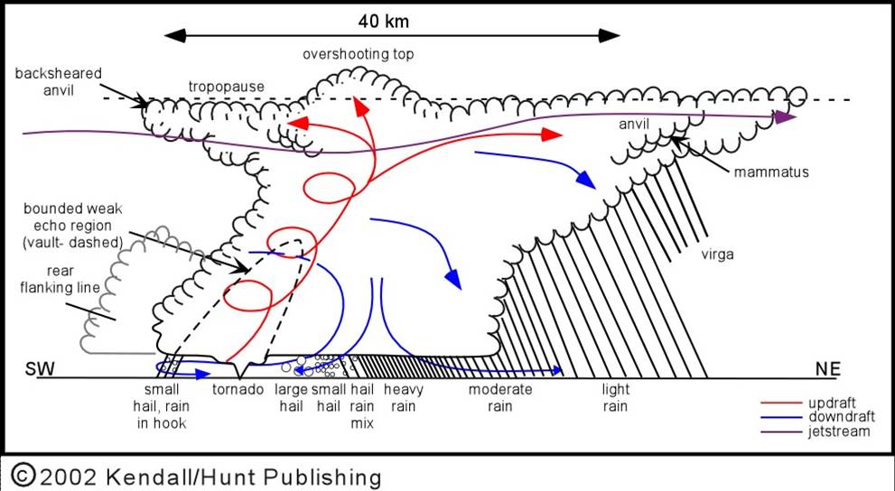
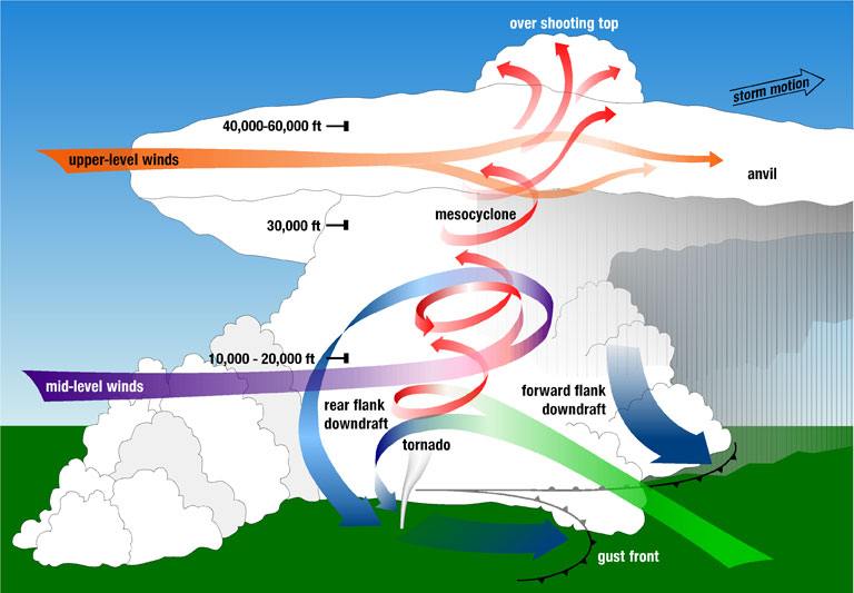
Supercell
Thunderstorm: the most
intense and longest-lasting type
of thunderstorms; the key to the longevity of a supercell is the tilt and rotation of the intense updraft; frequently associated with severe weather: torrential downpours (flash floods), strong,
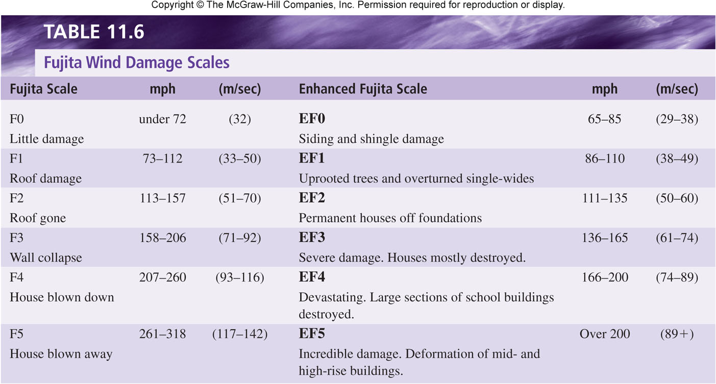
damaging winds, large hail, and the most violent tornadoes (which actually forms in a mesocyclone
in the larger convective cell and are categorized by the Fujita
damage scale).
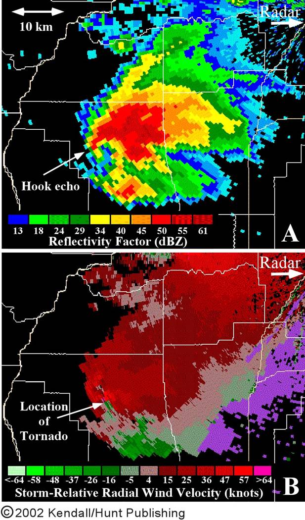
Doppler Radar:
the two main aspects are reflectivity (the amount of energy reflected back to the
Radar; image A) and radial velocity (measures the
change of frequency before and after reflection; image B).
Tornado
Signature: on
Doppler reflectivity is a hook
echo (image A) and on Doppler radial
velocity is a small area of rapidly changing winds (image
B).
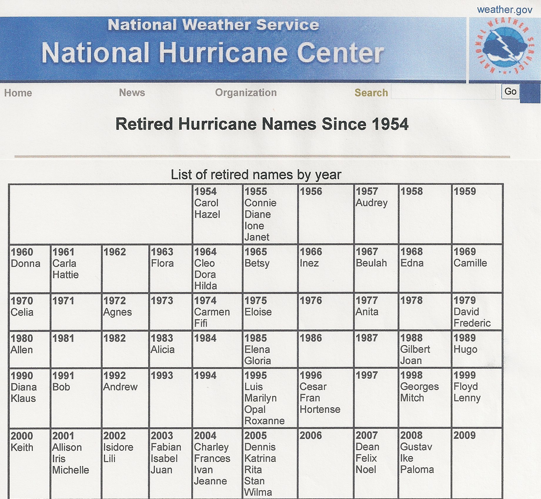
Tropical Storm: a warm-core low pressure system with
sustained winds from 40-74 mph; the storms are given names, which are alphabetized
in the
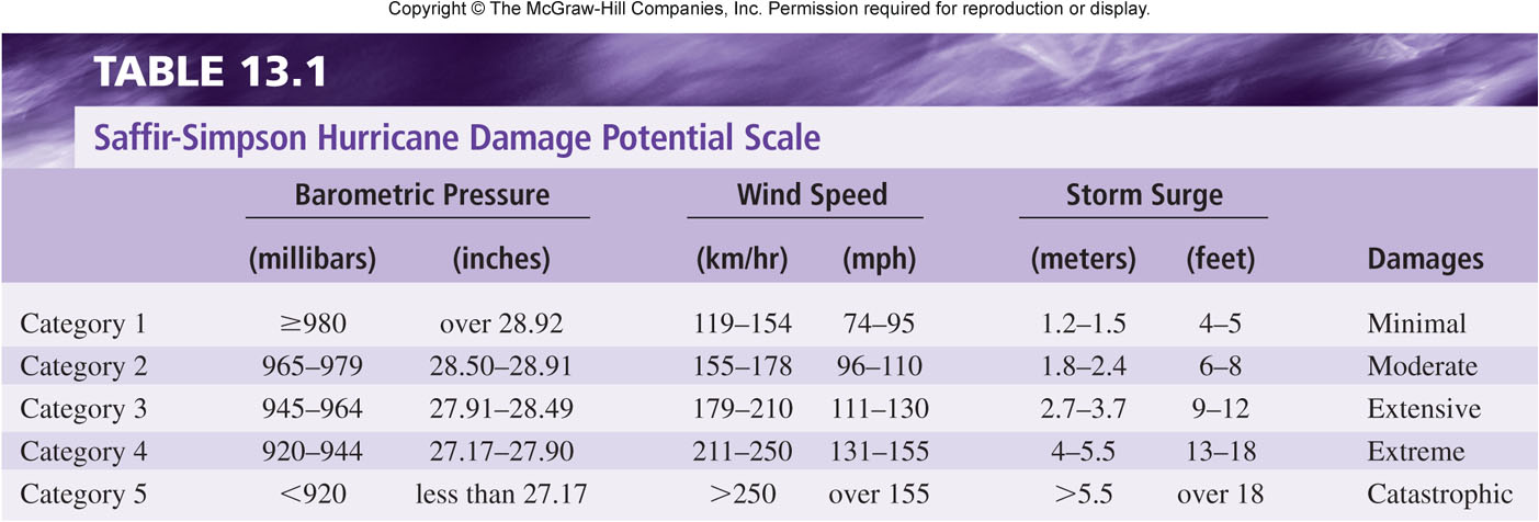
Hurricane (Typhoon, Tropical Cyclone): a warm-core
low pressure system in which the sustained winds exceed 74 mph; categorized
by the Saffir-Simpson scale.
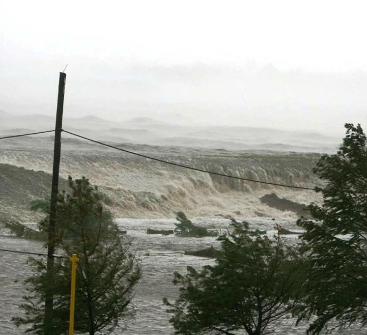
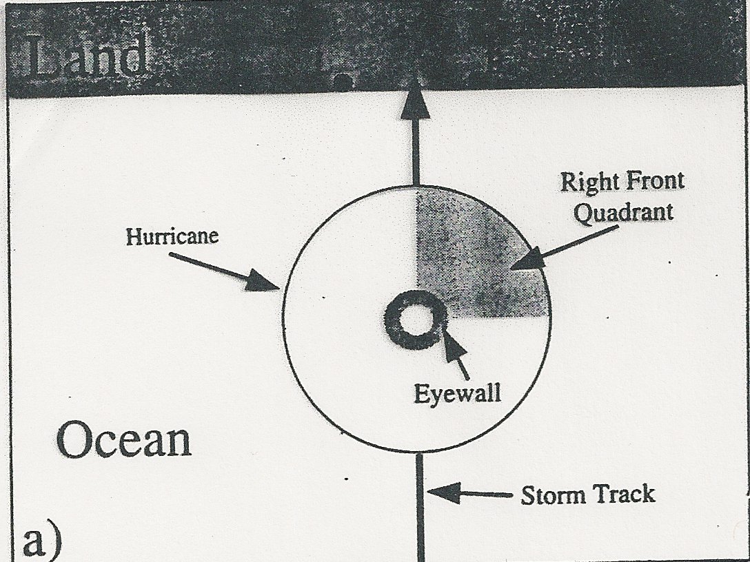
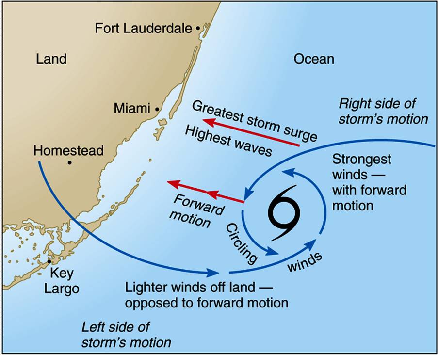
Storm surge: the most
destructive aspect of a hurricane and is most severe on the right-front
quadrant of the hurricane (in the Northern Hemisphere), from the eye
wall outward; the geographical quadrant having
the greatest storm surge is dependent on the direction the hurricane is heading.
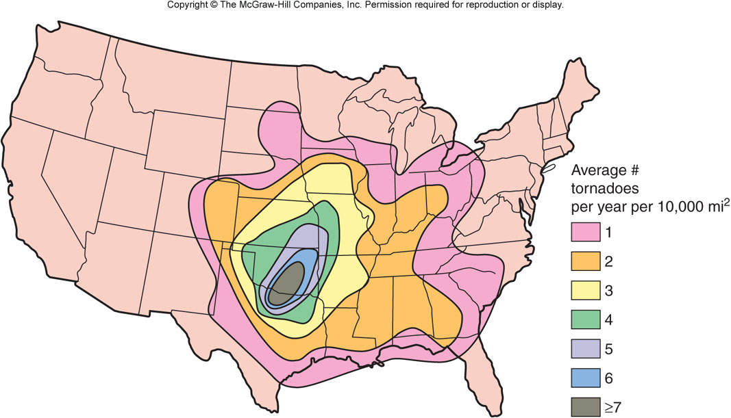
Key Facts: 1925 Tri-State Tornado