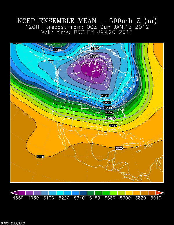
While the deterministic PW plume is nice
to watch (one attached), and the GEFS 500 mb pattern classic (one
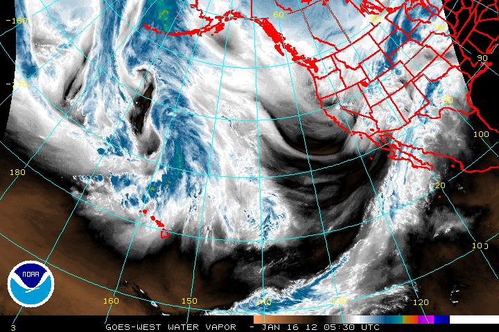
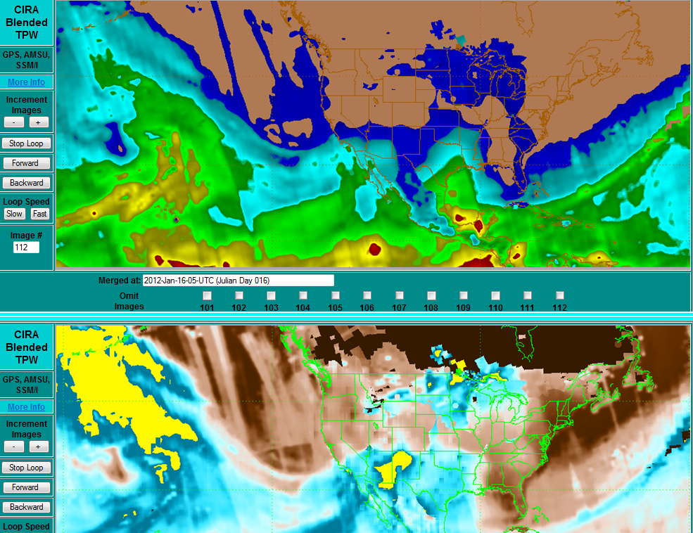
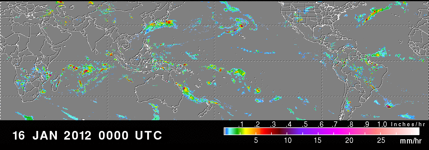
attached), seeing it cometogether on recent Polar mosaics and TRMM is awesome (both attached).
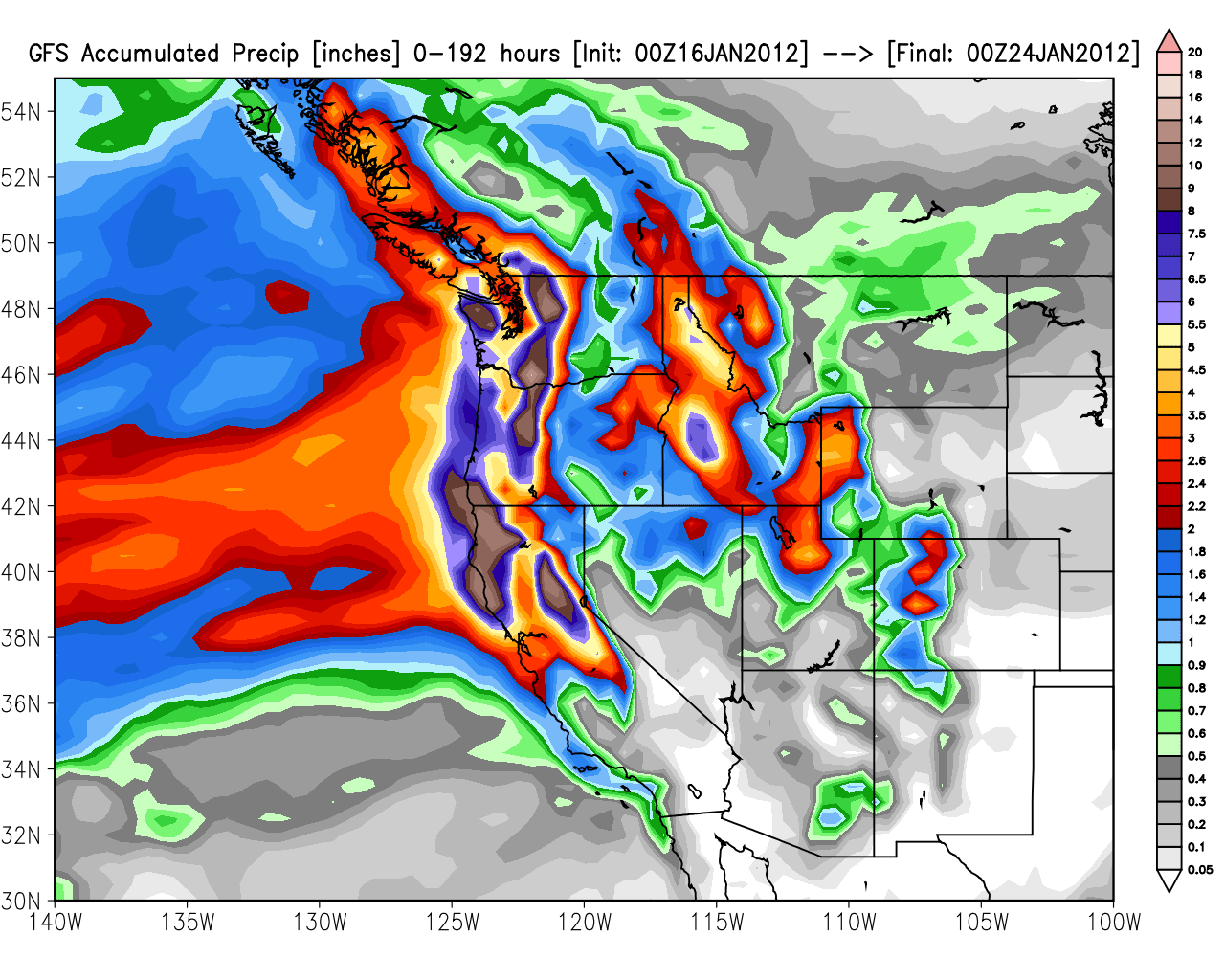
GFS guidance (attached) has slowly increased past
several runs with peak amounts near 18 inches in the Trinity Alps, where
the heart
of the PW anomaly plume/AR is forecast to sit for a few days and slowly sag southward hosing all of norcal. Considering
this is a global model and the plume becomes parallel to the flow (there is a notable wave Jan 20) could we be talking
amounts exceeding 20 inches on the north coast and 15 inches for the Northern Sierra Nevada and Cascades. The pattern does
not appear to go away after Jan 24, though the forecast PW plume is
much narrower and less while heights rise. Amounts of 5 inches SWE
respectable even for the Wasatch Range, given snow density and avalanche concerns. Based on PW fields and
height falls in the GEFS January 19-24, still think the southern California orographic areas are considerably underdone
in this QPF total. Up north it approaches historical levels.
--
Alex Tardy
Warning Coordination Meteorologist
National Weather Service, San Diego