September
30, 2013
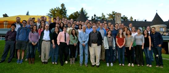
16th Cyclone Workshop
The
16th Cyclone Workshop was held at The Chantecler Hotel in Sainte-Adele, Quebec,
Canada, on 22-27 September 2013. Co-organized by current UAlbany DAES
Assistant Professor Kristen Corbosiero,
former DAES post doc Ron McTaggart-Cowan,
and McGill University Professor John
Gyakum, the Cyclone Workshop is a forum for presentations and discussions
on current research topics in the fields of synoptic, dynamic, mesoscale and
tropical meteorology. Over 100 U.S. and European meteorologists attended
the workshop, including 25 UAlbany DAES graduate students, post docs and
faculty members. DAES participants gave talks on a wide variety of topics
including the factors influential in the genesis and intensification of
tropical cyclones, the interaction between the tropical and extratropical
atmospheres, and the structure of midlatitude fronts and snowstorms.
Additional information on The Cyclone Workshop, including the program and links
to talks, may be found at http://www.atmos.albany.edu/facstaff/rmctc/cw16/index.html.
September
9, 2013
DAES Students Forecast for NASA Hurricane Field Campaign
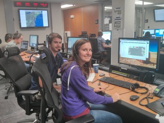
DAES graduate students Alan Brammer and Stephanie Stevenson are currently working in a weather forecasting
team in support of NASA’s HS3 field campaign to observe hurricanes in the
Atlantic (http://www.nasa.gov/mission_pages/hurricanes/missions/hs3/index.html#.Ui37X7wp2qA).
The HS3 field campaign, based out of
Wallops, Virginia is using two unmanned Global Hawks to observe these
important weather systems to improve our understanding of how their intensity
changes and ultimately to better predict them. Chip Helms, another graduate student, is also part of the team and
was based in Wallops earlier in the field campaign. The Department has been
awarded over $1Million in research funding to participate in this 5-year project
(PIs: Lance Bosart, Kristen Corbosiero, Jason Dunion, John Molinari and Chris
Thorncroft).
July
31, 2013
UAlbany Researcher Leads Investigation of Games for Enhanced STEM Education
in K-12 Environment

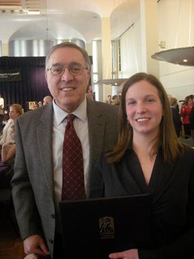
UAlbany educational game researchers share
a laugh, left to right, science education specialist Alan Oliveira,
geoscientist Roberta Johnson,
SUNY Games II project director Peter Shea, doctoral student Dima Kasssab, and Assistant Dean
of Informatics, Jennifer Goodall. (Photo by Paul
Miller)
ALBANY,
N.Y. (July 29, 2013) – University at Albany School of Education
Associate Professor Peter Shea is leading a research study investigating the
use of games to promote learning. “SUNY Games II” will explore how faculty and
students from diverse fields across the SUNY system can develop guided
inquiry-based, immersive games to promote enhanced understanding of science,
technology, engineering and math (STEM) content in K-12 settings.
The
project will foster the research and development of games for learning through
the Open SUNY framework, whose goal is to bring all online courses offered at
each of SUNY’s 64 campuses onto a shared and comprehensive online environment.
The
project is partially funded through a 2013 SUNY Innovative Instruction Technology Grant
(IITG) and the team has applied for a $1.2 million grant from the National
Science Foundation. The team believes that a focus on STEM will address
significant state and national challenges and will help position the project
for additional external funding, which will be sought in the coming year.
In
addition to developing a joint, online academic program that promotes
understanding of games for learning, Shea said SUNY Games II will leverage
collaborations with area industry. Partners on the SUNY Games II grant include
the Troy-based game-design company First Playable and the atmospheric
simulation and forecasting company MESO. Shea’s team is also in the process of
establishing a working relationship with the Boston-based game developer
Turbine Games, a subsidiary of Warner Bros.
Shea
serves as principal investigator on the SUNY Games II’s study, which brings
together faculty and students from UAlbany and other SUNY institutions
representing a wide range of disciplines:
- Shea, Alan Oliveira and Jianwei Zhang,
Department of Educational Theory and Practice, UAlbany
- Daniel Goodwin, chair, Department of Art, UAlbany
- Jennifer Goodall and George Berg, College of
Computing and Information, UAlbany
- Roberta Johnson and Mathias
Vuille, Department of Atmospheric and Environmental Sciences, UAlbany
- Bina Ramamurthy, Department of Computer Science and
Engineering, University at Buffalo
- James McElwaine, Department of Music,
Purchase College
- Edward Bever, College at Old Westbury
- Alexandra Pickett, associate director, SUNY Learning Network
- Kim Scalzo, director, SUNY Center for Professional Development
- Suzanne Hayes, director of instructional technology, Empire State
College
- Larry Dugan, director of online learning, Finger Lakes Community
College
- Anna Zhou, Shoubang Jian, and Dima Kassab, doctoral
students, UAlbany
A
nationally recognized expert in online learning, Shea’s research focuses on the
development of communities of learners in higher education online environments.
He holds joint appointments in the Department of Educational Theory and
Practice and the Department of Informatics in
the College of Computing and Information.
Shea
directs a program of research that has recently attracted more than $2 million
in external funding from organizations such as the Alfred P. Sloan Foundation
and the U.S. Department of Education. He is the recipient or co-recipient of
four national awards including the EDUCAUSE Award for Systemic Improvement in
Teaching and Learning and awards from the Sloan Consortium for online and
faculty development programs. He is a Sloan-C Fellow in research on online
learning and a member of its board of directors.
Prior
to joining the University at Albany, Shea was director of the SUNY Learning
Network, one of the largest online higher education systems in the United
States with annual student enrollments of more than 100,000.
More
info: http://www.albany.edu/news/41449.php?WT.source=RSS&WT.source=PortalAllNews
July 29, 2013
|


July 2, 2013
Forecaster tends to
see the big weather picture
Associate professor
looks at patterns a month or so in advance
By Claire Hughes
Published
6:38 pm, Monday, July 1, 2013
Paul
Roundy, an associate professor of atmospheric science at University at Albany,
talks about
satellite images which show infrared radiation Monday, July 1, 2013, during an
interview at the
college in Albany, N.Y. (Paul Buckowski / Times
Union)
Anyone
who counts on the weather forecast for planning a summer picnic knows getting
an accurate prediction for even one day ahead is no sure thing.
Paul Roundy is looking out a good deal
further — say, a month at a time. The associate professor in the University at
Albany's Department of Atmospheric and
Environmental Sciences makes weather predictions from atmospheric
waves, created by rain-related tropical heat, that can
be as large as Earth itself. He's not trying to determine if, say, it will rain
in the middle of a particular afternoon, but what general patterns will persist
or change: several weeks that are unseasonably cool, for instance, or a
particularly snowy period weeks ahead.
While
his forecasts are less specific than what you see in this newspaper for the
next 24 hours or week, the general patterns they predict provide the energy
industry or large chain stores that sell seasonal supplies with general trends
that assist their planning.
"I
study these waves in the tropics and how they interact with global atmospheric
circulation," Roundy said.
To
predict weather in the United States, Roundy analyzes air circulating in the
tropics. One of the major systems he tracks is the Madden-Julian oscillation, a
tropical pattern he predicts will become as well-known in the future as El
Nino, a weather system that it can influence. The MJO can take 40-50 days to
play out — 20 days of rain, say, followed by 20 days of dry weather. The number
of days is not always the same, Roundy said, but the pattern of a sustained
period of rain followed by a similar length of dry weather is typical
to MJO.
Roundy
analyzes models that show how MJO might move around equatorial regions — bands
of precipitation bordered by clear air, moving generally from west to east. He
then looks at other overlying weather patterns and statistics, then makes some
subjective judgments about how to weigh their worth.
In
his office Monday, Roundy showed how even a simple index using some of this
data could produce broad but nonetheless useful forecasts. Looking at how the
MJO interacts with mid-latitude climates — that includes all of the United
States — he predicted it will be unseasonably cool in the central part of the
country and moist in the Northeast through the middle of July, followed by a
warmer-than-average period at the end of the month.
His
likelihood of accuracy with this simple index for this time frame, he said, was
perhaps only 60 percent.
"It's
better than rolling the dice, but you will be wrong sometimes,"
he quipped.
Nonetheless,
even that degree of accuracy can be useful in some industries, he explained.
Someone investing regularly in natural gas heating futures, for instance, will
likely come out ahead with a 60 percent chance.
"But
if it's a one-off (investment), it's not worth the risk," he said.
Roundy
contributes a more sophisticated analysis to the MJO Global Threats Hazards
weekly report, which, for example, helped warn the energy industry about
extremely unusual weather in March 2012, when temperatures topped
80 degrees.
chughes@timesunion.com • 518-454-5417
VITALS
Age:
39
Lives
in East Schodack
Married
with four children, ages 5, 8, 10, 13
Grew
up in southern Idaho
Joined
UAlbany seven years ago
Enjoys
gardening, running and playing with his kids
May 21, 2013
UAlbany Researchers Seek to Improve Thunderstorm Forecasting
UAlbany
researchers are hoping to improve forecasting models for
thunderstorms, such as supercell events common to the Great Plains region.
ALBANY, N.Y. (May 21, 2013) – University at Albany atmospheric scientists Lance Bosart and Ryan Torn are part of an elite team of researchers working with
the National Center for Atmospheric Research in Boulder, Colorado, to improve
the models that forecast thunderstorms.
The
Mesoscale Predictability Experiment (MPEX) will be conducted through June 15 and
take advantage of the known high frequency of widespread, severe storm
outbreaks over the Great Plains region.
From
flash flooding to high winds or lightning strikes, thunderstorms hold the
potential to devastate communities in mere minutes. While not as large as
hurricanes or blizzards, thunderstorms, nonetheless are responsible for several
hundred deaths and billions of dollars in property damage each year in the U.S.
“The
goal of MPEX is to evaluate whether taking targeted observations of features
within the holes of the observation network could influence the development and
intensity of thunderstorms and ultimately improve weather forecasts,” said
Torn, an assistant professor at UAlbany who examines atmospheric predictability
and computer weather models. “We also want to better understand how
thunderstorms modify the atmospheric environment they move through.”
The
project will include early morning flights with the NSF/NCAR Gulfstream V
aircraft to sample the pre-storm atmosphere across Colorado and nearby states.
In MPEX, the aircraft will cruise at 40,000 feet for up to six hours, which
will enable researchers to thoroughly canvass the entire region where triggers
for severe weather lurk. MPEX will also include afternoon launches of weather
balloons carrying instrument packages that will profile conditions around
thunderstorms as they develop and move east across the Great Plains.
Bosart,
a distinguished professor at UAlbany, and Torn will act as operations directors
during their month-long stay at NCAR. UAlbany graduate student Corey Guastini will also assist in
forecasting. After the data collection is complete, Torn will work with UAlbany
students in the fall to examine and analyze the information.
“We’ll
be evaluating the cases to determine how well we sampled the important regions
and trying to understand how errors in atmospheric models grow and evolve to
impact thunderstorm forecasts,” said Torn. “We hope to ascertain if examining
the thunderstorms in this manner holds the potential to significantly improve
the predictability of the more regional aspects of convective weather, and to
improve the probability timeframe for these often devastating events.”
In
addition to the University at Albany, the project also includes the National
Center for Atmospheric Research (NCAR); Colorado State University; Purdue
University; the University of Wisconsin–Milwaukee; and NOAA's National Severe
Storms Laboratory (NSSL).
Info: http://www.albany.edu/news/38664.php
April 26, 2013
UAlbany Advanced Computing System Provides Large-Scale Capacity to Examine
Arctic Sea-Ice Variations, Tropical Hurricane Formation
|
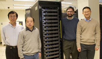
Liming Zhou, Jiping Liu, Justin Minder, and
Brian Tang, Department of Atmospheric and Environmental Sciences Faculty. |
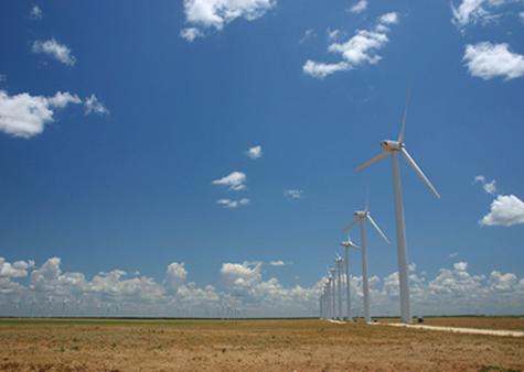
Texas Mill Wind Farm
ALBANY, N.Y. (April 25, 2013) A new, highly sophisticated computing system will
allow several new University at Albany Atmospheric Scientists to conduct
large-scale research of arctic sea-ice variations, tropical hurricane
formations and structure, and boundary layer weather conditions of large
operational wind farms.
The
computing system, which combines servers and storage into a ‘cluster,’
represents the University’s most powerful and architecturally advanced
supercomputer.
UAlbany’s
Department of Atmospheric and Environmental Sciences (DAES) and the Office of
Information Technology Services ((ITS) acquired the supercomputer, aided in
part by a $35,000 grant from the New York State Division of Science, Technology
and Innovation (NYSTAR). The cluster provides the department with the computing
capability to conduct large-scale atmospheric modeling projects.
UAlbany
Atmospheric Sciences faculty members will utilize the cluster for the following
research:
Understand
how weather and climate works on the scales at which humans and ecosystems are
affected - Assistant Professor Justin Minder will use to the cluster for
high-resolution simulations of the processes controlling temperatures, winds,
rain, and snow on local scales, as well as the processes shaping local response
to climate change. The computational power provided by SNOW will allow for
detailed simulation of individual cloud features, such as lake-effect snow
bands. It will also offer long simulations that characterize the mechanisms of
regional climate change such as the effect of snow-loss over mountains on
regional weather and hydrology.
Study
the impacts of changing polar sea ice on weather and climate, and
implement polar sea ice forecasting - Assistant Professor Jiping Liu
will utilize the cluster to explore how arctic sea-ice variations impact the
weather in high latitudes during winter subsequent to the observed
variations.
Investigate
the causes of variability in hurricane structure, intensity and frequency using
a hierarchy of different modeling approaches - Assistant Professor Brian Tang
will use SNOW to run idealized simulations investigating the climatology of
tropical disturbances and clusters of convection, and idealized high-resolution
hurricane simulations to investigate the dynamics and thermodynamics of
tropical cyclones.
Conduct
numerical simulations using Weather Research and Forecasting (WRF) models to
explore the impact of wind farms on local climates - Associate Professor Liming
Zhou will conduct high-resolution modeling using weather and climate prediction
models. He will examine the sensitivity of key hydro-climate variables to the
presence of large operational wind farms, and monitor the changes in
atmospheric boundary layer processes and conditions in the context of land
cover use and global warming.
Housed
in the University Data Center, the cluster consists of 512 Intel cores with 4
terabytes of RAM, 30 terabytes of scratch disk space and a quad-data-rate
Infiniband computational communication backplane. The system can be instantly
configured to give individual investigators dedicated, reserved resources or
work as one large system.
More Info: http://www.albany.edu/news/37698.php
March 18, 2013
Associate Professor
Mathias Vuille participated in a meeting organized by the Comunidad Andina
(Andean nations of Colombia, Ecuador, Peru and Bolivia) in La Paz, Bolivia between March 13-15. The goal of the meeting was to assess
climate change projections elaborated by each country over the past several
years within a World Bank funded project to adapt to climate change and
glacier retreat. Dr. Vuille was invited as an external project evaluator and
gave 4 keynotes on Andean climate, climate change impacts, regional climate
change projections and possible adaptation strategies.
February
19, 2013
UAlbany Research:
Tackling Climate Change
Discover the research of UAlbany's associate
professor Mathias Vuille as he ventures into the Andes to study the effects of
glacier melt and trains students to tackle this global challenge.
http://www.albany.edu/news/35590.php?WT.source=home&WT.svl=headline
http://www.albany.edu/research/
January
7, 2013
PhD Student Nicholas
Joseph Schiraldi
wins First Place Poster Award for “An
Operational Approach to Predicting the Global Circulation Impacts of
Simultaneous Interaction between the MJO and Equatorial Rossby Waves” (N. Schiraldi, P.E. Roundy, D. Margolin,
and L. F. Bosart) at the 2013 American Meteorological Society’s (AMS) Special
Symposium on Advancing Weather and Climate Forecasts: Innovative Techniques and
Applications.
Friday, December 14, 2012
UAlbany grant plan
gets OK
Governor's approval, after earlier
objections, frees $35 million that will help start large-scale projects
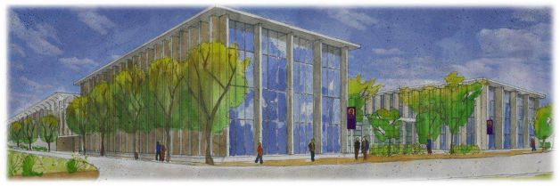
Rendering of proposed E-TECH building at University at
Albany.
The state University at Albany has proposed a $165 million Emerging Technology
and Entreneurship Complex. The new
225,000-square-foot center, which would be located on the west side of campus
near the Life Sciences building, would house expanded programs in Atmosphere
and Environmental Sciences, biomedical and biotechnology studies, forensic
science and cybersecurity, and advanced data and
analytics. (University at Albany)
Read
more: http://www.timesunion.com/local/article/UAlbany-grant-plan-gets-OK-4117333.php
October 31, 2012
DAES Expertise and Sandy Media Coverage
YNN: http://capitalregion.ynn.com/content/capital_tonight/video/609502/climate-change-interview/
Science Friday: http://www.luisquevedo.org/
Times Union: http://www.timesunion.com/local/article/The-risk-of-extreme-weather-on-upswing-3998651.php#photo-3673505
Times Union: http://blog.timesunion.com/weather/
Register-Star: http://www.registerstar.com/news/.
WAMC: http://wamc.org/post/damage-widespread-northeast-reflects-historic-storm.
Saratoga Wire: http://saratogawire.com/article/437/121030-hurricane-sandy-a-bust-for-saratoga/
CBS 6: http://www.cbs6albany.com/news/top-stories/stories/ualbany-professor-describes-flight-into-sandy-3899.shtml
Times Union: http://www.timesunion.com/local/article/UAlbany-researcher-flies-straight-into-Sandy-3990804.php#ixzz2AiXnDFxh
Times Union: http://www.timesunion.com/local/article/Storm-readiness-a-priority-3984339.php#page-1
Times Union: http://www.timesunion.com/opinion/article/The-storms-of-New-York-4047064.php#page-1
Monday, October 23, 2012
Dr. Roberta Johnson has been selected as
the 2012 recipient of the American Meteorological Society Award for Outstanding
Service to Pre-college Teachers. This award recognizes Roberta’s contribution
and service to Science education across the country. Dr. Johnson’s dedication to the Science education
profession is recognized by this award.
Friday, October 19, 2012
Winter weather forecasts are out;
are we in for big snow?
Reported
by: Nicole Papay
Email: nicolepapay@fox23news.com
Last year showed us
nature is perfectly fine dumping snow on us in October, so what can we expect
this winter? The National Oceanic and Atmospheric Assocation's
climate prediction center, AccuWeather, and the Old
Farmer's Almanac have all released 2012-2013 winter forecasts.
FOX23 Chief Meteorologist Steve Teeling says the NOAA
is giving equal chances for it to be cold or warm, but on average, says the
weather will be normal. AccuWeather and the Old
Farmer's Almanac have predicted a colder, snowier winter.
But, the local community seems split on whether or not to believe in long-range
forecasts.
"I'm not skeptical. I just read each one and say, 'Well, who's going to
come in the forefront and be the winner?," said Scarlette Kinley of Albany.
"We hope for the best," said Jodi Modri of
Loudonville. "We don't really look into articles or the Farmers'
Almanac."
If you follow long-range forecasts, it's important to know how they're built.
Typically, the data goes through a computer, which then spits out a base
forecast for a meteorologist to analyze.
Dr. Paul Roundy, an Associate Professor
at UAlbany for Atmospheric and Earth Sciences, said, "Every model that
you might find has different biases, different tendencies to be wrong in
different ways, so it takes some work to interpret these things."
The Farmer's Almanac is different and makes its forecast secretly. It claims a
mathematical, human-calculated formula takes into account sunspots, tides, moon
phases and more. To know which forecast to follow, you need to take into
account its history.
"Make sure that there's verification data available from past
forecasts," said Dr. Roundy. "Don't just trust any
one outright. They all follow different techniques and some will have
different levels of skill in different scenarios."
Last winter, Farmers' Almanac predicted above-normal precipitation and
above-normal temperatures, so less snow than normal. AccuWeather
predicted above average snowfall, and NOAA, same as this year, predicted an
equal chance for above or below average snowfall.
The Farmers' Almanac seems to win for last winter, so we'll have to wait and
see for this year.
Wednesday, October 16, 2012
|
Aiguo Dai Receives 2012 International Surface Water Prize
|
|
The prize was awarded
to Dr. Trenberth and Dr. Dai for ground-breaking work that provides a
powerful estimate of the effects of climate change on the global hydrological
cycle, with a clear explanation of the global water budget. If we are going to talk
about hydrology in the 21st century, and the challenges hydrologists face,
clearly the overwhelming challenge is to understand hydrologic variability,
and the likely impact on hydrology of anticipated climate change. Dr.
Kevin Trenberth and Dr. Aiguo Dai have made a unique contribution through the
investigation of climate variability and trends in the past, and through the
use of models and other creative efforts to reconstruct river discharge into
the oceans across the planet for almost 1000 river basins. They use climate
models to understand likely changes in the future and the uncertainty
associated with those predictions, and explain their findings using
such popular indicators as the Palmer drought severity index. As a result,
they have provided an exemplary account of the global water budget that is
being used in textbooks and encyclopedias. They have made
pioneering contributions to understanding the past with real data, and
evaluating the future prospects within the context of what we know of the
global climate and hydrology. They have provided a much better understanding
of hydrologic responses to climate change, which in turn will provide
tremendous guidance for future planning. |
For more information: http://www.albany.edu/cas/news-dai-surface.shtml
Monday, October 15, 2012
DR. LOUIS W. UCCELLINI, Director, National Centers for
Environmental Prediction (NCEP), National Weather Service (NWS) and The
National Oceanic and Atmospheric Administration (NOAA), will give a special
seminar “Taking Prediction to the Next Level: Expanding Beyond Today’s Weather,
Water and Climate Forecasts and Projections” on Sunday, November 11th at 7:00pm, in the University at Albany, Life Science Research Building, D'Ambra Auditorium.
“NCEP - From the Sun to the Sea:
Where America’s Climate, Weather, Ocean & Space Weather Services Begin”
Over the past 60+ years, the research and operational
weather enterprise has made revolutionary advances in the prediction of
weather. Remarkably, even greater
progress has been made in the prediction of extreme weather events including
hurricanes, tornado outbreaks, snowstorms, heat waves and heavy rainfall out to
7 days in advance (in some cases). In
this presentation, Dr. Louis W. Uccellini, Director of the National Weather
Service’s National Centers for Environmental Prediction, will review the advancements
that have been made in weather prediction.
He will then trace the revolutionary transformation of forecasting from
a subjective “art” in the 1940’s to the applied physical science that it is
today. Today’s forecast process is based
on 1) an integrated global observing system, 2) numerical weather, climate and
hydrologic prediction models and 3) the world’s fastest computers. He will also describe how climate, weather
and water predictions are being linked to decision makers, including the
emergency management, water resource
communities, health officials and others, and discuss how these developing
requirements are helping to shape a forecast system that can be extended to
such areas as water resources and health vectors. The talk will conclude with a summary of the
various improvements required to meet the growing demands and increasing
expectations placed on the forecast community. Improving the “Earth-System”
components of the prediction systems is only one of the challenges. The increasing need for an ensemble model
approach to define forecast uncertainty as we push the limits of predictability
is another. Finally, as those involved in making critical life-saving decisions
(based, in part, on these prediction capabilities) become more dependent on
weather forecasts for decision support services, the way forecasts are
disseminated in critical life-threatening situations and uncertainty conveyed
will also need to be addressed. As will
be discussed, the links between science and social sciences and related
challenges associated with advancing the use of improved weather forecasts will
provide a fundamental basis for taking predictions to the next level.
Thursday, October 4, 2012
Dr.
Paul Roundy Receives AMS Editor’s Award
Associate Professor Dr. Paul Roundy was given a prestigious
editors award from the American Meteorological Society for reviews he
contributed to the journal Monthly Weather Review. The AMS announcement states
that he was chosen for the award "For a large number of prompt and
high-quality reviews, and for assistance to the editors in making decisions on
controversial papers."
Monday, September 10, 2012

![]() Contact: Media
Relations Office (518) 956-8150
Contact: Media
Relations Office (518) 956-8150
UAlbany Students Join NASA Mission to Discover Why Some Storms Pack a
Wallop
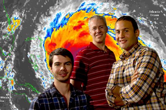
From left, Alan Brammer,
Professor Chris Thorncroft, and Mike Ventrice, are involved with the NASA
mission. (Photo by Mark Schmidt)
http://www.albany.edu/news/28428.php
ALBANY,
N.Y. (September 7, 2012) -- Mike Ventrice and Alan Brammer are packing their
bags for a “cool” mission at the NASA Wallops Flight Facility in Virginia. The
UAlbany doctoral students will forecast when to deploy two unmanned Global Hawk
aircraft into developing tropical storms in the Atlantic Ocean basin
Along
with fellow Department of Atmospheric and
Environmental Sciences graduate student Jason
Dunion, Professor Chris Thorncroft and his UAlbany colleagues John Molinari,
Kristen Corbosiero, and Lance Bosart, Ventrice and Brammer will join the $30
million NASA mission, the Hurricane and Severe Storm Sentinel (HS3),
specifically targeted to investigate the processes that underlie hurricane
formation and intensity change in the Atlantic Ocean.
The
mystery surrounding why some storms quickly intensify into dangerous hurricanes
remains unsolved, and more advance warning of an approaching storm would help
protect people’s lives and property.
“The
cool factor comes from the fact that we will be flying two unmanned aircraft to
measure hurricanes and their environment – to learn about the birth of
hurricanes as well as factors that determine how intense these hurricanes can
become and what determines whether a hurricane will intensify rapidly or not,”
said Thorncroft, who added UAlbany will be involved in the project in 2013 and
2014 as well.
Of the
$30 million obtained by NASA for the project, Thorncroft’s research is funded
at $684,488. DAES colleagues Corbosiero and Molinari obtained an
additional $300,000 grant to work on the same project. In addition, graduate
student Jason Dunion successfully led a proposal with Lance Bosart (DAES) and
Chris Velden of the Space Science and Engineering Center (SSEC) at the
University of Wisconsin-Madison that obtained $325,000. In addition to doing
his Ph.D. at UAlbany, Dunion also works for the NOAA Hurricane Research
Division in Miami and was key to helping coordinate manned NOAA aircraft
missions with NASA Global Hawk flights. Dunion is also leading the coordination
of the Hurricane Research Division’s daily map discussions that are used for
planning NOAA’s field activities during the season.
Lee
Harrison of the Atmospheric Sciences Research Center
(ASRC) is also participating in HS3 - he is carrying out collaborative research
(funded by NASA and the Office of Naval Research) with Yankee Environmental
systems to develop atmospheric observation instrumentation that will be
deployed on the Global Hawks in 2013.
Ventrice,
of Patchogue, N.Y., who plans to graduate in December, said, “This field
campaign is unique and it is an honor to be part of such an event.
UAlbany is one of a few select universities contributing to the field campaign.
Albany is developing a number of products to use operationally for forecasting
the formation of Atlantic tropical cyclones.”
As
part of a small team of two or three forecasters, he and Brammer will be on the
lookout for areas where a tropical cyclone may form or intensify.
Brammer,
of Macclesfield, England, said, “Making a correct forecast and being able to
position the Global Hawk over a developing system for such a long period of
time and thus capture those early periods of development will be very useful
for trying to understand the cyclogenesis process.”
One of
the benefits of the upcoming forecasting mission for NASA is that the planes
allow for extended flight times and observations further East
than is typically attainable.
“Each
Global Hawk can literally fly over the hurricane for 24 hours continuously,”
said Molinari. “We have never had anything close to that capability with other
aircraft.”
Brammer
added that they will be studying the environment surrounding storms as well as
the inner dynamics within a storm, to better understand the interaction between
storm and environment.
The
experience also gives UAlbany students a competitive edge.
“Being
a member of a field campaign [like this one] is highly desirable because it
shows future employers that you have true experience in the field. Further, it
allows you to meet a broad range of professionals who will help you find your
career path,” said Ventrice.
Learn
more about a major in atmospheric science. For
more UAlbany news, visit the News Center.
Friday, August 31, 2012
Dr.
Ryan Torn Shares “Lessons Learned From Last Summer’s
Hurricane Season”
Professor Ryan Torn examines the latest
predictions for Tropical Storm Isaac in his office at UAlbany.

Credit Marie Cusick
/ WMHT
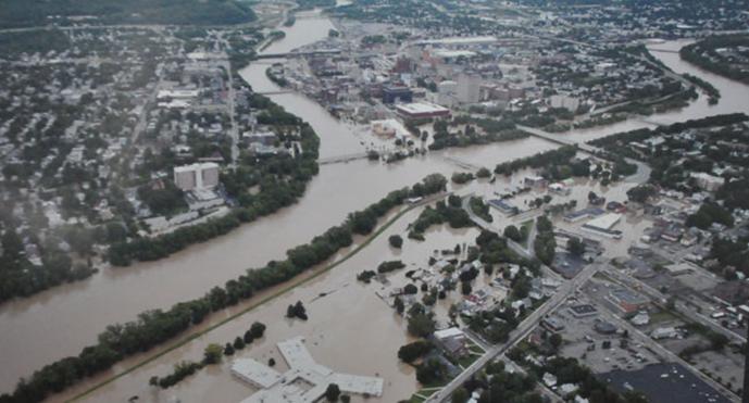
Flooding in downtown Binghamton at the
convergence of the Susquehanna and Chenango Rivers after Tropical Storm Lee.
Credit Ed Aswad
A home in the Catskill Mountain town of Prattsville after Tropical Storm Irene

Credit Marie Cusick
/ WMHT
The Mohawk River floods the Erie Canal
outside of Amsterdam.

Credit Karen DeWitt / New York State Public
Radio
The Hudson River floods parts of Troy after
Irene.

Credit Matt Ryan / WMHT
Flooding from Irene devastates parts of the
Schoharie Valley.

Credit Marie Cusick
/ WMHT
A shelter for victims of Tropical Storm Lee
in Binghamton.

Credit Matt Richmond / WSKG
Last summer when Irene and Lee blew through
New York, both were classified as tropical storms, not hurricanes. Yet they
still managed to cause $1.5 billion in damage across the state. A year later,
the cleanup and recovery is far from complete.
So how can these weaker storms still wreak
such havoc? And did the classification of the events as tropical storms rather
than hurricanes cause some people to let down their guard?
"In hindsight, there were several groups
that were trying to communicate that the rainfall was going to be the big issue
with this storm, but it didn’t always get into the public perception."
Dr. Ryan Torn is an expert in atmospheric
prediction at the University at Albany. He talks about how scientists are
getting better at understanding how extreme weather behaves, and why
people don't always heed the warnings.
Note: this interview has been edited for
length and clarity
Q: What is the most dangerous aspect of a
hurricane?
A: It really
depends on a number of factors, starting with where you live and the intensity
of the hurricane. For a lot of weaker hurricanes, people often let their guard
down. They think ‘Oh, the wind is weaker so it must not be that dangerous. I
can stay in my house.’ Especially people who are inland.
In a lot of cases in a weaker hurricane, the
bigger danger is the rainfall. There can be many inches of rain as we saw last
year as we saw last year with Irene. In the stronger storms, if you’re on the
coast, there’s a double danger: the wind speed and/or the storm surge.
There’s not a perfect relationship between
wind speed and storm surge. You can have weaker storms that can create a huge
storm surge, or you can have intense storms that don’t have a big storm surge.
Q: So a really weak storm that just sits over
the land can do a lot more damage than a powerful storm that blows by the
coast?
A: Absolutely.
Q: How have weather modeling and hurricane
forecasts improved? What are scientists still struggling to understand?
A: We’ve gotten
a lot better at track over the past 20 years. We’re improving track forecasts
on the order of a few percent per year. Over time, what used to be two-day
track error, is now a three-day track error.
The leading reason we’ve gotten better is
that we’ve been making models of the large-scale aspects of the atmosphere.
We’re getting really good at taking observations of the oceans with satellites
and incorporating those observations into our numerical models.
If we talk about the maximum wind-speed
forecast of the hurricane (or intensity) we haven’t gotten really better over
the last 20 years.
Hurricanes have these large-scale influences
like how much water vapor is in the air, and the difference in wind speed at
different levels of the atmosphere (or vertical shear). We’re pretty good at
predicting those things. We also have a pretty good idea of what the sea
surface temperature looks like.
What we don’t really know too much about are
what we call “internal processes.” Hurricanes can go through a lot of natural
fluctuations. There’s something called an "eyewall" replacement cycle
where the hurricane can actually create a new "eyewall". It’s a
really interesting process; the position of the eye (of the hurricane) changes.
In 2005, scientists observed this through
aircraft really vividly in Katrina and Rita. We know how the process happens,
but we don’t know how it starts yet, or what causes it to start.
Q: Another thing scientists don’t understand
very well is how much rain a hurricane can produce— why is that?
A: One issue is
data. Over the ocean there are no rain gauges for us to be measuring. Once
a hurricane comes on shore, there are a lot of rainfall measurements.
There have been a lot of studies, especially in the Southeastern United States,
about some of the factors that give enhanced rainfall.
But it’s often easier to do hurricane
research over the ocean. Land adds a big complication factor. So while you have
lots of rain gauge data over land, it’s often hard to pick out how much of that
rainfall is coming from a land influence versus the hurricane itself. Rainfall
in general is a very hard problem for models. It’s one of the weaker links in
numerical models.
In the case of Irene, there was a good sense
that there was going to be a lot of rain. No one had a really good feel for
what the exact number was going to be, but everyone knew that this was going to
be a very large rain event three days out.
In hindsight, there were several groups that
were trying to communicate that the rainfall was going to be the big issue with
this storm, but it didn’t always get into the public perception.
Q: Is it difficult sometimes to get weather
messages out to the public and make sure people act on the warnings?
A: There’s a
whole group of social scientists that are really interested in this problem…
giving people raw forecast data and then trying to see how they use that data.
With Irene, forecasters were putting out
warnings a few days beforehand saying, ‘Hey, this looks like it’s going to be a
lot of rainfall.’ The problem is I think sometimes the public perception is
different in that the notion of a storm surge in New York City is a more
exciting thing than rainfall over upstate New York.
So that just got a lot of media attention,
but I would say the experts had a pretty good handle on this storm.
Q: Hurricane Irene was downgraded to a
tropical storm before it hit New York. Do you think that caused some people to
take the threat less seriously?
A: That’s
absolutely a fear for forecasters. The category of a storm only describes its
wind speed, it doesn’t describe all those other
things. It doesn’t describe storm surge or rainfall. People can let their guard
down.
This happened in 2008 with Ike in Texas. As
it was approaching the Houston area, many people evacuated. Then the storm
weakened. The problem was that when it had been stronger, it created a large
storm surge over the ocean. Storm surge doesn’t respond to the instantaneous
wind, it’s kind of a history of all that sustained wind over many days.
So all of a sudden, there’s this Category 2
storm, and people are thinking they can deal with that. But because it had been
so large and so intense for several days before that, it came with a very large
storm surge and caught a lot of people by surprise and did a lot of damage.
With Irene people said, ‘Oh, the wind speed
is going down. Not a big deal.’ But again, they didn’t take rainfall into
account. With weaker storms, the bigger impact is often rainfall, and rainfall
will often have a bigger impact over a larger area than wind and storm surge
will, which are primarily costal problems.
Q: Say we’d all listened carefully to the
Irene forecasts. Other than evacuating, what can you really do about massive
flooding?
A: In this kind
of event, not much. In theory, we could have drawn the reservoirs down to a
really low level, but you need some time to do that.
I know a couple of days beforehand, they did
start opening up reservoirs, but this is just a really extreme event. When you
get that much rain over that large of an area, over that amount of time,
there’s just not much you can do, except to warn people.
Q: What role does climate change play in
hurricanes?
A: That’s a very
hotly debated topic right now. There are lots of things that go into intensity
change in hurricanes.
One of the things people readily see is that
the intensity of a hurricane is a function of the sea surface temperature. The
warmer the sea surface temperature is, typically you’ll get a more intense
hurricane.
All other things being equal, with climate
change you might expect the sea surface temperatures to get warmer, and you
might expect there to be more intense hurricanes.
There was data about five years ago, and
several groups published studies showing that the global intensity of hurricanes
has increased over past 20 years. They looked at sea surface temperatures and
they saw they’d increased at the same time. So they said, ‘Oh there must be a
relationship between the two.’ They predicted that hurricane intensity would
keep going up.
It turns out that in 2010 and 2011 we’ve
observed some of the lowest intensity hurricanes over the past 40 years.
That kind of threw everyone a curveball.
There’s no good explanation as to why all of a sudden we’ve gone to a minimum,
in terms of intensity. You have to start thinking about some of these other
factors—like a difference in wind speed (or wind shear). The more wind shear
you have, the harder it is for a hurricane to develop for a variety of physical
reasons.
One of the things we don’t really know about
going into the future, is how is that distribution of wind shear is going to
change. Even if the sea surface temperature warms a lot, if the wind shear changes, we may not get any increase in
intensity. It may get harder to make a hurricane, in general.
The scientific consensus seems to be that we
should get more intense hurricanes in the future, but we might get fewer of
them.
But I would say this is one of the great open
questions in the field right now.
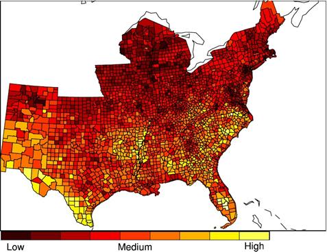
Mapping the threat
Researchers at the National Center for
Atmospheric Research developed this map, which shows how vulnerable
different areas are to hurricanes. They cite a
study which shows that more than half of
hurricane-related deaths happen in inland counties:
Hurricane Vulnerability Map by
County
http://www.innovationtrail.org/post/lessons-last-summers-hurricane-season
Thursday, August 16, 2012
Climate Models That Predict More Droughts
Win Further Scientific Support
By Hristio Boytchev,
Published: August 13The Washington Post
The
United States will suffer a series of severe droughts in the next two decades,
according to a new study
published in the journal Nature Climate Change. Moreover, global warming will
play an increasingly important role in their abundance and severity, claims Aiguo Dai, the study’s author and newly
appointed Associate Professor at the
University at Albany, Department of Atmospheric and Environmental Sciences beginning
September 1st.
His
findings bolster conclusions from climate models used by researchers around the
globe that have predicted severe and widespread droughts in coming decades over
many land areas. Those models had been questioned because they did not fully
reflect actual drought patterns when they were applied to conditions in the
past. However, using a statistical method with data about sea surface
temperatures, Dai, a climate researcher at the federally funded National Center
for Atmospheric Research, found that the model accurately portrayed historic
climate events.
“We
can now be more confident that the models are correct,” Dai said, “but
unfortunately, their predictions are dire.”
In the
United States, the main culprit currently is a cold cycle in the surface
temperature of the eastern Pacific Ocean. It decreases precipitation,
especially over the western part of the country. “We had a similar situation in
the Dust Bowl era of the 1930s,” said Dai, who works at the research center’s
headquarters in Boulder, Colo.
While
current models cannot predict the severity of a drought in a given year, they
can assess its probability. “Considering the current trend, I was not surprised
by the 2012 drought,” Dai said.
The
Pacific cycle is expected to last for the next one or two decades, bringing
more aridity. On top of that comes
climate change. “Global warming has a subtle effect on drought at the moment,”
Dai said, “but by the end of the cold cycle, global warming might take over and
continue to cause dryness.”
While
the variations in sea temperatures primarily influence precipitation, global
warming is expected to bring droughts by increasing evaporation over land.
Additionally, Dai predicts more dryness in South America, Southern Europe and
Africa.
“The
similarity between the observed droughts and the projections from climate
models here is striking,” said Peter Cox, a professor of climate system
dynamics at Britain’s University of Exeter, who was not involved in Dai’s
research. He said he also agrees that the latest models suggest increasing
drought to be consistent with man-made climate change.
Saturday, May 19, 2012
Class
of 2012
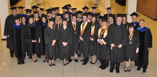
Bachelor of Science in Atmospheric Science
Hannah E. Attard (Magna Cum Laude & Honors Degree)
Kaitlin G. Cooley
Rachel S. Goldstein (Cum
Laude)
Timothy W. Humphrey (Summa Cum Laude & Honors Degree)
Jason H. Keefer (Summa Cum Laude & Honors Degree)
Luigi F. Meccariello
Adrian N. Mitchell
Nicholas J. Schiraldi (Magna
Cum Laude & Honors Degree)
Marc B. Sedor (Cum
Laude)
Steven Welch
Bachelor
of Science in Earth Science
Richard J. Heames
Tara Laneville
Kaylee J. Schartner
Christina M. Torres
Bachelor of Arts in
Earth and Atmospheric Sciences
Stephen W. Hassard
Jan C. Nova
Bachelor of Science in Environmental Science
Chelsea L. Baker
Donald B. Bonville
Philip J. Canale
Jeffrey D. Dzwonkowski (Summa
Cum Laude)
Clare B. Gaffey (Magna
Cum Laude)
Chenyong Han
Evan H. Hogan (Cum
Laude)
Lauren R. Holland (Summa
Cum Laude)
Kyle F. Hussey
Diane M. Macdowell (Cum
Laude)
Robert J. Moretto (Cum
Laude)
James P. Mulligan
Joseph E. Pennisi (Magna
Cum Laude)
Brian A. Philipps
Andrew C. Preston
John Puglia
Meghan A. Sickles (Cum
Laude)
Zachary M. Smith (Magna
Cum Laude)
Primo R. Stropoli
Andrew J. Stummer
Laura D. Varble (Magna
Cum Laude)
Danielle E. Wilkens
Saturday,
May 19, 2012
Professor and Chair, Chris Thorncroft
presented the following student awards at Department of Atmospheric and
Environmental Science Recognition Ceremony May 19th:
Outstanding Student ~ Atmospheric Science
Program:
Timothy W. Humphrey
Best Forecaster ~ Atmospheric Science Program:
Adrian N. Mitchell
Outstanding Student ~ Environmental Science Program:
Jeffrey D. Dzwonkowski
Friday, March 30, 2012
Attard, Humphrey and Schiraldi receive
Presidential Award for Undergraduate Research
Three Department of Atmospheric and Environmental
Sciences students have been named recipients of the 2012 Presidential Award for
Undergraduate Research. Hannah Attard, Timothy W. Humphrey and Nicholas
Schiraldi will each receive a $100 check in recognition of their success in
this important University-wide competition demonstrating outstanding research
skills and scholarship.
Hannah Attard:
“Large-Scale Precursors to
Major Lake-Effect
Snowstorms Lee of Lake
Erie”
Timothy W. Humphrey:
“Results of a Preliminary
Evaluation of CAPE Tendency”
Nicholas Schiraldi:
“CFS Reforecast Analysis of
Intraseasonal Variability of Tropical/Extratropical Interactions”
March 20,
2012
Falconer
Natural History 2012 Spring Lecture Series Schedule: http://www.atmos.albany.edu/daes/falconer.pdf
February 6,
2012
Mathias
Vuille has been invited to serve as a member of the U.S. National Committee
(USNC) for the International Union of Quaternary Research (INQUA), for a term
ending January 31, 2016. Quaternary
research spans the last 2.6 million years of Earth's history. The USNC/INQUA serves as a focal point for
U.S. discussion on how to promote the advancement of Quaternary research both
in the U.S. and throughout the world.
January 18, 2011
Paul K. Moore graduated with a Bachelor of Science degree
in meteorology from the State University of New York (SUNY) College at Oswego
in 1985, and went on to receive a Master's degree in atmospheric science from
the University at Albany in 1988. His Master's thesis research involved the
first in-depth study of cloud-to-ground lightning in lake-effect rain and
snowstorms.
The Buffalo Blizzard Book is a fascinating chronicle of
the Buffalo region's 200-year battle with its legendary lake-effect blizzards
and other monstrous snowstorms.
The saga begins with the tragic consequences of a fierce
storm on the eve of the War of 1812, and takes the reader through two centuries
of dramatic encounters with Western New York's wild winter weather, including
the most recent lake-effect bombardment of December 2010.
Over 50 snowstorms and blizzards are covered in depth,
including the long-lasting "Great Christmas Storm" of 1878, the
exceptionally destructive "St. Patrick's Day Storm" of 1936, the
ferocious "Blizzard of '85," the incredibly devastating "October
Surprise" lake-effect storm of 2006, and, of course, Buffalo's
unprecedented and incomparable "Blizzard of '77."
The Buffalo Blizzard Book is richly illustrated with over
100 spectacular photographs and prints, and ten informative diagrams. Along
with the fast-paced text, they tell the captivating story of winter weather at
its very worst…and a community at its very best.
|
|
http://www.buffaloblizzardbook.com/
January
5, 2012
TEDx
Albany-Is Anyone Else Out There?
John Delano is a
Distinguished Teaching Professor in the Department of Atmospheric and
Environmental Sciences at the University at Albany (State University of New
York), and is the Associate Director of the NASA-funded, multi-institutional New York Center
for Astrobiology headquartered at Rensselaer Polytechnic Institute. Professor
Delano is the author of 60 scientific publications, and has served on many
advisory panels for NASA.
NASA's Astrobiology program is frequently in the news with important
discoveries (e.g., discovery of habitable planets orbiting other stars;
environments and processes that led to life on Earth; sequencing of DNA that
has revealed evolutionary relationships). These discoveries are providing
Humanity with a better understanding of the events that have led to life's
emergence on this planet and of our context in the galaxy.
In the spirit of ideas worth spreading, TEDx is a program of local,
self-organized events that bring people together to share a TED-like
experience. At a TEDx event, TEDTalks video and live speakers combine to spark
deep discussion and connection in a small group. These local, self-organized
events are branded TEDx, where x = independently organized TED event. The TED
Conference provides general guidance for the TEDx program, but individual TEDx
events are self-organized.* (*Subject to certain rules and regulations)
To view
Professor Delano’s presentation, please go to NASA’s home page: http://www.astrobiology.nasa.gov/nai
November
22, 2011
Energy Campaign Recap
The fifth annual Energy Campaign wrapped up on November 13. This year we achieved a 9% reduction in electricity use over our baseline. This represented a 1,095,724 reduction in kilowatt hours and 409 tons of carbon. While we fell a little short of our goal of a 10% reduction, we did improve over last year realizing an additional 20,000 kilowatt hour and 8 ton carbon reduction over last year. The academic buildings garnered a 7% reduction (1% more than last year) and the living residences an 11% reduction (3% less than last year).
A recognition ceremony was added to the campaign to honor those that demonstrated extra effort and commitment to energy conservation. The Best Performer awards, for the largest percent reduction in electricity use from the baseline, went to Freedom Apartments and the Fine Arts building. Empire Commons won the Biggest Impact award for its reduction in kilowatt hours of electricity and carbon emissions. This honor went to the Lecture Centers for the Podium and Arts & Sciences for the Academic Buildings. The Best Quad award went to Colonial Quad, for the largest percent of electricity reduction among the quads. The Most Improved awards went to Earth Science, Physics and Business Administration by successfully increasing their electricity reduction over the course of the campaign. The Green Scene award for the academic building most dedicated to creating a culture of sustainability went to the Education building. Lastly, the Honor Roll featured all buildings that had achieved a 10% energy reduction or greater over the campaign. Among the residence areas, this included Empire Commons, Freedom Apartments, and Colonial Quad. Among the academic buildings, the honor went to Arts & Sciences, Business Administration, Earth Science, Education, Fine Arts, the Lecture Centers, the PAC, Physics, the Science Library, and the Social Science building.
Congratulations to all our award winners. For more details on the Energy
Campaign results go to: http://www.albany.edu/gogreen/4.energycampaign.shtml. A
recap of our honorees will be available soon at the recognition page on our
website: http://www.albany.edu/gogreen/index.shtml
November
16, 2011
Physical Controls on Carbon Dioxide Flux to the Atmosphere from a Southern
Adirondack Lake
Matthew Czikowsky,
Atmospheric Sciences Research Center, University at Albany
Seasonally-stratified temperate lakes are a source of carbon
dioxide to the atmosphere, particularly during autumn overturning as CO2
trapped below the thermocline becomes available to the surface for release to
the atmosphere. We made continuous
measurements of the vertical profile of pCO2 in a ~600 ha temperate
lake (Lake Pleasant, maximum depth ~24 m) in southwestern Adirondack Park, New
York from mid-September to mid-October 2010 from a moored pontoon boat. Continuous eddy covariance flux measurements
of momentum, sensible and latent heat, and CO2 were made in situ, and the water column thermal
structure was measured using thermistor chains.
The spatial variability (horizontal and vertical) of pCO2
throughout the lake was characterized periodically using a roving profiling
system. At the beginning of the study
interval, pCO2 at the pontoon boat varied from 500 ppm at the
surface to > 3000 ppm below the thermocline. The vertical profile of pCO2
changed markedly during the campaign due to the effects of wind forcing and
evaporation (buoyancy), with nearly uniform, high pCO2 throughout
the water column at the end of the campaign.
The elevated surface water pCO2 increased CO2
emission to the atmosphere.
November
10, 2011
JOINT COLLOQUIUM SERIES
DEPARTMENT OF ATMOSPHERIC & ENVIRONMENTAL SCIENCES &
ATMOSPHERIC SCIENCES RESEARCH CENTER
Computing and Understanding Forecast Errors in Tropical Cyclone
Motion
by
Thomas Galarneau
National Center for Atmospheric Research Boulder, Colorado
Monday, Nov. 14, 2011, 4:15 pm
Earth Science Room 232
Previous work has shown that the environment flow is the leading
factor that influences tropical cyclone (TC) motion. What exactly is meant by
"environment flow" varies greatly among the refereed papers on the
subject, but in general it has been suggested that the motion of well-developed
TCs can be best approximated by the deep-layer mean wind. Relatively weak TCs
may be steered by a lower-tropospheric shallow layer mean wind. How the
environment flow is defined may vary greatly from case to case. Typically, the
computation of environment flow involves removing the wind field associated with
the TC vortex. Since TCs vary in horizontal scale, the computation of the
environment wind is sensitive to the radius of TC removal in addition to the
vertical depth. How well might the environment flow agree with the actual TC
motion when computing the environment flow over a fixed depth and TC removal
radius versus a varying depth and radius? Are forecast errors in TC motion
primarily due to error in environment wind, or other factors such as errors in
vertical depth and/or horizontal structure of the TC? These questions will be
addressed in this presentation.
The aim of this presentation is three-fold. First, we will discuss
the overall characteristics of TC motion vector errors in the 2011 version of
the Advanced Hurricane Weather Research and Forecasting (AHW) model run in
real-time, and retrospectively for 2008-2010, at NCAR. Second, we will examine
the computation of steering flow and how it is sensitive to the vertical depth
and the radius of TC removal. Third, we will examine the TC track forecast busts
in AHW for the 2008-2010 retrospective period. Specifically, we will diagnose
the sources of error quantitatively in the 24-h AHW forecasts that contributed
to large errors in TC motion. We will examine the motion vector errors at 24-h
in the AHW forecast because it is (i) relatively certain that the actual
position error is small enough that the diagnosis makes sense, and (ii)
expected that large errors in TC motion early in the forecast will lead to huge
position errors at longer lead times.
September 23,
2011
Kerry Emanuel, Breene M. Kerr Professor of Atmospheric Science at MIT, will give a special seminar on Black Swan Tropical Cyclones, Sunday, November 6th at 7:00pm, in the University at Albany, Life Science Research Building, D'Ambra Auditorium.
 Tropical cyclones (a.k.a. “hurricanes”) have no
doubt been part of the earth’s climate since the planet formed some 4 billion
years ago, but we have only been tracking them with any accuracy for the past
40 years or so. That is enough to give us some idea of their basic
climatology…where they typically form and move, and how strong they typically
get, but it is not nearly long enough to tell us what the worst possible event
is at any given location. But in recent, years, we have developed a technique
that allows us to simulate millions of hurricanes in this and possible future
climate states that reflect changing climate. When we deploy this technique we
see some events that we would not have otherwise thought possible; we have
nicknamed these “Black Swan Tropical Cyclones”.
In this talk, I will review the basic science of hurricanes as well as
our technique for synthesizing large numbers of these storms and use this as
background to discuss the rare Black Swans, focusing on their possible impacts
on society. All are welcome
Tropical cyclones (a.k.a. “hurricanes”) have no
doubt been part of the earth’s climate since the planet formed some 4 billion
years ago, but we have only been tracking them with any accuracy for the past
40 years or so. That is enough to give us some idea of their basic
climatology…where they typically form and move, and how strong they typically
get, but it is not nearly long enough to tell us what the worst possible event
is at any given location. But in recent, years, we have developed a technique
that allows us to simulate millions of hurricanes in this and possible future
climate states that reflect changing climate. When we deploy this technique we
see some events that we would not have otherwise thought possible; we have
nicknamed these “Black Swan Tropical Cyclones”.
In this talk, I will review the basic science of hurricanes as well as
our technique for synthesizing large numbers of these storms and use this as
background to discuss the rare Black Swans, focusing on their possible impacts
on society. All are welcome
August 22, 2011
The
National Center for Atmospheric Research (NCAR) Integrated Science Program
(ISP) Summer Colloquium on
African Weather and Climate: Unique Challenges and
Application of New Knowledge
25
July – 5 August 2011, NCAR, Boulder, Colorado
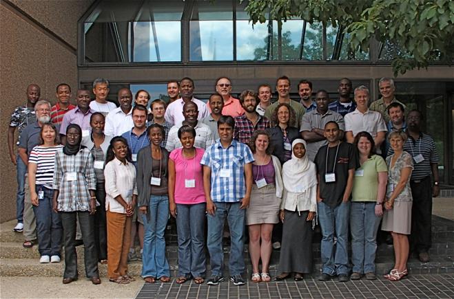
The colloquium aimed to educate and attract graduate students from Africa and
the US (including PhD student Matt Janiga from
DAES) to research with far-reaching consequences and promote their
collaboration. The focus was on (i) developing synthesized knowledge on African
weather and climate, and (ii) applying modern tools of remote sensing,
numerical simulation and prediction, statistical data analysis, and
visualization to understand the variability of weather and climate in the
African region. Lectures were presented by a core group of instructors,
including experts from Africa. Professors Paul Roundy and Chris Thorncroft from
the DAES were both invited lecturers. In addition to the lectures students
worked in small groups on laboratory exercises and simulations based on case
studies. Students also had opportunities to present their research and to
identify areas of priority for future collaboration.
Wednesday, May 25, 2011
Meteorologist Ross Lazear is interviewed by Fox News on the
recent tornado activity in the Midwest.
Recipe for Weather Disaster link:
http://www.clipsyndicate.com/video/playlist/20261/2493444?title=local_news_videos&wpid=9616
Saturday, May
14, 2011
Professor and Chair, Christopher Thorncroft presented the following student awards at Department of Atmospheric and Environmental Science Recognition Ceremony, May 14th:
Atmospheric
Science Program Outstanding Students:
Alicia Bentley and Sara Ganetis
Atmospheric Science Program Best
Forecasters:
Alicia Bentley and Matthew Corbi
Environmental Science Program
Outstanding Student:
Christopher Ferraro
Wednesday, May
4, 2011
The Department of
Atmospheric and Environmental Science is proud to announce that Thomas J.
Galarneau Jr. (PhD ’10) has been selected to receive a 2010-2011 Distinguished
Doctoral Dissertation Award for his dissertation: “Tropical Cyclogenesis Associated with
Extratropical Precursors in the North Atlantic Basin”.
Friday, April
29, 2011
DAES
PhD student Robert Setzenfand has received a National Science Foundation (NSF)
Graduate Research Fellowship, effective Fall
2011. The fellowship provides three
years of financial support: a stipend
and cost of education allowance, as well as access to the TeraGrid
supercomputer. A key component of the
application was a proposal to study tropical-extratropical weather
interactions. That proposal was based on recent work by Assistant
Professor Paul Roundy and Lynn Gribble Verhagen (MS ‘10).
Friday, April 8,
2011
Gabriel Susca-Lopata and Alicia Bentley have been named recipients
of the Class of 1905 Bazzoni Fellowship Award for 2011.
The Class of 1905 Bazzoni Fellowship
was established by Charles Bazzoni in memory of his wife, Edith Vera
Bazzoni, both of the Class of 1905. This fellowship is awarded for outstanding
achievement in the natural sciences.
Each recipient will receive a $1000 fellowship to be used as direct
payment toward tuition, books or other educational expenses.
Wednesday,
March 29, 2011
UAlbany Professor Vuille's Talk on Melting Glaciers in the Andes, March 29, 3rd in Annual Falconer Natural History Spring Lecture Series
|
|
|
The effect of glacier retreat in the Andes of
Ecuador, Peru and Bolivia will be the subject of a March 29 talk by Professor
Mathias Vuille. |

ALBANY, N.Y. (March 14, 2011) -- The Falconer Natural History 2011 Lecture Series continues March 29 at 8 p.m. at the University at Albany John J. Sullivan Auditorium, CESTM building, 251 Fuller Road, Albany. The Tuesday night lectures feature leading scientists on topics ranging from bird migration to melting glaciers, and are free and open to the public.
The schedule began on March 15 with Professor Lynn M. Russell of the Scripps Oceanographic Institute's talk on "Can Aerosol Particles Offset Global Warming?", then on March 22 hosted Professor Victor Magaña Rueda of the Universidad Nacional Autónoma de México and his talk on "Urbanization and climate change: the case of central Mexico" on March 22, followed on March 29 by Professor Mathias Vuille of ASRC, addressing "Climate Change in the South American Andes: will the glaciers survive?"
April
5: Doug Wolfe, Atmospheric Sciences Research
Center, University at Albany, on Whiteface Mountain - A Natural Laboratory.
The first scientific survey some 175 years ago noted that Whiteface Mountain,
with its grand panoramic vistas and unusual flora and fauna, had both tourism
and scientific possibilities. ASRC and UAlbany involvement in the past half
century will be highlighted.
April
12: Dr. Judy Shamoun-Baranes,
Institute for Biodiversity and Ecosystem Dynamics, Universiteit
van Amsterdam, the Netherlands, on The
intimate relationship between birds and their atmospheric environment.
Birds are incredibly mobile animals and their ability to fly thousands, even
tens of thousands of kilometers a year, is truly spectacular. Yet what happens
when birds are trapped in bad weather when flying, or great weather for that
matter? Birds, especially migrants, must adapt their behavior to dynamic
atmospheric conditions.
April
19: Spring Break
April
26: Deborah Martin USGS, Denver, Colo., on Fires,
watersheds, and risks: Comparing western and eastern landscapes. Though
wildfires in the western United States are prominently featured in the
headlines, fire is also considered one of the major ecological disturbances in
eastern ecosystems. Martin will compare the legacy of fire in western and
eastern ecosystems and explore the role of fire in future climate scenarios.
Tax-deductible
donations to sustain the Natural History Lectures may be made out to the
University at Albany Foundation: and mailed to the University at Albany
Foundation, UAB 226, 1400 Washington Ave., Albany,
N.Y. 12222. Address donations “Attention: Ray Falconer Fund.”
Monday,
March 28, 2011
Three DAES students receive the Presidential
Award for Undergraduate Research.
1. Alicia
Bentley: "A Preliminary Climatology of Tropical Moisture Exports in
the Southern Hemisphere"
2. Sara
Ganetis: "Analysis of Banding in 26-27 December 2010 East Coast
Blizzard"
3. Gabriel
Susca-Lopata: "The Role of the Melting Effect in an Oklahoma Winter
Storm”
Each student will receive a $100 award, and participate in the 8th Annual Undergraduate Research Conference Saturday, April 2nd and Sunday, April 3rd in the UAlbany Lecture Center. Recipients will do an oral presentation or prepare a poster presentation/art installation piece for the conference.
Friday,
March 4, 2011
University at
Albany ATM-BS major, Sara Ganetis has
been selected to receive the 2011 SUNY
Chancellor’s Award for Student Excellence, and the 2011 Distinguished Scholar-Leader Award, a President's Award for
Leadership. A ceremony honoring Sara and other recipients of the SUNY
Chancellor’s Award for Student Excellence will be held on Tuesday, April 5,
2011 from 3pm-5pm in the Empire State Plaza Convention Center in Albany,
NY. The Distinguished Scholar-Leader Award ceremony will be held at 2:00
p.m. on Sunday, March 20th in the Campus Center Ballroom.
Saturday, February 26, 2011
Pittsfield
meteorologist keeps eye on the sky
By Clarence Fanto, Berkshire Eagle Staff,

Kimberly McMahon works as a meteorologist in her
office... (Patrick Dodson / Special to The Eagle)
·
PITTSFIELD -- When Kimberly G. McMahon told
friends she was studying to become a professional meteorologist, some of them
gave her a hard time, but all in good fun.
"'Nice work, a job where you get to be wrong 50 percent of
the time,' they told me," McMahon recalled from the Pittsfield home she
shares with her husband of less than a year, Shawn.
The couple relocated from Schenectady, N.Y., to the Berkshires so
that each could be roughly halfway between their workplaces -- she's less than
an hour from the National Weather Service's regional headquarters on the
University at Albany (SUNY) campus, and he's about 90 minutes from Hartford,
where he works as a mechanical engineer.
"I got the better deal -- it's a little more important that I
live closer to the office since I have to get there in all kinds of
weather," McMahon said.
Although McMahon, 28, has become immersed in her dream job during
this severe winter, the four-year veteran of the job called herself a
"late bloomer" in the forecasting world. That's unlike many
colleagues, who developed a fascination with weather in elementary school.
"Originally I wanted to be a volcanologist," she said,
having been impressed by "Dante's Peak," the 1997 disaster film
depicting the impact of a volcano's eruption near a small town in the Pacific
Northwest.
McMahon, born Kimberly Sutkevich, is a native of Long Island, N.Y.
She earned her meteorology degree at the Department![]()
![]()
![]() of Atmospheric and Environmental Sciences
on the SUNY campus, where she studied with Mike Landin, the now semi-retired
professor who broadcast detailed forecasts on AMC Northeast Public Radio for 30
years.
of Atmospheric and Environmental Sciences
on the SUNY campus, where she studied with Mike Landin, the now semi-retired
professor who broadcast detailed forecasts on AMC Northeast Public Radio for 30
years.
"I took his course on severe hazard forecasting,"
McMahon said.
And how did that go?
"Like every forecaster, you have your ups and downs,"
she said. "I was only slightly above average."
Professor Vincent Idone, a 35-year veteran of the department who
was chairman when McMahon was a student, remembers her as "very motivated,
extremely popular with the other students. Her own
dedication and motivation and the training she got here made for a good
combination."
Before graduating from SUNY in May 2005, McMahon served as a
volunteer intern with the National Weather Service. Then she applied for -- and
got -- a student temporary position, one notch up from the internship. She said
her primary responsibility was launching the upper-air balloon for atmospheric
data and training volunteer interns.
After graduation, she worked for the Defense Department at the
Army's Dugway Proving Ground in Utah, an area the size of Rhode Island
surrounded by mountains on three sides.
"I was a federal civilian employee, working as a
meteorologist, setting up observation equipment, launching balloons,
forecasting, issuing thunderstorm warnings and doing research," she said.
"But it was kind of in the middle of nowhere. Definitely
an experience."
When McMahon learned of an opening at the National Weather Service
office in Albany, she went after it.
"I was thrilled to get it," she said. "It was like
coming home, professionally. Everyone there is very respectful, and it's a
great working environment."
In the beginning, McMahon went through rigorous training,
especially on the Weather Service's exclusive high-tech software. After exams
and certification, she was deemed ready for shifts that rotate every few days.
Her supervisor, Raymond O'Keefe, says she is "on the fast
track, very dedicated, conscientious and bright."
Most significantly, he added, she's "a very good
forecaster."
Forecaster Brian Montgomery said McMahon is on "a very fast
career path."
"She's motivated and proactive," Montgomery said.
"Her calmness is always a bonus, and her professionalism shines through. "
But off-duty, McMahon still gets plenty of ribbing from friends
who give her a hard time about forecasts that don't quite turn out, or about
seemingly never-ending bouts of winter weather.
"They still ask me, ‘Can't you make
it stop snowing?' I always tell them: ‘I'm in prediction, not production,'
" she said.
McMahon has her priorities in order.
"I know that my co-workers and I feel we don't want to let
the public down. We take it to heart if we miss a forecast or we put out a
warning for severe weather that doesn't happen. We always try to learn from our
mistakes, or if we did a good job, what can we take away from it."
In fact, according to O'Keefe, the Albany forecast office has had
a stellar winter, with a 97 percent accuracy rate in predicting 117
winter-weather events in its 19-county, four-state region. That's along with a
"false alarm" rate of 23 percent -- out of 149 heavy-snow warnings,
35 didn't pan out.
"It's been one of our best years for predicting winter
weather," O'Keefe said.
Tuesday,
February 1, 2011
Ross Lazear receives Best of our Blogs honor in the Times Union newspaper:
Historic snow, and a mid-week storm…
January 30, 2011 at 1:11 pm by Ross Lazear
It’s been a remarkably snowy winter for many locales across the northeast U.S. While it has indeed been snowy in the Capital Region, with 34″ of snow falling in January alone in Albany, the truly historic snowfall amounts have fallen farther south and east. New York’s Central Park has officially had its snowiest January in recorded history, with a total of 36″. This breaks the old record of 27.4″, set back in 1925. Though only two inches more than Albany’s total for the month, these snowfall amounts are more uncommon in places farther south and along the coast, like New York.
These amounts get more impressive north and east of the NYC metro area. At Bradley International Airport outside Hartford, Connecticut, a whopping 57″ (nearly five feet!) of snow has fallen in the month of January. Worcester, Mass. has received just under 50″.
The map below, from the National Operational Hydrologic Remote Sensing Center (NOHRSC), shows the current snow depth over southern New England. Note the purples in southern Massachusetts and northeast Connecticut. Over thirty inches of snow are still on the ground in these regions, even after the snow has had time to compact, melt, and sublimate (the act of a solid, in this case ice or snow, changing phase directly into a gas, or water vapor).

All eyes are on another potential snowstorm mid-week. First, a light to moderate snow event is possible on Tuesday. Then, a major cyclone will develop in the middle of the country, move across the Ohio Valley and toward the mid-Atlantic coast on Wednesday. At this time, it looks like coastal regions to our south may receive a sloppy mix of precipitation, or even all rain. Upstate, however, we may see significant snowfall potentially mixing with, or changing over to sleet. There is still too much uncertainty in the models to pinpoint specific snowfall amounts, or locations where amounts will be hindered due to mixing with sleet or freezing rain. Nonetheless, we could be looking at quite a mess on our hands here in Albany on Wednesday.
Stay tuned . . .
Wednesday, January
26, 2011
Meteorologists Sleepless in Seattle!
January 26, 2011 at 2:19 pm by Chris Thorncroft
![]() At this time of year the American
Meteorological Society holds its annual
meeting. It’s a huge scientific
conference that covers a wide range of topics including severe weather,
hurricanes, climate variability and change, water and climate, lightning,
clouds and dust to name but a few. There have also been some sessions that
discussed how to communicate with society on sensitive and important issues
such as climate change and there is also a session today that deals with
weather and the energy industry – great stuff!!
At this time of year the American
Meteorological Society holds its annual
meeting. It’s a huge scientific
conference that covers a wide range of topics including severe weather,
hurricanes, climate variability and change, water and climate, lightning,
clouds and dust to name but a few. There have also been some sessions that
discussed how to communicate with society on sensitive and important issues
such as climate change and there is also a session today that deals with
weather and the energy industry – great stuff!!
This year’s meeting is being held during this
week in Seattle and the Department of Atmospheric and Environmental Sciences is
well represented by faculty (Lance Bosart and myself), staff and students (including 4 of our bloggers – Ross, Kevin, Heather,
and Kyle). The meeting is a great experience for students. Graduate students
Heather Archambault, Jay Cordeira and Kyle Griffin are here giving talks on
various aspects of weather and climate. Also three of our undergraduate seniors
Alicia Bentley, Sarah Ganetis and Larry Gloeckler are attending and benefiting
from the experience that includes, in addition to attending the scientific
sessions, meeting with professors from other Atmospheric Science Schools in the
country. A great benefit when you are thinking of graduate school.
Tonight the AMS hosts its annual award
ceremony and we in the Department are very proud that one of our graduate
students, Mike Ventrice, will be receiving an award for the best student
presentation at the AMS Conference on Hurricanes and Tropical Meteorology that
took place in April last year.
This meeting was also a special one for the
Department. For the first time we hosted an alumni event. The event attracted
more than 75 people including many of our past alumni and friends. It was a
particular pleasure to meet up with our alumni, who are now gainfully employed
around the country and, in some instances, around the world.
Perhaps I should end by mentioning that the
temperature here today is in the 50s! Seattle experiences, what we call, a
“maritime climate” that is generally warmer and wetter than the “continental
climate” that we experience in Albany – a
reminder of England for me!
Monday,
January 10, 2010
UAlbany Atmospheric and Environmental Sciences Department Launches Weather Blog
ALBANY, N.Y. (January 10, 2011) -- The University at Albany's Department of Atmospheric and Environmental
Sciences (DAES) today launched "Weather
and Climate," a blog that will be a leading voice on regional and
global weather and weather-related phenomena.
"Weather and Climate," hosted by the Times Union newspaper online, comprises
the collective efforts of expert faculty and staff from the department,
commenting on weather issues in the region and throughout the world. Topics
covered include severe Northeast weather events such as snow storms, floods,
hail, and wind storms; high-impact events affecting the U.S., including
land-falling hurricanes; and conditions in the Pacific region related to El
Nino or La Nina, and what they mean for the planet's weather patterns.
Given its importance to the health of the planet and the vast amount of
conflicting information surrounding the issue, climate change will also be
addressed by the blog's authors.
"Forecast: a great interactive experience"
"People talk about the weather and climate almost every day of their
lives," said Christopher Thorncroft, chairman of DAES, "I am hoping
this blog will be able to provide new information for readers about how weather
and climate work, how forecasts work -- or don't! -- and,
in particular, reasons why high impact events occur. We will also look forward
to some lively posts and discussion about climate and climate change and how
this is relevant to society."
"Weather is one of the few story lines that affect every one of our
readers," said Michael Huber, the Times Union's interactive audience
manager. 'We live in a region with dramatic weather changes through all four
seasons, and this blog gives our readers an opportunity to join in a
conversation with UAlbany’s weather experts. Forecast calls for a great
interactive experience."
The audience for the blog, Thorncroft said, is anyone who has an interest in
the weather and climate, especially those who want to learn more than they
might get from traditional media outlets.
Contributors to "Weather and Climate" include DAES professors Paul
Roundy, a climate variability expert; tropical weather and hurricane specialist
Chris Thorncroft; climate change expert Mathias Vuille; staff members and
meteorologists Ross Lazear and Kevin Tyle; graduate students Heather
Archambault, Kyle Griffin and Matt Potter; and retired professor and former
broadcast meteorologist Mike Landin.
|
|
|
The audience for the new blog is anyone who has an
interest in the weather and climate, especially those who want to learn more
than they might get from traditional media outlets. (Photo Mark Schmidt) |

The authors expect to update the blog at least three or four times per week,
Thorncroft said.
The Department of Atmospheric and Environmental Sciences, part of the UAlbany's
College of Arts and Sciences, carries
out innovative research and provides internationally recognized training for students
at the undergraduate and graduate levels.
Department Highlights
One of the most prestigious members of the
Department in its early years was the late Bernard Vonnegut who, in addition to
working on weather modification, carried out research on electrification of
storms, thunderstorms, tornadoes, and aerosols. He published more than 190
papers and reports and received 28 patents.
A major department achievement was the establishment of the National Lightning
Detection Network, which started as a mere four-station network in New York in
1982.
Starting in the 1990s, the synoptic-dynamics group, led by Distinguished
Professor Lance Bosart, pioneered a collaborative arrangement with the National Weather Service (NWS) in programs
called CSTAR (Collaborative Science, Technology, and Applied Research Program)
and COMET (Cooperative Meteorological Education and Training). The latter
program involved internships for students to work with the regional NWS
personnel housed at the University. The cooperation with NWS is one of the
features that continues to attract undergraduate and
graduate students to the atmospheric science programs at UAlbany today.
Boosted by the arrival of several new faculty over the last 10 years, the
Department has been successful at mobilizing funds and carrying out research in
a variety of areas of tropical meteorology, including hurricanes, monsoons,
intra-seasonal variability, as well as climate variability and change.
Hurricane research has received significant funding in recent years, including
this year’s NASA supported Genesis and Rapid Intensification Program (GRIP) and
NSF supported Pre-Depression Investigation of Cloud-systems in the Tropics
(PREDICT), with funding just for these projects amounting to nearly $1 million.
UCAR Magazine, Monday, November
8, 2010
Hurricanes in the making
Parallel field studies gain the best look yet at incipient tropical cyclones
2 November 2010 • It’s not exactly a moment for celebration, but when a tropical storm is born in the Atlantic, millions of people learn about it quickly. As with any birth, though, a great deal has to happen in just the right way before a tropical storm is christened.
Most tropical storms take shape after spending a few hours to several days as a tropical depression, a quasi-closed circulation whose peak sustained winds haven’t reached the threshold of 63 kilometers per hour (39 miles per hour). For every tropical disturbance that makes it to the depression stage, several more in the Atlantic are snuffed out by wind shear, dry air, and other influences. Both winners and losers in this battle got their six weeks of fame—at least among researchers—in 2010. Aircraft from several agencies spent much of late August and September flying in and around embryonic disturbances, while computer models tracked the circulations and assessed their odds of developing.
Working in tandem, three studies canvassed the tropical Atlantic this year, shown here with their primary funders:
- PREDICT (Pre-depression Investigation of Cloud systems in the Tropics), NSF
- GRIP (Genesis and Rapid Intensification Processes), NASA
- IFEX10 (the 2010 phase of the multiyear Intensity Forecasting Experiment), NOAA
Each project evolved on a separate timeline, with its own goals and instruments, but the three were closely linked. Scientists for each project shared insights and rotated forecasting duties, and the teams synchronized their flight plans with coordination calls twice per day, plus near-continuous exchanges by email.
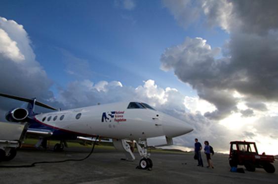
The NSF/NCAR Gulfstream V prepares for an early-morning flight from the St. Croix airport.
“I have never observed such extensive and constructive collaboration between agencies in the planning and carrying out of this kind of field program,” says Edward Zipser (University of Utah). A principal investigator for GRIP, Zipser has nearly five decades of experience in tropical field studies.
The atmosphere itself was also well synchronized with the three studies. With the tropical Atlantic simmering at near-record warmth, and an unusually strong La Niña taking shape, the preconditions were as good as they get. After a quiet start, activity began to bubble toward the end of August. By late September, the projects had gathered exhaustive multiday profiles of the formation of two hurricanes (Earl and Karl), a destructive tropical storm (Matthew), another that was harmless but long-lived (Fiona), and a remnant tropical storm that never revived (Gaston). If analysis goes as well as planned, the results could enhance the ability of forecasters to pick out future hurricanes and weed out doomed systems days in advance.
Nurturing a hurricane-to-be
The problem facing hurricane forecasters and theoreticians alike is aptly stated in the PREDICT project summary: “The formation of tropical cyclones remains one of the great unsolved problems in meteorology.” Once a tropical storm takes shape, track models are increasingly skilled at projecting its path (see related article, inside front cover). The prediction of intensity remains much more difficult, though. That’s especially the case for incipient disturbances that might or might not become tropical cyclones at all.
At the Naval Postgraduate School (NPS), Michael Montgomery, PREDICT’s lead principal investigator, and his research group, including colleague Timothy Dunkerton (NorthWest Research Associates), have spent the last few years grappling with this longtime challenge. Earlier work had made it clear that convection (showers and thunderstorms) is an essential ingredient. Deep layers of moisture are needed in and near the disturbance in order to nourish this convection. And wind shear (the change of winds with height) must be light to keep a system from being torn apart.
The flow in and near an incipient tropical cyclone resembles a cat’s eye on its side, with air circulating inside a protected region where convection and rotation can consolidate. (Illustration courtesy Michael Bell.)
Around 60 disturbances each year move westward across the tropical Atlantic during a typical hurricane season. Many look promising, but only about 20 percent make the transition to tropical depressions, at which point they’re likely to become tropical storms. Why, then, do so many disturbances fail to develop? Montgomery and colleagues knew that disturbances can take many forms on the larger scale, but they focused on atmospheric waves rolling westward through the Atlantic’s deep tropics.
Like waves atop the sea, these systems travel just north of the richly moist ribbon of air known as the intertropical convergence zone, pulling in an umbilical cord of moisture. When the waves move at the same speed as the encompassing flow, a protected region develops—often called the Kelvin’s cat-eye circulation (see graphic) or nonlinear critical layer—that embraces the formative elements of a tropical cyclone. The metaphor that took hold for Montgomery and Dunkerton was the marsupial pouch in which a young kangaroo develops.
“We think the marsupial pouch provides a focal point or ‘sweet spot’ where favorable conditions could persist for several days and where rotating thunderstorms are most likely to aggregate into a larger-scale storm,” says Montgomery. Not all of his colleagues were enraptured with the analogy, says Montgomery, “but we’re actually proving that it has strong scientific merit.”
In a study reported in the journal Atmospheric Chemistry and Physics, Dunkerton and Montgomery, plus Zhuo Wang (University of Illinois at Urbana-Champaign), found pouches in 55 of 61 tropical storms and hurricanes that had roamed the Atlantic and Pacific between 1998 and 2001. The marsupial hypothesis gained further traction through a Pacific field study called Tropical Cyclone Structure–2008, and NPS’s Mark Boothe and doctoral student Robert LeeJoice applied techniques developed for the Pacific study to identify and track pouches in the output of computer forecast models.
What’s inside the pouch is equally important. For a cyclone to develop, it appears that small pockets of rotation and convection need to coincide, thus strengthening both as well as bolstering the larger disturbance. These processes unfold on too small a scale to be monitored routinely, but PREDICT, IFEX, and GRIP were ideally positioned to take a closer look.
Forecasters on the line
At the PREDICT operations center, located on the north coast of St. Croix, forecasters and researchers huddled each morning to look over the day’s data and make flight plans. Similar scenes unfolded at the Fort Lauderdale International Airport for GRIP, and at MacDill Air Force Base near Tampa for IFEX, whose flights overlapped with routine Air Force and NOAA reconnaissance missions into tropical cyclones.
Above: Principal investigators Christopher
Velden (University of Wisconsin–Madison) and Roger Smith (University of Munich)
discuss tropical cyclone dynamics at the PREDICT operations center
Below: PREDICT nowcaster Derrick Herndon (University of
Wisconsin–Madison) keeps an eye on thunderstorms building close to the flight
path of the Gulfstream V.
The teams had a wealth of new analysis tools at their disposal. Along with the “pouch products” developed by Boothe and LeeJoice, they drew on more than 250 model runs each day from ensembles developed by Ryan Torn (University at Albany, State University of New York), Sharan Majumdar (University of Miami), and Fuqing Zhang (Pennsylvania State University). Torn’s ensemble employed initial conditions generated with NCAR’s Data Assimilation Research Testbed, then used the Weather Research and Forecasting model to generate PREDICT-specific output, including the probabilities of pouch quantities exceeding relevant thresholds. The pouch products and longer-range forecasts helped PREDICT gain the flight approvals needed from a web of jurisdictions spanning the Caribbean and western Atlantic.
“The forecasts were excellent from day one,” says Albany’s Lance Bosart, who joined other faculty as well as postdoctoral researchers and graduate students in calling the meteorological shots. Sometimes the prediction took patience, as with Hurricane Karl, which took several days to develop. “I was a day too soon in predicting Karl’s formation,” says Bosart. However, he adds, “The track was well forecast, and the storm was well sampled from the pre-genesis period through the Category 3 hurricane stage. We obtained excellent research datasets.”
GRIP benefited from a brand-new observing platform: NASA’s Global Hawk, a remotely piloted vehicle. After tests in the Pacific, the Hawk made its first flight into a hurricane by slicing through Earl on 2 September. With its range of 11,000 nautical miles (20,000 kilometers), the aircraft gathered data continually for up to 13 hours at a stretch, providing a sorely needed look at hurricane evolution on both short and long time scales. The project also tested a system developed at NCAR that will soon allow the Global Hawk to deposit dropsondes (parachute-borne instrument packages) on command. “It’s clear that the Global Hawk will be an amazing tool for studying tropical cyclone formation,” says Albany’s John Molinari.
PREDICT gave the NSF/NCAR Gulfstream V some of the most intensive workouts in its five-year history. Only a year after retiring, veteran NCAR pilot Henry Boynton returned to the skies for PREDICT, accompanied by longtime colleague Lowell Genzlinger. The presence of a second crew headed by pilots Joseph McClain and Stephen Thompson allowed for five consecutive days of G-V coverage on two prolonged systems.
As they circled around and through pouches, the G-V pilots got the kind of customized weather guidance that most commercial pilots only dream of. A group led by Christopher Velden at the Cooperative Institute for Meteorological Satellite Studies (NOAA/University of Wisconsin–Madison) brought real-time, high-frequency satellite data and derived products into a large-format display developed at NCAR that showed the G-V’s flight path (see photo). The mission coordinator and scientist on board the aircraft could see the same real-time display as the forecasting team on the ground, which helped them guide the pilots around thunderstorms and gather prime data while staying safe.
”The combination of real-time satellite products, data displays, and chat communications with the operations center gave us a great capability to adjust our flight patterns on the fly in the dynamic pre-hurricane environment,” says Michael Bell (NPS/NCAR), who served as a principal investigator and a G-V mission scientist.
Students played meaningful roles across the spectrum of field work at PREDICT. “It’s been exciting to apply cutting-edge analysis tools used to understand tropical cyclone formation in an operational setting,“ said Heather Archambault, a graduate student at Albany and a lead forecaster for PREDICT. “This has been one of the best educational experiences I’ve had.”
According to Velden, ”Many times in these high-powered field programs, the students are invited along as a learning experience and end up playing passive onlookers while the mentoring scientists lead the charge. But there was a significant, measurable contribution from the student involvement in PREDICT, from forecasting to decision support to aircraft flight tasks.”
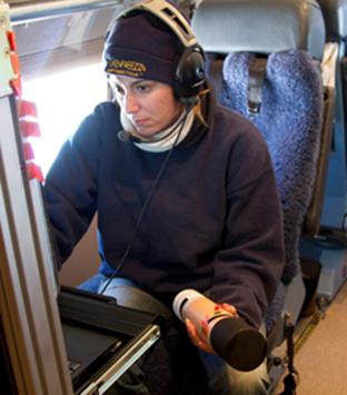
NCAR technician Laura Tudor prepares a dropsonde for launch.
Storm after storm
The PREDICT/GRIP/IFEX trio made the most of the stream of tropical cyclones that traversed the Atlantic this year. A couple of the season’s first hurricanes developed too quickly and too far east for the projects to document, but September brought a rapid-fire string of successful sorties.
Hurricane Earl was a particular success for GRIP’s rapid intensification component, as the system quickly grew to Category 4 intensity just north of the Caribbean before recurving off the U.S. East Coast. NASA’s DC-8 made four flights into Earl over five days, while NOAA’s Gulfstream IV and two P-3 aircraft sampled the storm and its environment with 18 research flights. Another dozen or so flights were deployed by the Air Force’s fleet of C-130 hurricane hunters. “By any measure, this is the best data on rapid intensification ever obtained,” says Zipser. (Earl also gave the PREDICT ground team a jolt of adrenaline as it moved north of St. Croix. The outer bands of the quickly strengthening storm brought debris-tossing gales to the operations center, forcing the staff to seek higher ground for a time in the hurricane-shuttered restaurant of their hotel.)
Along with capturing Hurricane Karl, as noted above, PREDICT gathered ample data on the birth of Tropical Storm Matthew across the southern Caribbean. The prolonged demise of Tropical Storm Gaston provided an equally valuable but much different case. Only a day after being named, Gaston diminished to a remnant low in the tropical Atlantic. At one point the NHC gave the remnants an 80% chance of reviving, but those odds slowly dropped as the system limped into the Caribbean and finally decayed. “Gaston continued to struggle even though it seemed like a viable disturbance for a long time,” says PREDICT PI Christopher Davis (NCAR). “It could teach us a great deal.”
Daily flights during the process made Gaston the most thoroughly observed case of failed tropical cyclogenesis in history, as well as a perfect “null case” for PREDICT: why didn’t the system redevelop?
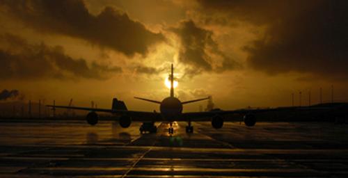
NASA’s DC-8 shuttled to St. Croix for a flight into the remnants of Tropical Storm Gaston on 7 September. (Photo by John Cowan, NCAR.)
“The depth of the pouch seemed to diminish with time,” according to Montgomery. “There was strong shear from the east, and a lot of dry air was going over it.” If Gaston’s apparent top-down decay is confirmed, it could lend support to the bottom-up development model favored by Montgomery. It’s one facet of a longstanding debate over the vertical sequence of tropical cyclone formation that PREDICT may help settle.
As for forecasting, Montgomery and collaborators would like to see the new pouch-prediction model output added to the arsenal of tools used by NHC forecasters to help save lives and property. This year’s field work could also benefit NOAA’s ten-year Hurricane Forecast Improvement Program, which aims for a 20% improvement by 2013 in the accuracy of NHC’s five-day hurricane track and intensity forecasts. Another goal is to extend hurricane forecasts to seven days.
In order to stimulate progress in long-range prediction, the PREDICT and GRIP teams will need to analyze the data they’ve gathered this year from the difficult-to-observe areas within pouches where the biggest uncertainties lie. “Satellite pictures don’t tell you everything,” Montgomery notes. “The models have a lot of skill at predicting where the pouches are, but they don’t have a lot of skill at predicting what’s going to happen within the pouches. That’s why we’ve been collecting data.” These observations, he adds, should help solve the mystery of why some storms thrive in their protected regions while others struggle to survive.
—Bob Henson
September 3, 2010
Featured Faculty 2010
|
Ryan Torn Collaborates
with NCAR to Develop Numerical Weather Models |
|
|
|
|
|
|
|
In
early August, the National Hurricane Center designated
two numerical weather models as semi-operational, meaning that the output
from these models would be available to hurricane specialists to make their
operational forecasts. This process involved running these computer
models over many different hurricanes and many different times, and comparing
the model's track and intensity forecast against the best estimates of these
quantities. One of the two models is the National Center for
Atmospheric Research (NCAR) Advanced Hurricane Weather
Research and Forecasting (AHW) model. Over the past two hurricane
seasons, the initial conditions for that model have been generated using an
advanced technique that combines the information from observations and a
previous computer model forecast. The application of this technique to
hurricanes has been developed over the past three years by Ryan Torn,
Assistant Professor in Atmospheric and Environmental
Sciences in collaboration with scientists at NCAR. Current
forecasts from this system are available at: http://www.wrf-model.org/plots/realtime_hurricane4km.php |
August 3, 2010
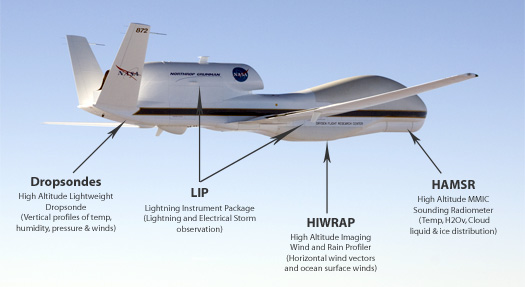
Faculty and Students from DAES
participate in two hurricane field campaigns in summer 2010
Four faculty along with their students will be participating in two hurricane field campaigns in August and September this summer. NASA-supported GRIP and NSF supported PREDICT will be working together and with NOAA-supported IFEX (Intensity Forecasting Experiment) to improve our understanding of the nature and causes of hurricanes including their genesis and rapid intensification.
Genesis and Rapid Intensification
Processes (GRIP)
The GRIP experiment is a NASA Earth science field experiment in 2010 that will be conducted to better understand how tropical storms form and develop into major hurricanes. NASA plans to use a DC-8 aircraft and the Global Hawk Unmanned Airborne System (see photo above) configured with a suite of in situ and remote sensing instruments that will be used to observe and characterize the life-cycle of hurricanes. The GRIP deployment is planned for 15 August – 30 September 2010 with bases in Ft. Lauderdale, for the DC-8, and at NASA Dryden Flight Research Facility, CA, for the Global Hawk.
Professors John Molinari and Chris Thorncroft are members of the NASA Hurricane Science Team and are involved in this project. John will be one of the Mission Scientists for GRIP, serving for three weeks during the field campaign. This will involve directing the aircraft and sometimes flying (in the DC-8), as well as coordinating with PREDICT and IFEX. Two of John’s students (Leon Nguyen and Diana Thomas) and one of Chris’s students (Matt Janiga) will be based in Ft Lauderdale for two weeks each to help with forecasting and will also likely get a chance to fly missions on the DC-8.
See http://grip.nsstc.nasa.gov for more information.
PRE-Depression
Investigation of Cloud-systems in the Tropics (PREDICT)
The PREDICT experiment is a close collaboration between the NSF, NOAA and Naval Postgraduate School in Monterrey, California. The aim of the program is to explore the nature of the precursor disturbances that can become tropical storms (and eventually hurricanes). It will utilize the high endurance NCAR G-V aircraft in collaboration with two NOAA WP-3D aircraft (from IFEX).
Professors Lance Bosart and Ryan Torn are co-PIs on the NSF PREDICT project. Lance will serve as the lead forecaster for PREDICT and will be responsible for scientific mission planning from late August through mid-September when he will be based in the PREDICT operations center in St. Croix, Virgin Islands. Ryan will be running a computer model in the Department that will assimilate the additional data in real-time to assess the impact of this data and to provide guidance for mission planning. Lance has four students who will be contributing to PREDICT. Newly admitted graduate student Kyle Griffin and existing graduate student Jay Cordeira will provide PREDICT forecast support during the second half of August. Existing graduate students Tom Galarneau and Heather Archambault will provide forecast support during the first and second halves of September respectively. They may also have options on PREDICT research flights based out of St Croix, Virgin Islands. A newly admitted student of Chris’s, Jason Dunion, will be a lead forecaster for PREDICT during the second half of August.
See http://met.nps.edu/~mtmontgo/predict.html and http://www.albany.edu/news/campus_news_9949.php for more information.
Video clip: http://www.youtube.com/watch?v=s_V2mKypJ2g