Ground
based radar
During
Elena's slow
loop in
the Gulf, the center was
within 200 km of the WSR-57 radar at
Apalachicola, FL (AQQ) from 22 UTC 31 August through 07 UTC 2
September.
1,142 complete scans of Elena's eyewall and inner rainbands
were made
during
this 34 hour period with as little as 23 s between
scans. In
order to
have a uniform time step between radar images and to focus on
the
mesoscale
aspects of the reflectivity field, the scans were linearly
interpolated
to
five-minute intervals. Only the
closest two scans to the time in question
were weighted and used to compute the interpolated scan.
If there were no scans within five
minutes of either side of the prospective interpolated time,
no scan
was calculated
and a gap appears in the data.
Below are two scans from the AQQ radar. The image on the left is from 2205 UTC 31 August when Elena was a disorganized, but strong category 2 hurricane. The image on the right is from 1755 UTC 1 September as Elena was approaching peak intensity (~56 m s-1).
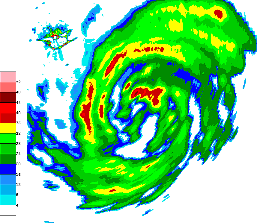
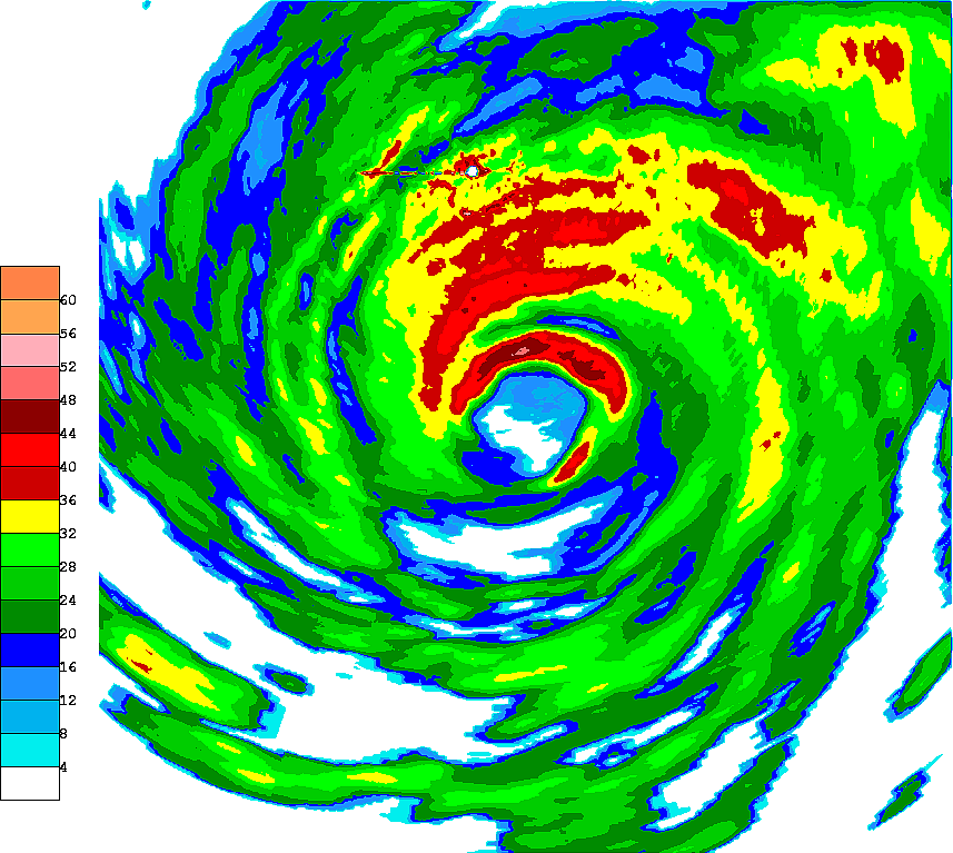
The
location
of the AQQ radar can be seen in both images as the open white
circle
and
surrounding high reflectivity values due to ground clutter
(upper left
corner
of left image; north-northwest of Elena's center in right
image).
In
order to analyze the changes in reflectivity with time in
Elena, the
radar
location and surrounding clutter were eliminated by removing a
box
centered on
the radar. The removed area was then filled by
bilinearly
interpolating
from the surrounding data points.