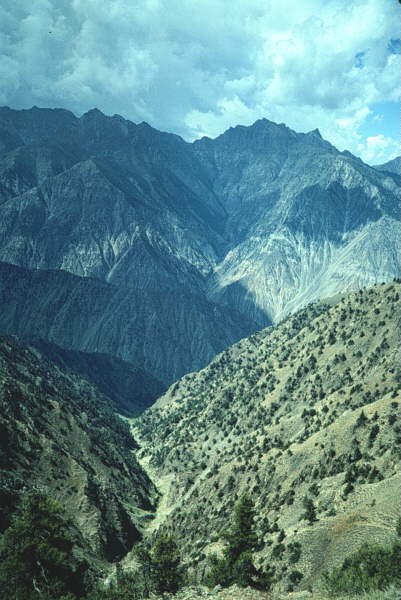
5. View to W from Airl Gali pass, looking across Manogush Ridge (foreground) to Nashkin Valley. ~2600m of vertical relief is represented. Viewer is standing within retrograde (?) metapelitic cover looking across the ~5 km (structural thickness) of Jalhari Granite (deformed in the Airl-Gah/Diamir Shear Zone). Note dark rocks of Kamila amphibolite that mark MMT hanging wall in distance at top of furthest ridge. They overlie the up to ~8 km (structural thickness) of carbonates, amphibolites, and metapelites of the local Indian plate cover rocks. Manogush Ridge dividing Biji Gah from Barai Gah is in shadow in the centre of the picture.
Image copyright © 1996 M.A. Edwards.
(email
to request permission to use)