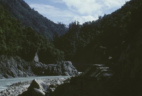
View down the Po-Tsangpo River gorge south of Tungmai. High peak in
the distance is Gyala Peri (7294m); elevation of the river here is
about 3050m.
Vegetation trim line
about 40 meters above the river is from the landslide dam breakout
flood of
July
2000. Photo taken 24 May 2002.
Photo copyright © 2002 W.S.F. Kidd. (email
to request permission to use)
View upstream
Outcrop photos from this section along the
Po-Tsangpo
return to Bill Kidd's Namche Barwa photo
index
page