Map Discussion: 28 September 2018
Map Discussion Summary
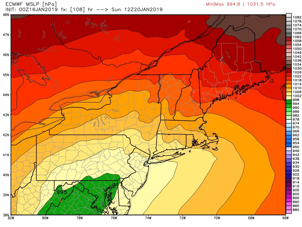
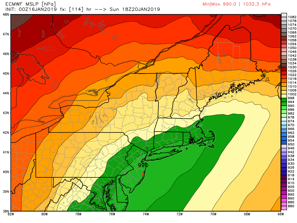
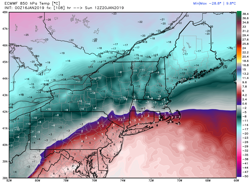
Map Discussion Synopsis (Lance Bosart)19-20 January 2019 Winter Storm
North America Standard Maps (Alicia Bentley)Eastern Pacific SSTs (Tropical Tidbits - Levi Cowan)
WPC Snowfall Forecast (WPC)
EC MSLP@2012Z (wxbell)
EC MSLP@2018Z (wxbell)
EC T850@2012Z (wxbell)
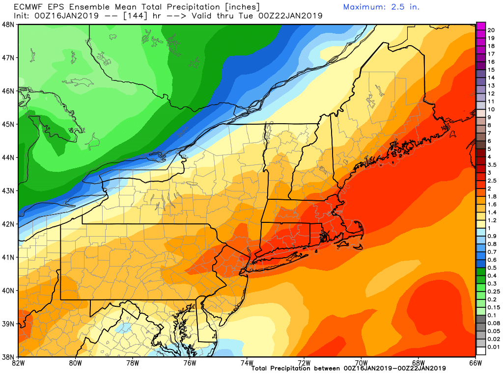
EPS QPF (wxbell)
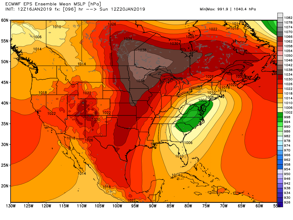
EPS MSLP@2012Z (wxbell)
Other Miscellaneous Links
Real-Time Global Surface Winds (Cameron Beccario)SPC Meso Archive
National Snow Analyses - NOHRSC
World Climate Index Map
Mike Ventrice's TRMM Precipitation / MJO Filtered VP200 hPa / 200 hPa Winds
Wyoming Sounding Page
Twister Data
National Buoy Data Center
Storm Prediction Center Meso-analysis
Penn State's EWALL Model Page
High Resolution Rapid Refresh Home Page
Kyle Griffin's Maps: Main Page
Heather Archambault's 2015 GFS Analyses
Tom Galarneau's Real-time Diagnosis of GFS Forecasts
Tom Galarneau's Real-time Analysis and Forecasts of the QG Diagnostic Equations
RAP-UCAR Real-Time Weather Data
Digital Typhoon - Typhoon Images and Information
PSD Maproom - ESRL
NeXt Generation Weather Lab - College of DuPage
Free Relief Maps
Modis Satellite Imagery World Viewer
Levi Cowan Tropical Tidbits
NCAR-RAL TC Guidance Project
Bob Hart's Model Page
Climate Reanalyzer (UMaine)
National Climate Center Monsoon Monitoring (China)
DAES In the News


Related Links
-
Department of Atmospheric and Environmental Sciences
University at Albany,
State University of New York -
DAES - ES351
1400 Washington Avenue
Albany, NY 12222
PHONE (518) 442-4556
FAX (518) 442-5825
-
- Faculty/Staff Directory
- Visit our Facebook site
