6
Feb 2009
*Loops
of 300-hPa HGHT (1 deg GFS), HGHT departures, and standardized HGHT
anomalies (climatology from NCEP-NCAR reanalysis) for:
Pacific/North
American sector (10 Dec -- 6 Feb 2009)
North
Atlantic/Europe sector
(1 Jan -- 6 Feb 2009)
*Isobaric and cross-section plots for recent SSW event (from Tom Galarneau)
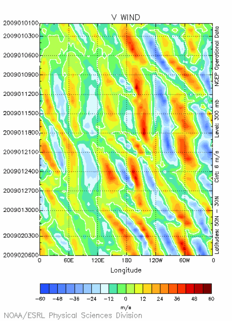
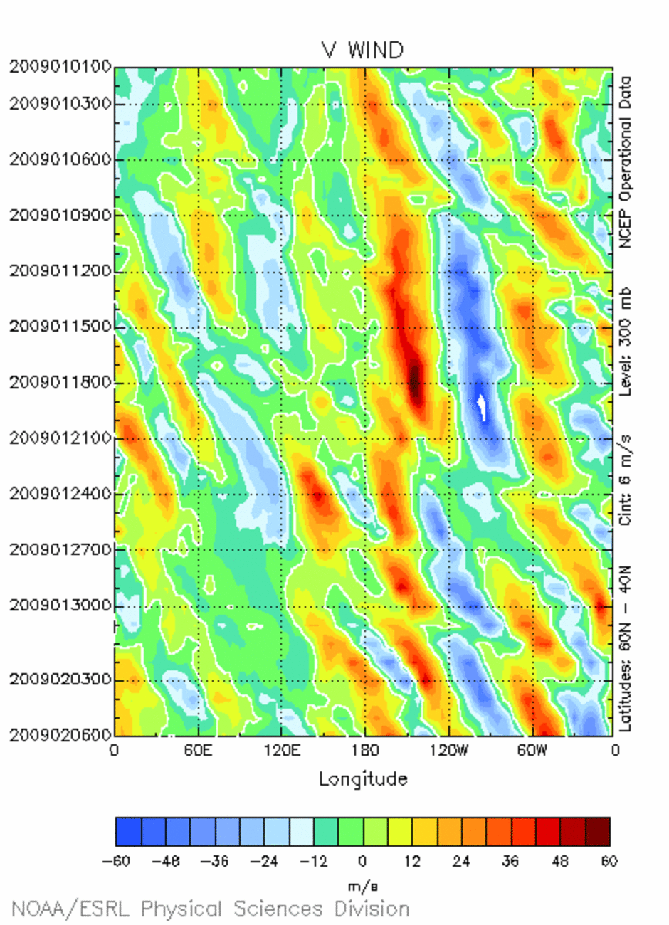
*300-hPa meridional wind Hovmoellers (30--50 N and 40--60 N; 1 Jan -- 6 Feb 2009)
9 November 2007: Part I: European wind storm of 8--9 November 2007. Part II: Flooding in the Mexican state of Tabasco in late October 2007. Part III: European wind storm #2 (10--11 November 2007).
2 November 2007: Extratropical transition of Noel.
26 October 2007: Meteorological and climate conditions favoring the 21–28 October 2007 southern California fire outbreak
19 October 2007: The central and eastern U.S. extended warm spell, and how the associated large-scale flow pattern favors autumnal severe weather outbreaks
12 October 2007: PV tails over the North Atlantic, South Atlantic, and South Indian oceans
5 October 2007: Recent central and eastern U.S. warmth, and recent null tropical transition events in the Gulf of Mexico and western Atlantic
28 September 2007: Recent 850-hPa/surface temperature relationships in the Northeast, and NH July/August decadal changes in 1000-500 hPa thickness
21 September 2007: Historical context and evolution of a recent southern California cutoff
14 September 2007: Record minimum Arctic sea ice and near-record maximum Antarctic sea ice
7 September 2007: Lifecycle of Tropical Storm Gabrielle
31 August 2007: Synoptic and sub-synoptic features controlling the life cycles of Tropical Storm Erin and Hurricane Dean
13 April 2007: (i) Recent NH height/temperature anomaly patterns, and (ii) severe weather in Texas and links to an upcoming Nor’easter (4/15–16)
30 March 2007: Mid- to late March severe weather outbreaks over the U.S. Plains and MS Valley
23 March 2007: String of South Indian TCs in mid-February
16 March 2007: St. Patrick’s Day storm in the Northeast
9 March 2007: No map discussion
2 March 2007: 1 March severe weather event in AL and GA, with a focus on the Enterprise, AL tornado (2 parts)
16 February 2007: Upper-level conditions associated with the Tug Hill Plateau lake-effect snows in the first two weeks of February, and the origin and evolution of the Valentine’s Day snowstorm
9 February 2007: Recent cyclone behavior in the eastern Pacific and North Atlantic, and cross-equatorial upper-level flow linkages between the NH and SH
2 February 2007: Life cycles of blocking anticyclones that formed over the North Pacific and North Atlantic in the third week of January 2007
26 January 2007: 17–18 January 2007 European wind storm and the ensuing formation of a significant omega block over the North Atlantic ocean
--- Fall 2006 ---
8 December 2006: Subtropical jetogenesis over the East Pacific, the NH 2006 SON climate, and the short-lived arctic cold surge over the Northeast
3 November 2006: 29 October 2006 eastern Pacific unnamed tropical storm (text only)