Map Discussion: 16 November 2018
Map Discussion Summary
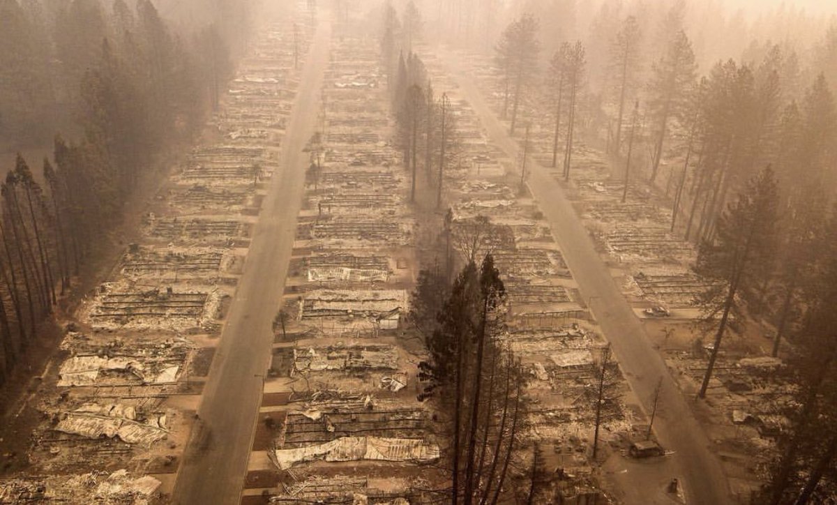
Map Discussion Synopsis (Lance Bosart)November 2018 California Wildfires
SPC Fire Weather Outlook (SPC)Destroyed Neighborhood in Paradise, CA (NBC News)
Paradise, CA Overhead view, Before and After Mike Bettes
Burn Index Percentile Maps (Daniel Swain)
Camp Fire Satellite Loop (CIRA RAMMB)
Camp Fire Summary and Simulation (Cliff Mass)
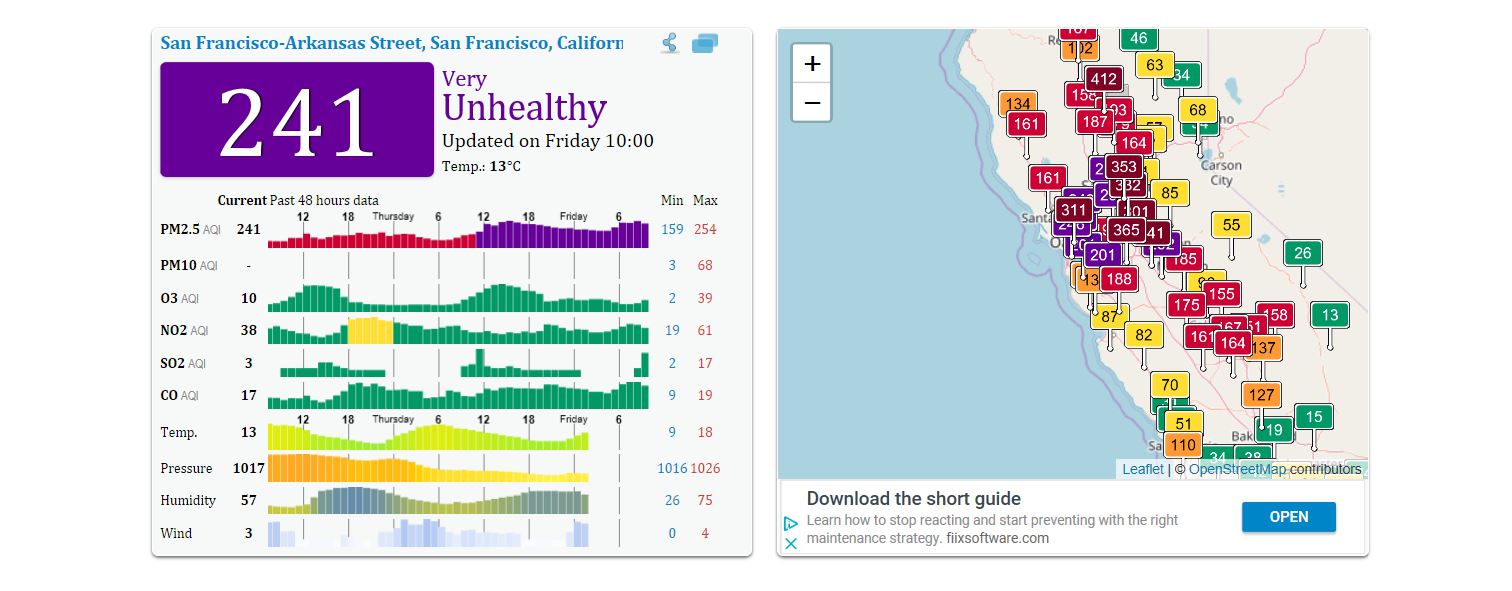
16 November SFO Air Quaility (AQICN snapshot)
Anomalous Southern U.S. Cold
NH November Composites (NCAR Reanalysis/Weatherbell)North America Standard Maps (Alicia Bentley)
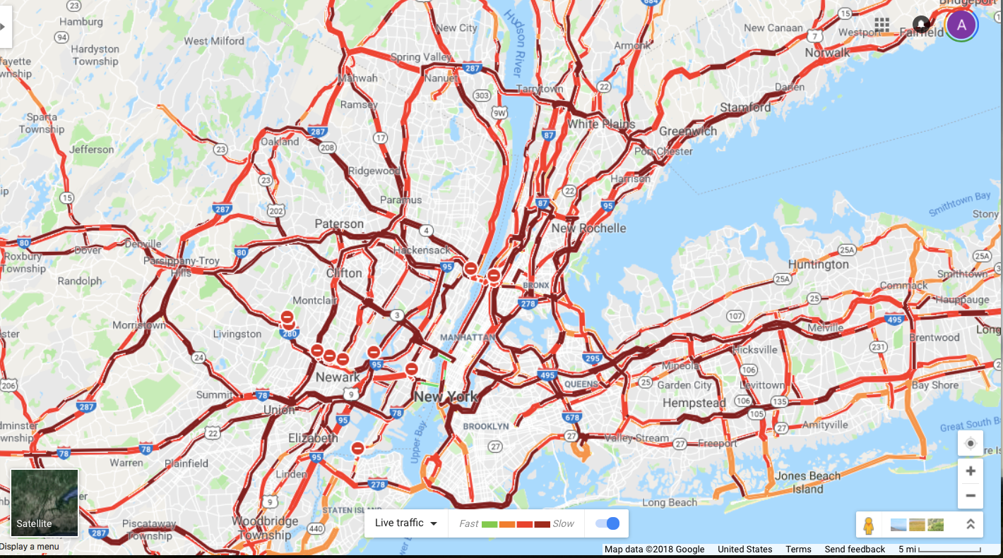
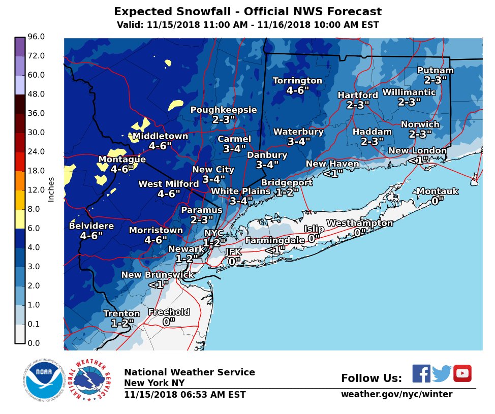
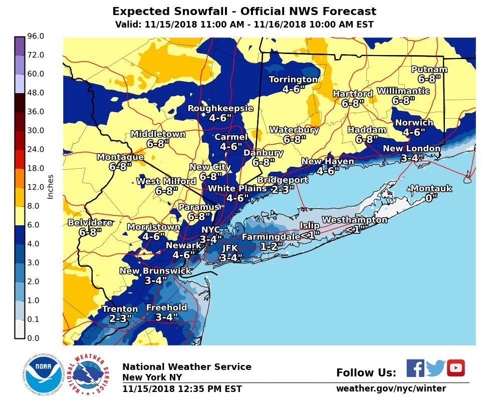
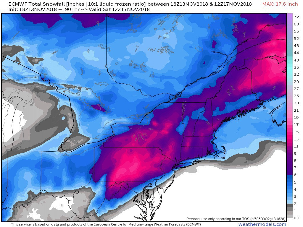
15-16 November 2018 Nor'Easter
NYC Traffic Jam (Google Map)Precip Type Radar Loop (Penn State)
15 November 12z NWS Forecast (NWS)
15 November 18z NWS Forecast (NWS)
Lance Bosart Automation Email 16 November 2018 (Lance Bosart)
Northeast U.S. soundings (SPC)
Snowfall Accumulations Tomer Burg
13 Novenber 18Z ECMWF Snowfall Forecast WeatherBell
GFS/ECMWF Verification (Ryan Maue)
Frontogenesis Cross-Section (Tomer Burg)
Frontogenesis GIF (SPC)
Backward Trajectories (HYSPLIT)
GFS Analyses (Tomer Burg)
Other Miscellaneous Links
Real-Time Global Surface Winds (Cameron Beccario)SPC Meso Archive
National Snow Analyses - NOHRSC
World Climate Index Map
Mike Ventrice's TRMM Precipitation / MJO Filtered VP200 hPa / 200 hPa Winds
Wyoming Sounding Page
Twister Data
National Buoy Data Center
Storm Prediction Center Meso-analysis
Penn State's EWALL Model Page
High Resolution Rapid Refresh Home Page
Kyle Griffin's Maps: Main Page
Heather Archambault's 2015 GFS Analyses
Tom Galarneau's Real-time Diagnosis of GFS Forecasts
Tom Galarneau's Real-time Analysis and Forecasts of the QG Diagnostic Equations
RAP-UCAR Real-Time Weather Data
Digital Typhoon - Typhoon Images and Information
PSD Maproom - ESRL
NeXt Generation Weather Lab - College of DuPage
Free Relief Maps
Modis Satellite Imagery World Viewer
Levi Cowan Tropical Tidbits
NCAR-RAL TC Guidance Project
Bob Hart's Model Page
Climate Reanalyzer (UMaine)
National Climate Center Monsoon Monitoring (China)
DAES In the News


Related Links
-
Department of Atmospheric and Environmental Sciences
University at Albany,
State University of New York -
DAES - ES351
1400 Washington Avenue
Albany, NY 12222
PHONE (518) 442-4556
FAX (518) 442-5825
-
- Faculty/Staff Directory
- Visit our Facebook site
