
Surface and Upper-Air Observations
ALBANY & NEW YORK STATE DATA
- Current decoded observation from the Albany County Airport (UAlbany)
- Current undecoded observations from the Albany County Airport (last 24 h) (UAlbany)
- Meteorogram from the Albany Airport. Previous days and nearby stations are available here (UAlbany)
- New York State Weather Hourly Roundup (NWS product from UAlbany)
- Current decoded observations for New York State (UAlbany)
- Current undecoded observations for New York State (UAlbany)
SURFACE DATA
- Interactive Weather Retrieval (SUNY Albany)
SURFACE MAPS
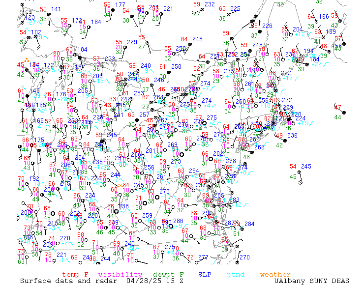
- Surface map of northeast United States in GIF format. You can also look at some older maps.
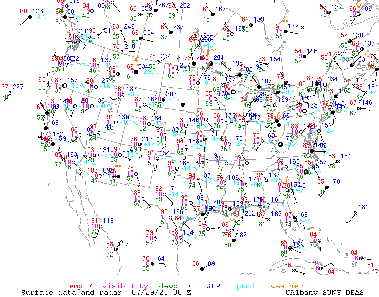
- Surface map of United States in GIF format. You can also look at some older maps.
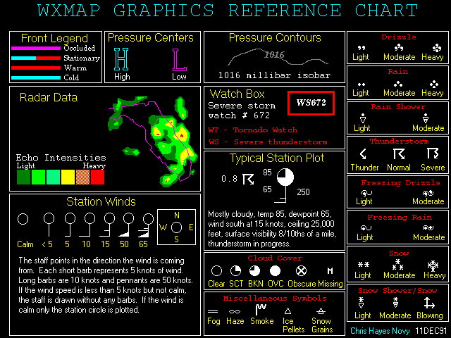
- Key to reading Surface maps
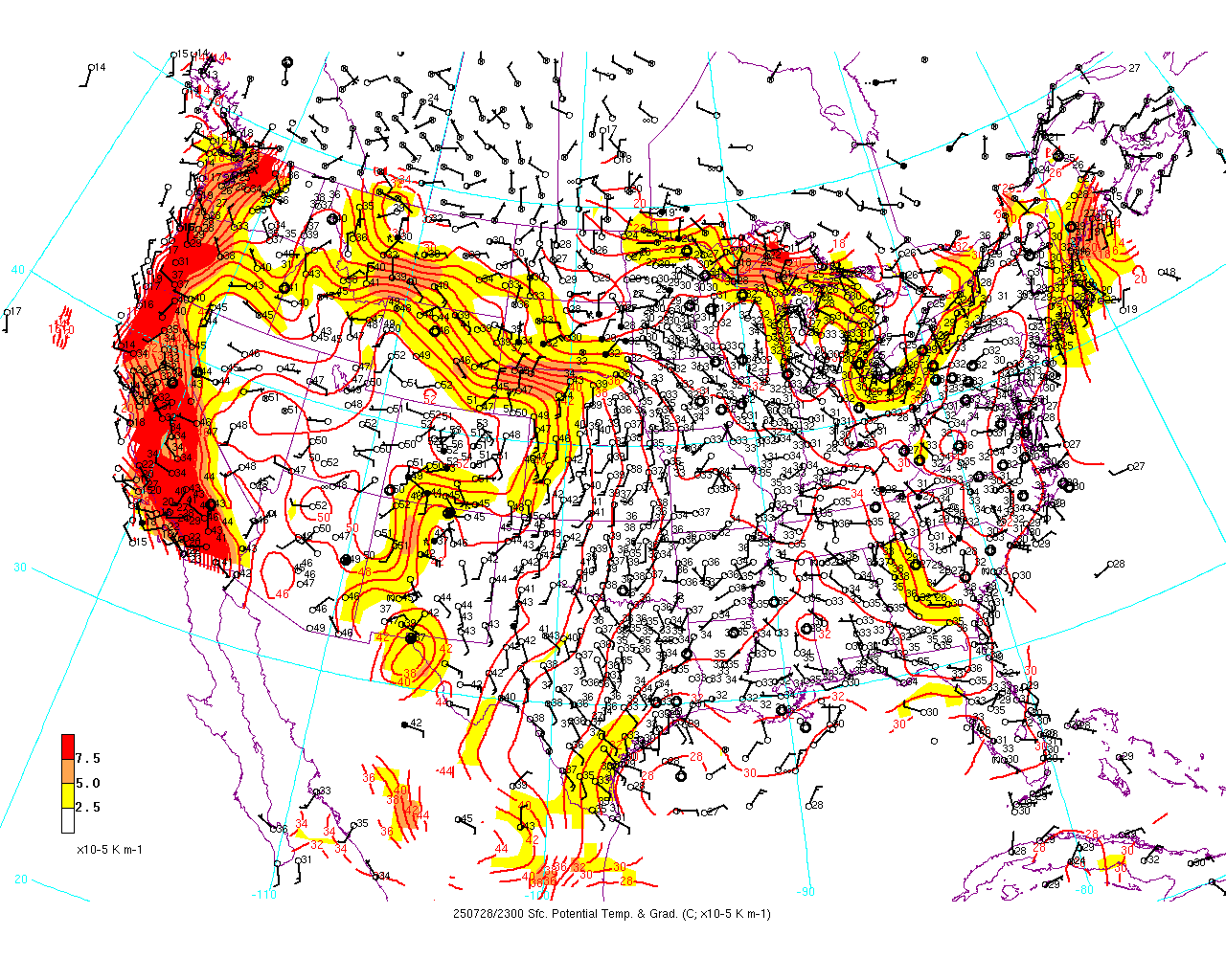
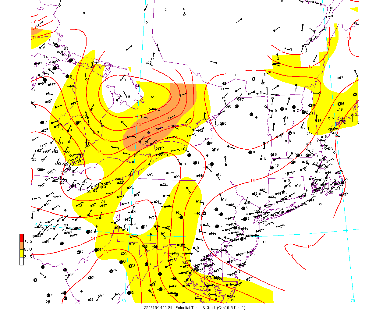
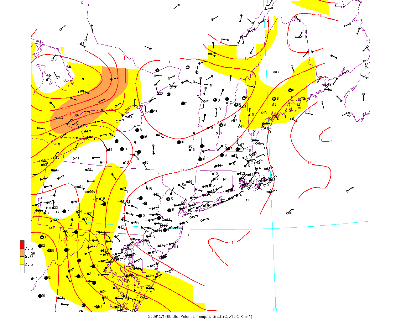
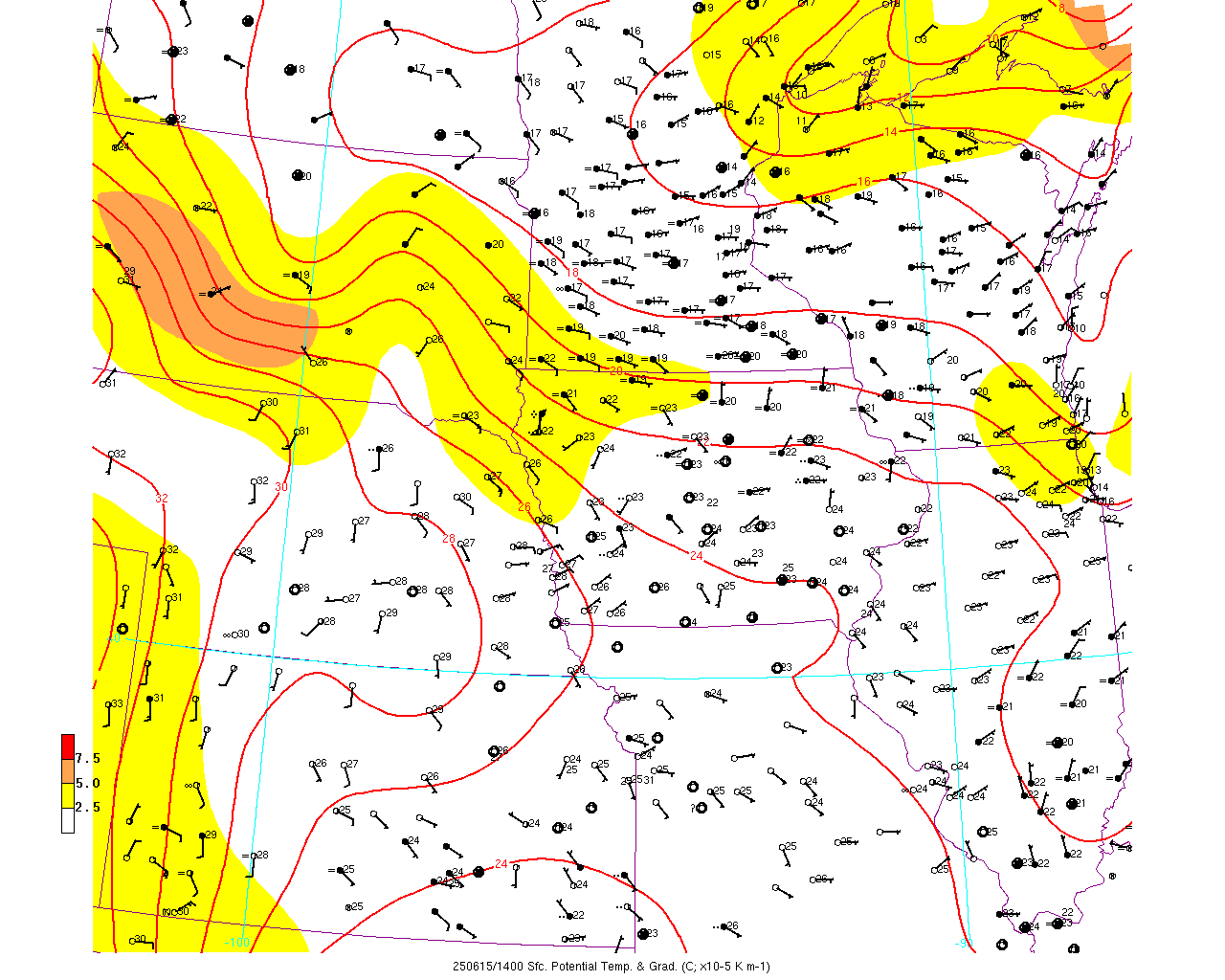
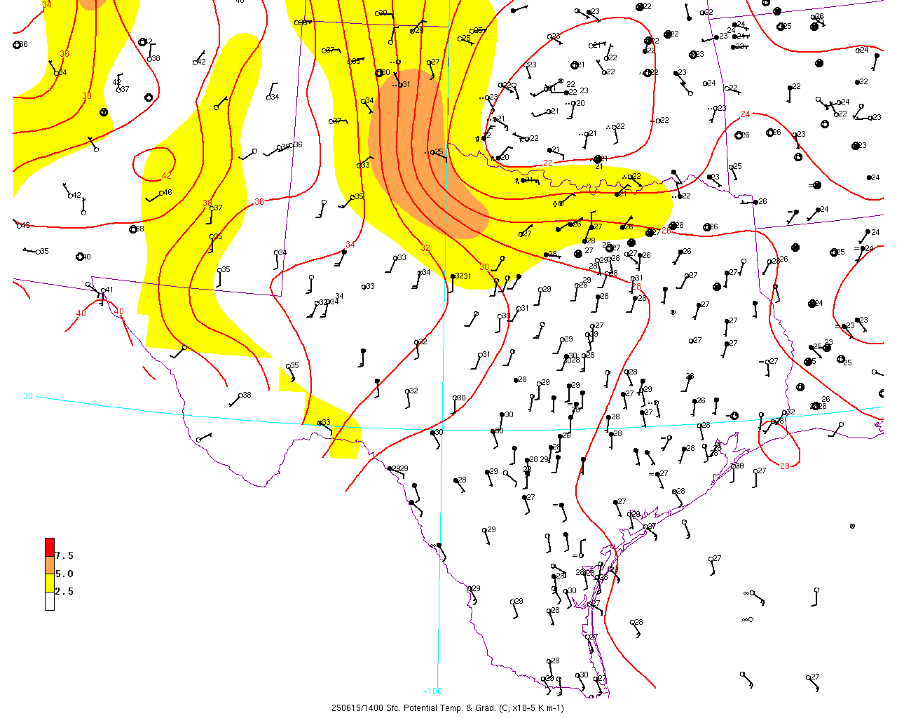
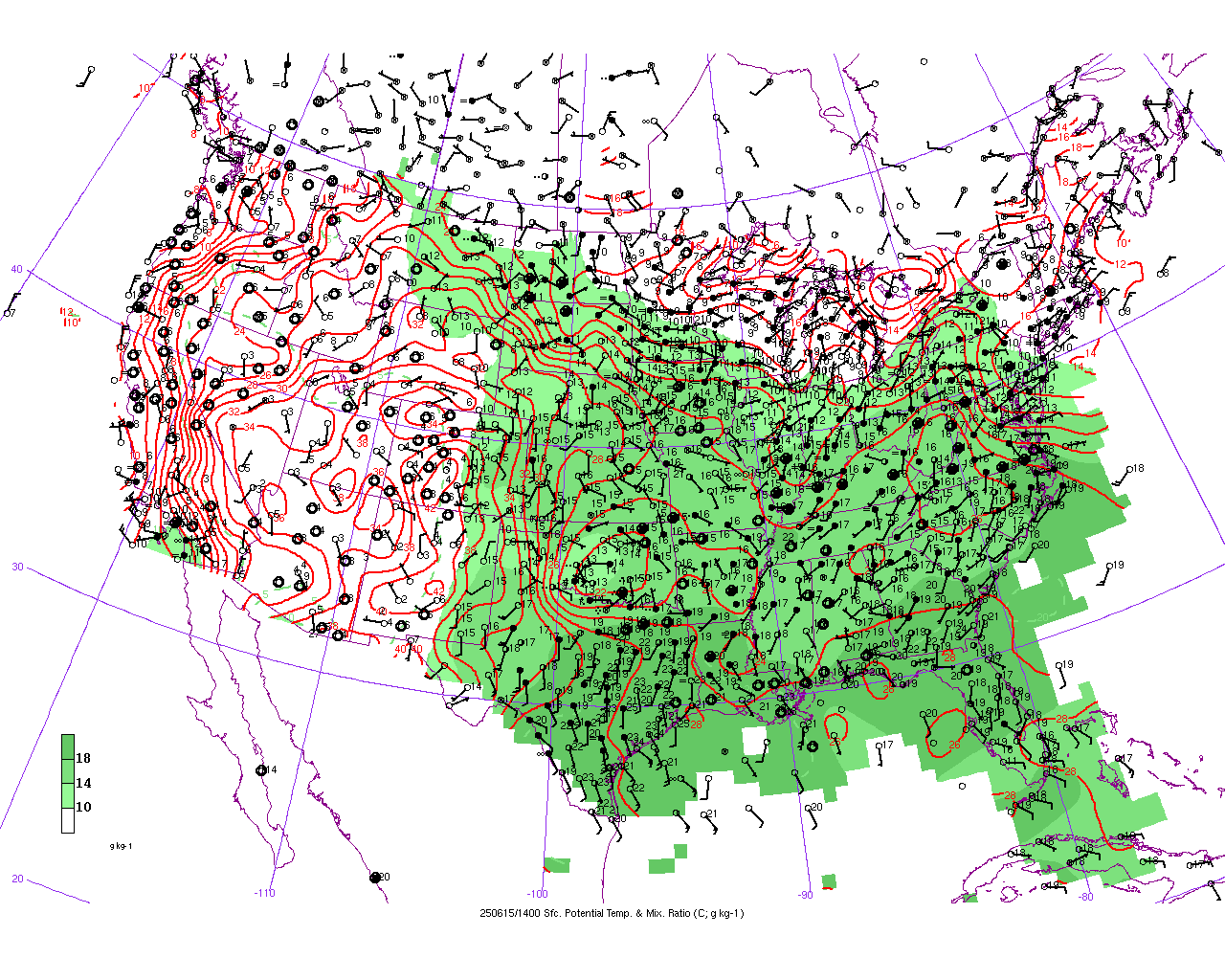
- Surface potential temperature map of US in GIF format. Here is an animation of theta (US) .
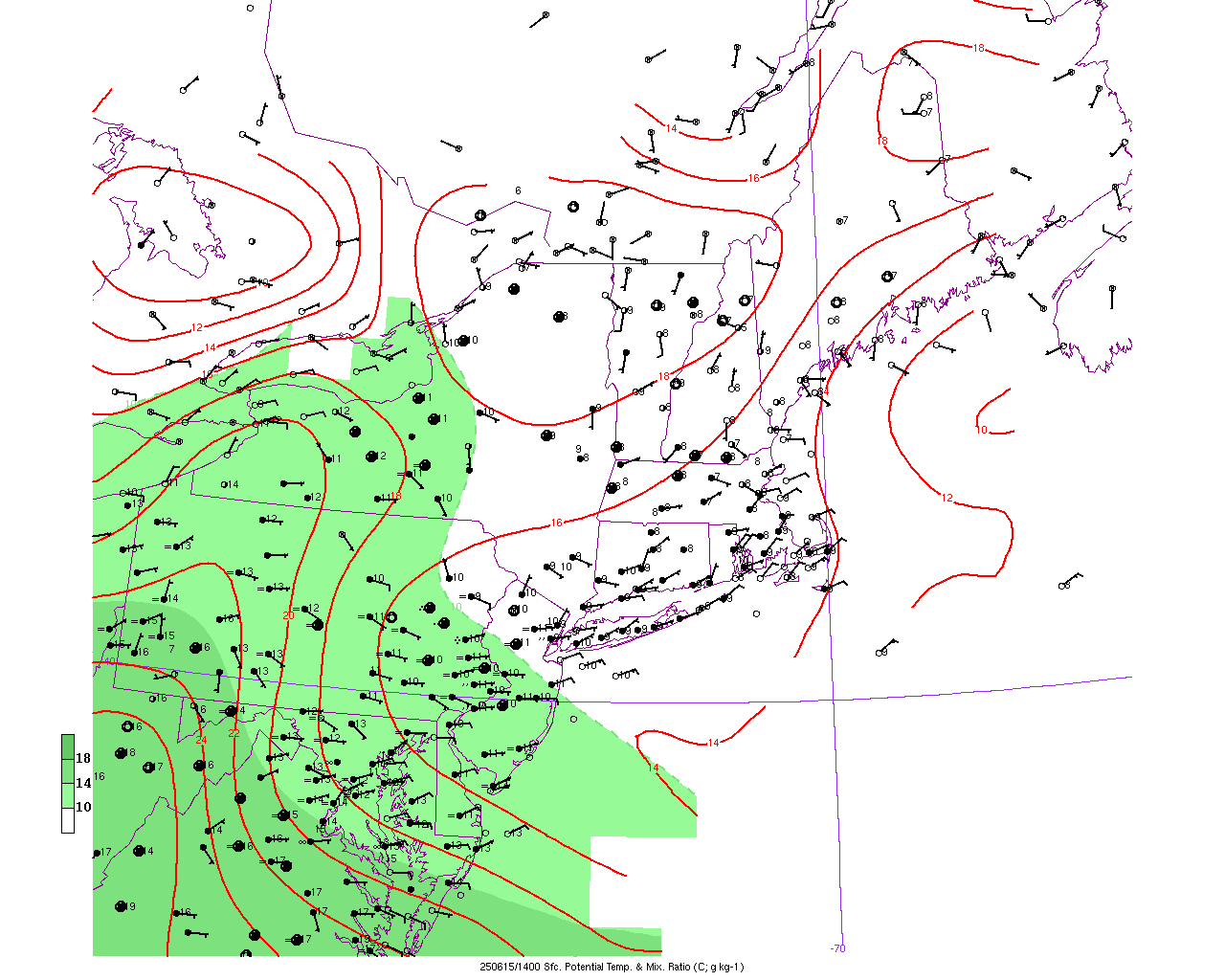
- Surface potential temperature map of NY in GIF format. Here is an animation of theta (NY) .
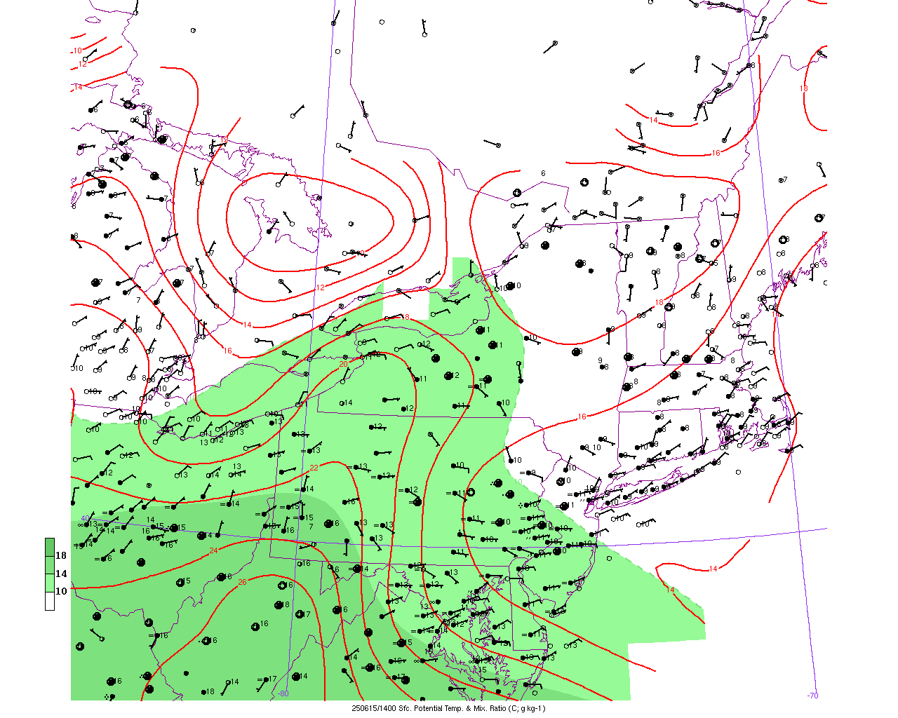
- Surface potential temperature map of MA in GIF format. Here is an animation of theta (MA) .
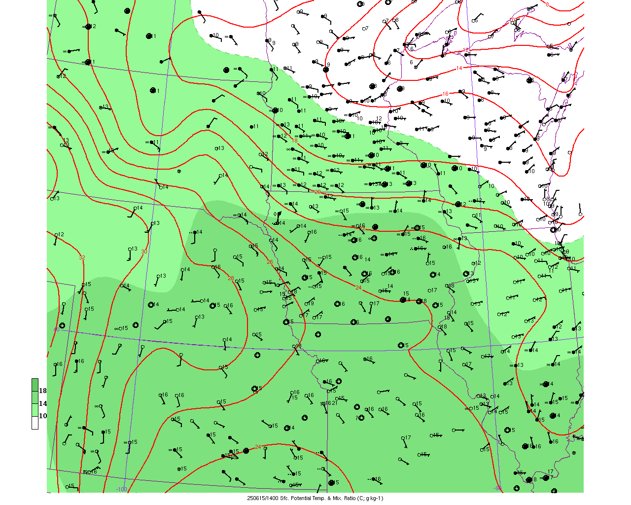
- Surface potential temperature map of IA in GIF format. Here is an animation of theta (IA) .
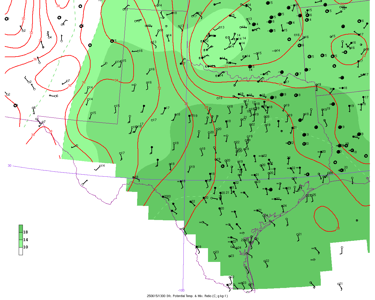
- Surface potential temperature map of TX in GIF format. Here is an animation of theta (TX) .
- Surface mixing ratio map of US in GIF format. Here is an animation of mixing ratio (US) .
- Surface mixing ratio map of NY in GIF format. Here is an animation of mixing ratio (NY) .
- Surface mixing ratio map of MA in GIF format. Here is an animation of mixing ratio (MA) .
- Surface mixing ratio map of IA in GIF format. Here is an animation of mixing ratio (IA) .
- Surface mixing ratio map of TX in GIF format. Here is an animation of mixing ratio (TX) .
UPPER-AIR MAPS
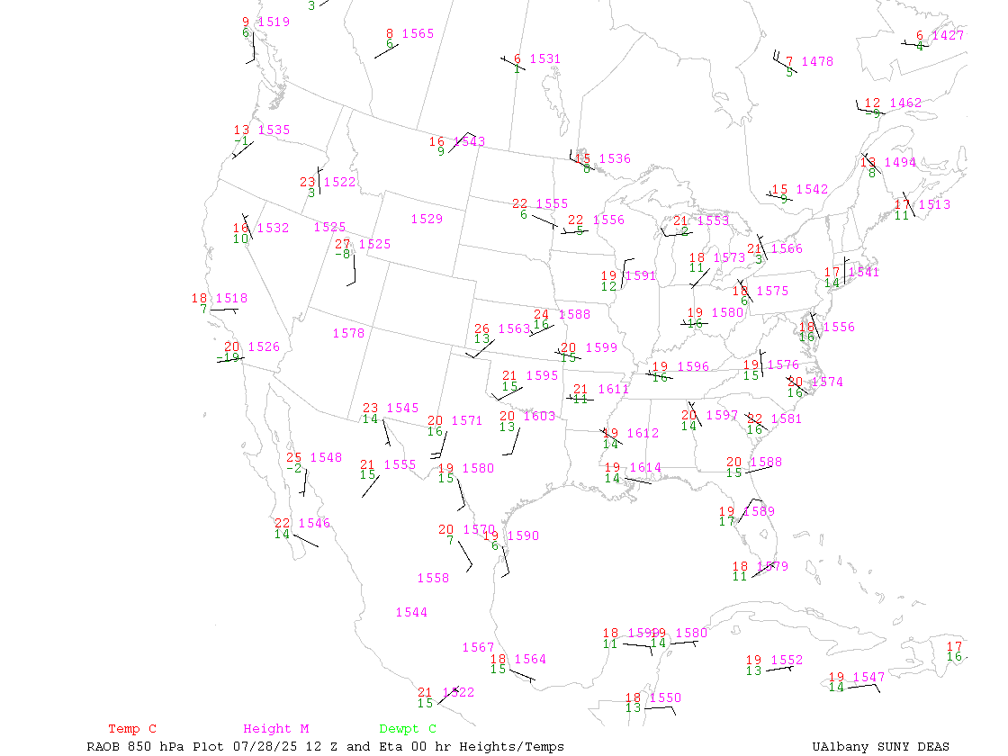
- 850 hPa data plot of United States with NAM 00hr forecast contours
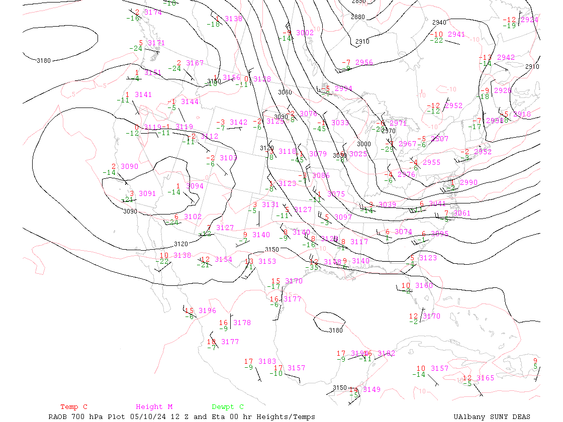
- 700 hPa data plot of United States with NAM 00hr forecast contours
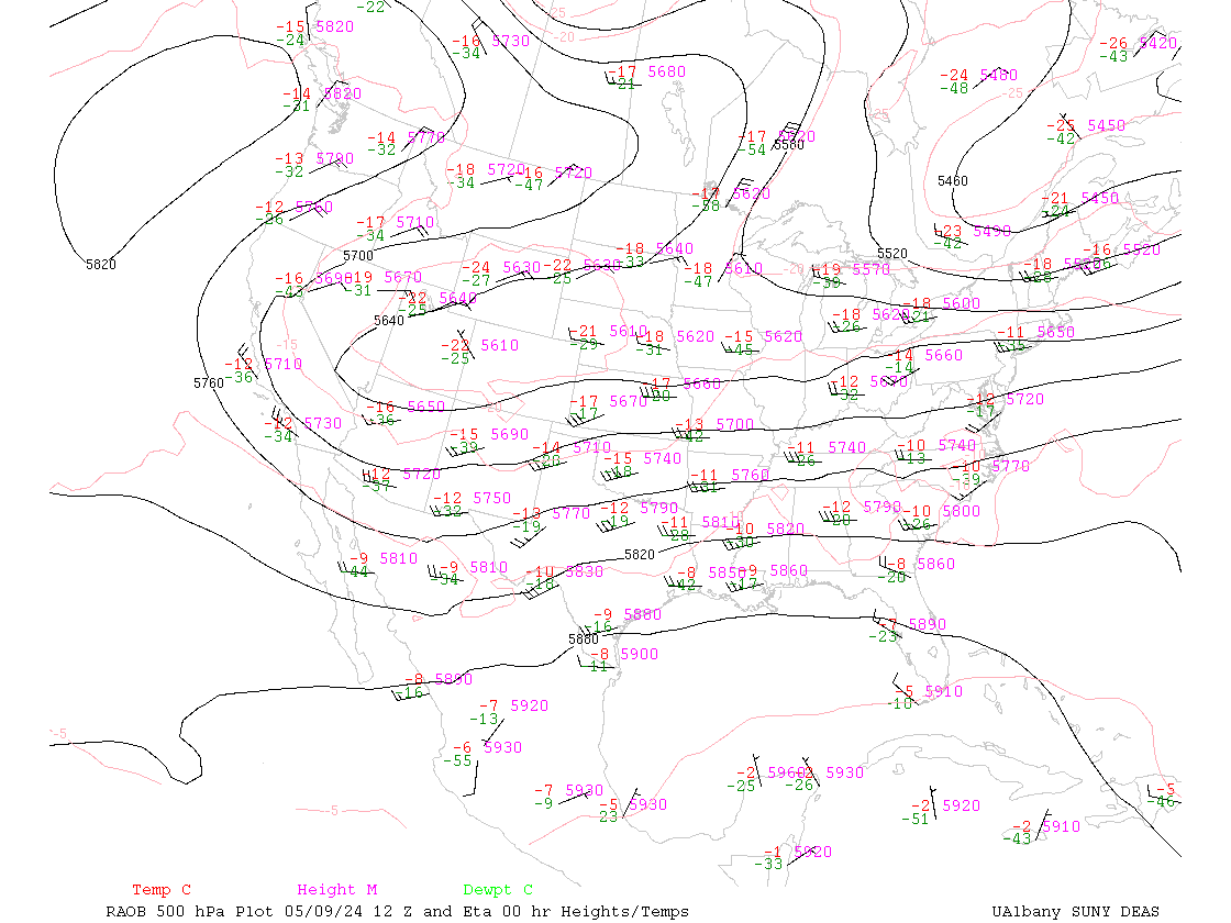
- 500 hPa data plot of United States with NAM 00hr forecast contours
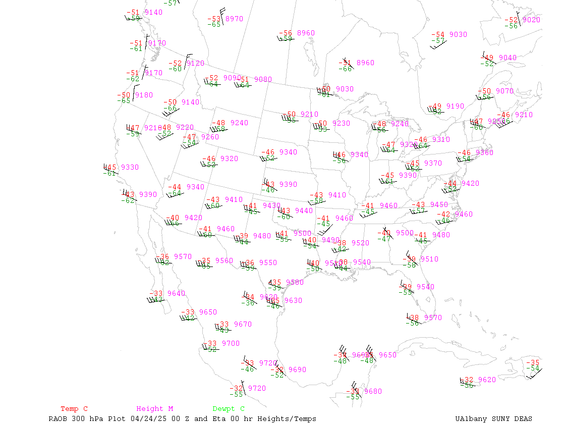
- 300 hPa data plot of United States with NAM 00hr forecast contours
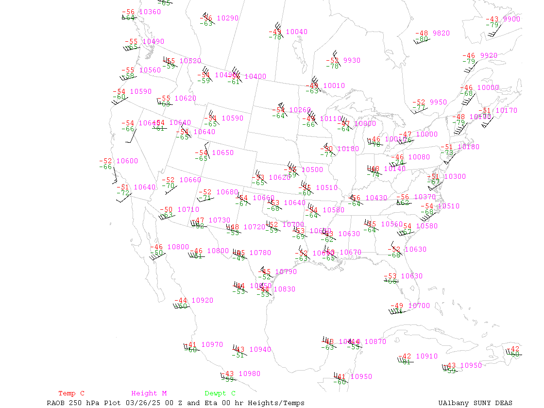
- 250 hPa data plot of United States with NAM 00hr forecast contours
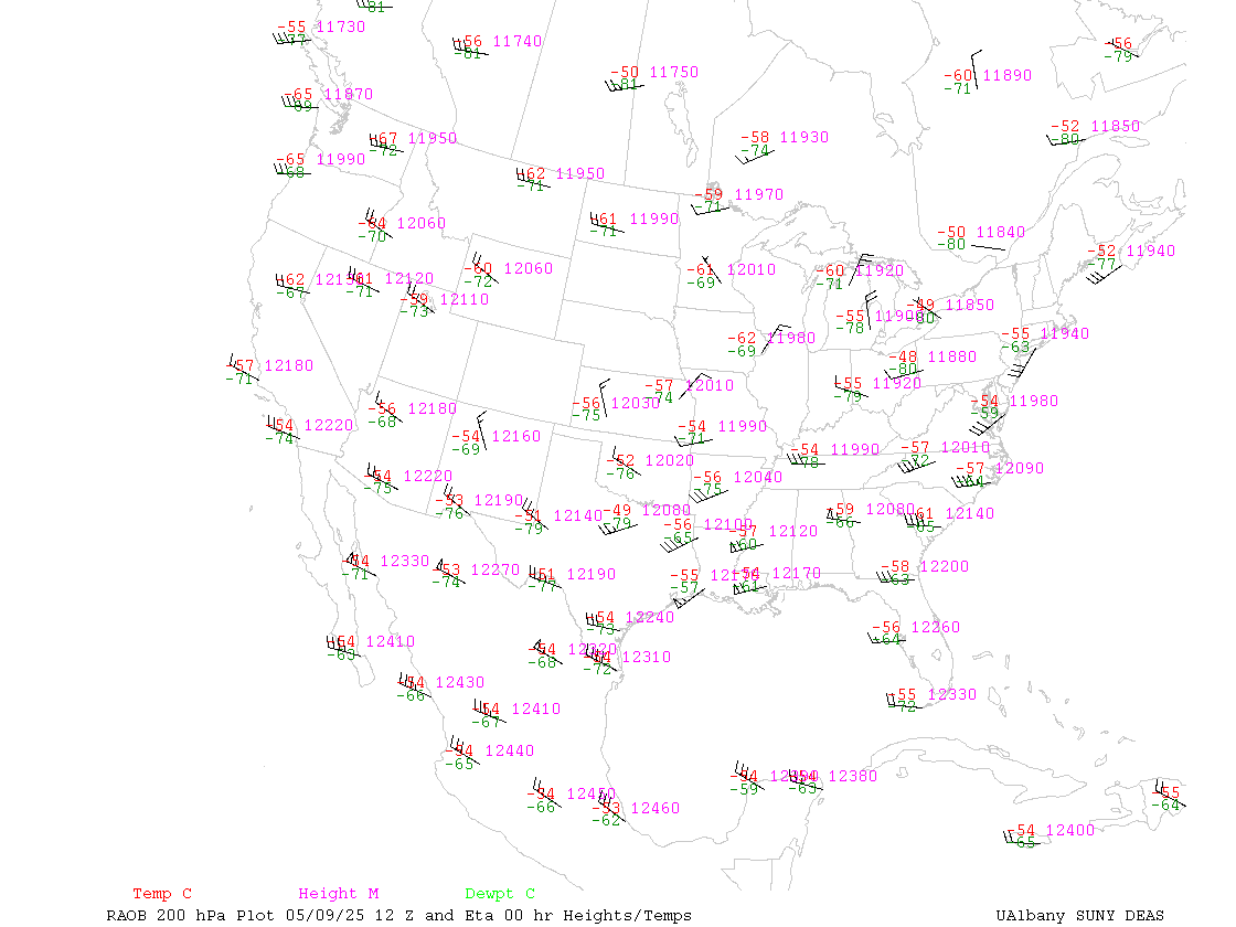
- 200 hPa data plot of United States with NAM 00hr forecast contours
VARIOUS LEGACY FAX AND PAPER MAPS
SOUNDINGS
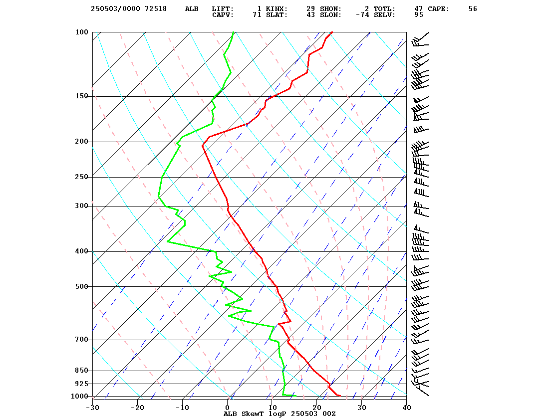
- ALBANY, NY 0000 UTC Sounding
- ALBANY, NY 1200 UTC Sounding
- Most Recent Albany Sounding
- Plotted Sounding from Ohio State
- Plotted Sounding Locally generated
- Other United States Soundings
- Plotted Soundings Locally generated (maybe one day we'll add a fancy image map)


