
(Source: CPC, click image for website)
Velocity Potential

(Source: CPC, click image for website)
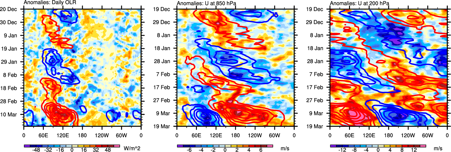
(Source: CICS-NC, click image for zoom and U200 hPa anomalies)
Associate Scientist
Cooperative Institute for Marine and Atmospheric Studies (CIMAS) | University of Miami (UM)
Hurricane Research Division (HRD) | NOAA's Atlantic Oceanographic and Meteorological Laboratory (AOML)
Disclaimer: The graphics I have compiled here from other sources are for informational purposes only and are presented in a way to give an at-a-glance view. While the graphics on this page are updated automatically from various sources, there is no guarantee that they will always be up to date or accurate, especially since some are experimental products. In regards to TC information, always visit the National Hurricane Center and the National Weather Service for the latest official advisories and warning information. Also, as the products here are from other sources, for more information please visit the corresponding websites by either clicking on the image or clicking on the provided link below the image.
(Source: CPC, click image for website)
Velocity Potential
(Source: CPC, click image for website)
(Source: CICS-NC, click image for zoom and U200 hPa anomalies)

(Source: CPC, click image for website)

(Source: IRI, click image for website)