|
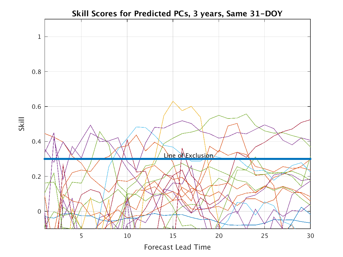
Skill of the Network for Each PC Retained (Updated nightly)
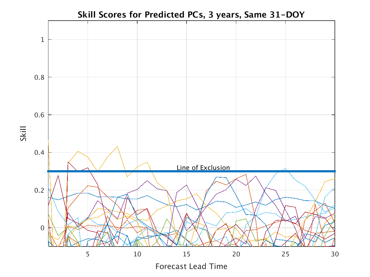
Skill of the Network hfor Each PC Retained (Updated nightly with the GLOBAL PCs)
(Skill is benchmarked against climatology: The zero anomaly for each PC, and it is assessed for 31 forecasts in each of the last 3 years beginning each day from 15 days before to 15 days after the present day of year).
|
|
 Click here for a paper that describes the updated improved version of the