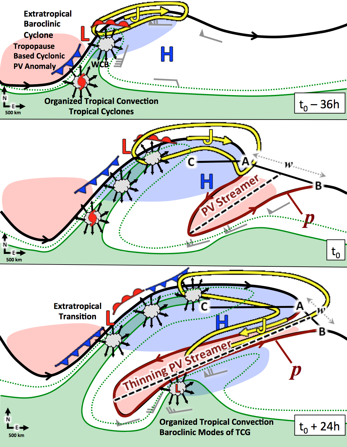
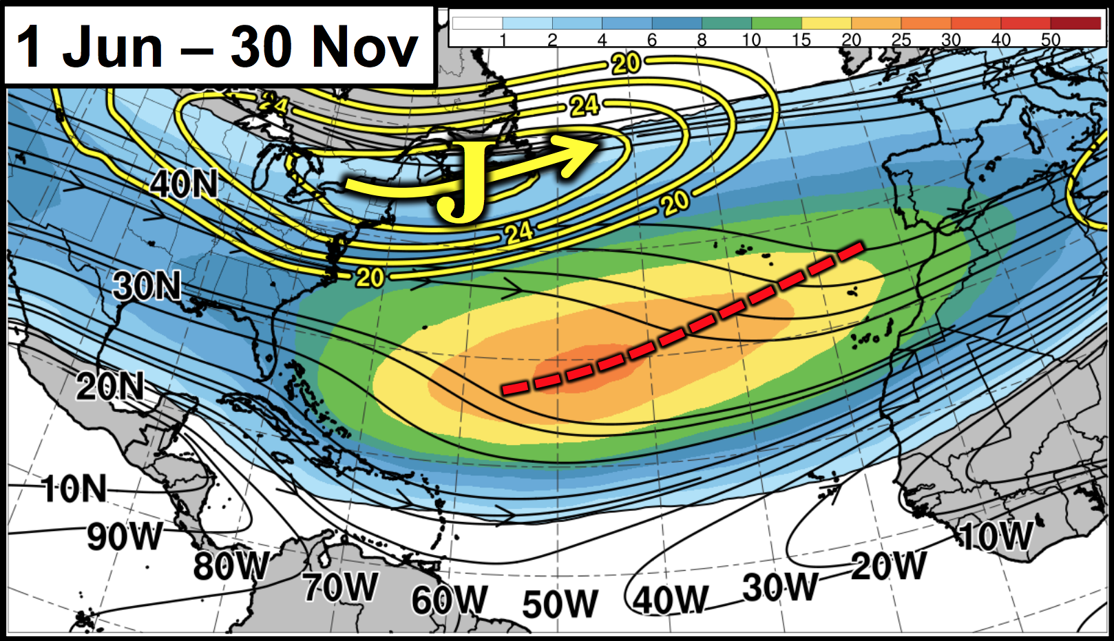
Potential vorticity streamers (PVSs) are elongated filaments of high PV air that frequently occur
in the subtropical Atlantic basin, and occur in conjunction with anticyclonic wave breaking (AWB), when low PV air folds over high PV air.
PVSs modify the nearby tropospheric environment by enhancing vertical wind shear (VWS) and moisture anomalies in their vicinity.
These environmental changes in VWS and moisture often impact tropical cyclone (TC) activity in the Atlantic basin.
This research is motivated by knowledge that PVS climatologies have not examined how these environmental variables change as
PVSs fluctuate in intensity during the TC season, which then affects seasonal TC activity in the Atlantic basin.
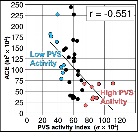
This study investigates PVSs in the Atlantic basin using the CFSR and ERA-Interim reanalysis from 1979–2015. PVSs are identified using an algorithm from June–November on the 350-K isentropic surface bounded by the 2-PVU contour, where PVSs are identified as the high PV trough downstream of the AWB axis. PVSs are then sorted into strong and weak intensity cases using their standardized PV anomaly averaged within the PVS area. Before formation, strong PVSs possess stronger upstream ridge growth, while after formation strong PVSs have higher VWS anomalies and lower precipitable water anomalies compared to weak PVSs. To assess the impact PVSs intensity has on TC activity, a seasonal PVS activity metric is computed, which combines PVS size, intensity, and duration during the TC season. In general, seasons with larger and stronger PVSs are negatively correlated with TC activity, while seasons with more cases of weak PVSs are positively correlated with TC activity. These factors are likely attributed to environmental differences in VWS and moisture that occur between strong and weak PVSs.
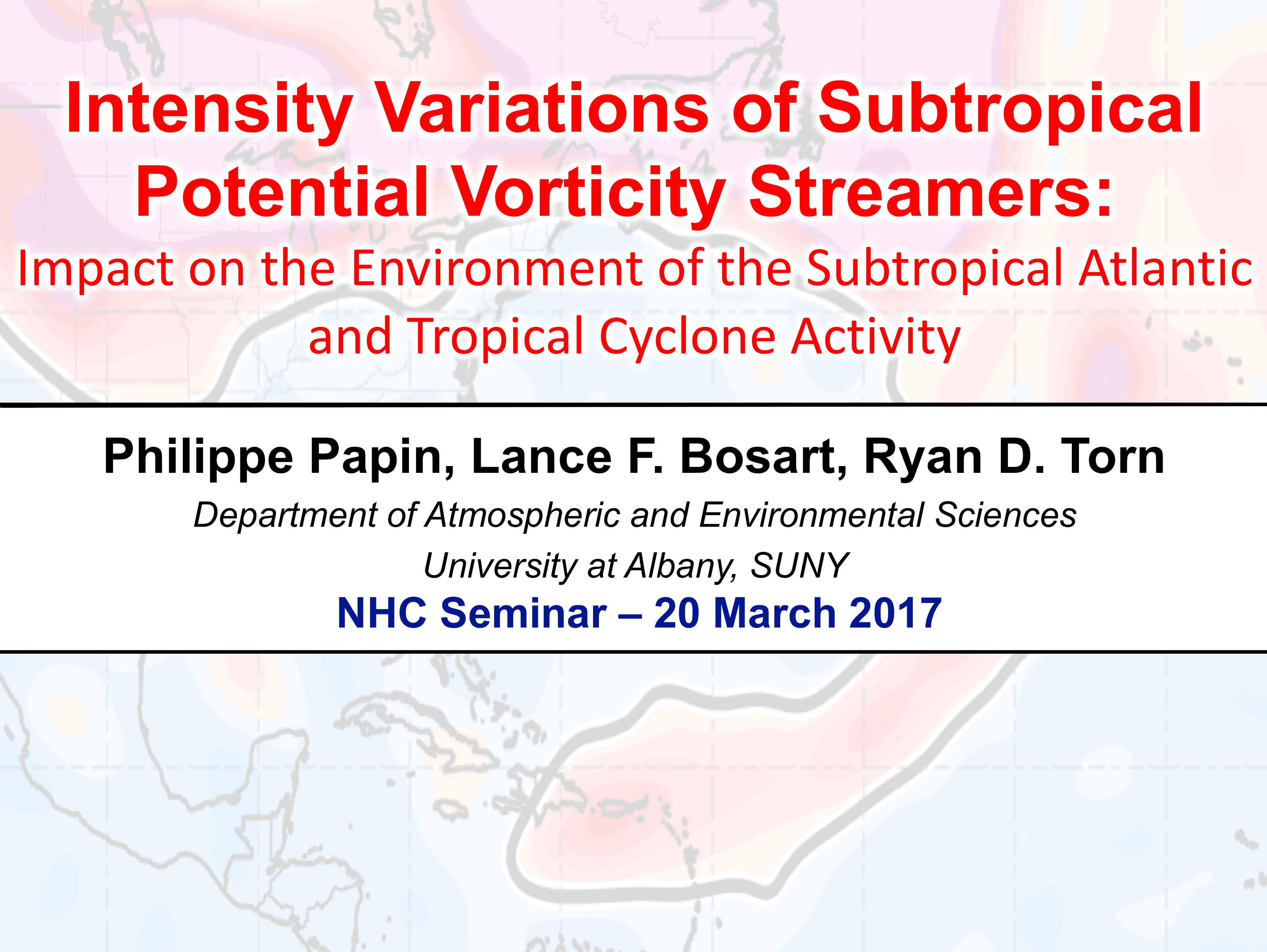
I recently gave a seminar presentation related to this particular topic at the National Hurricane Center in March 2017. You can view a video of the presentation below:
Abstract:[link]
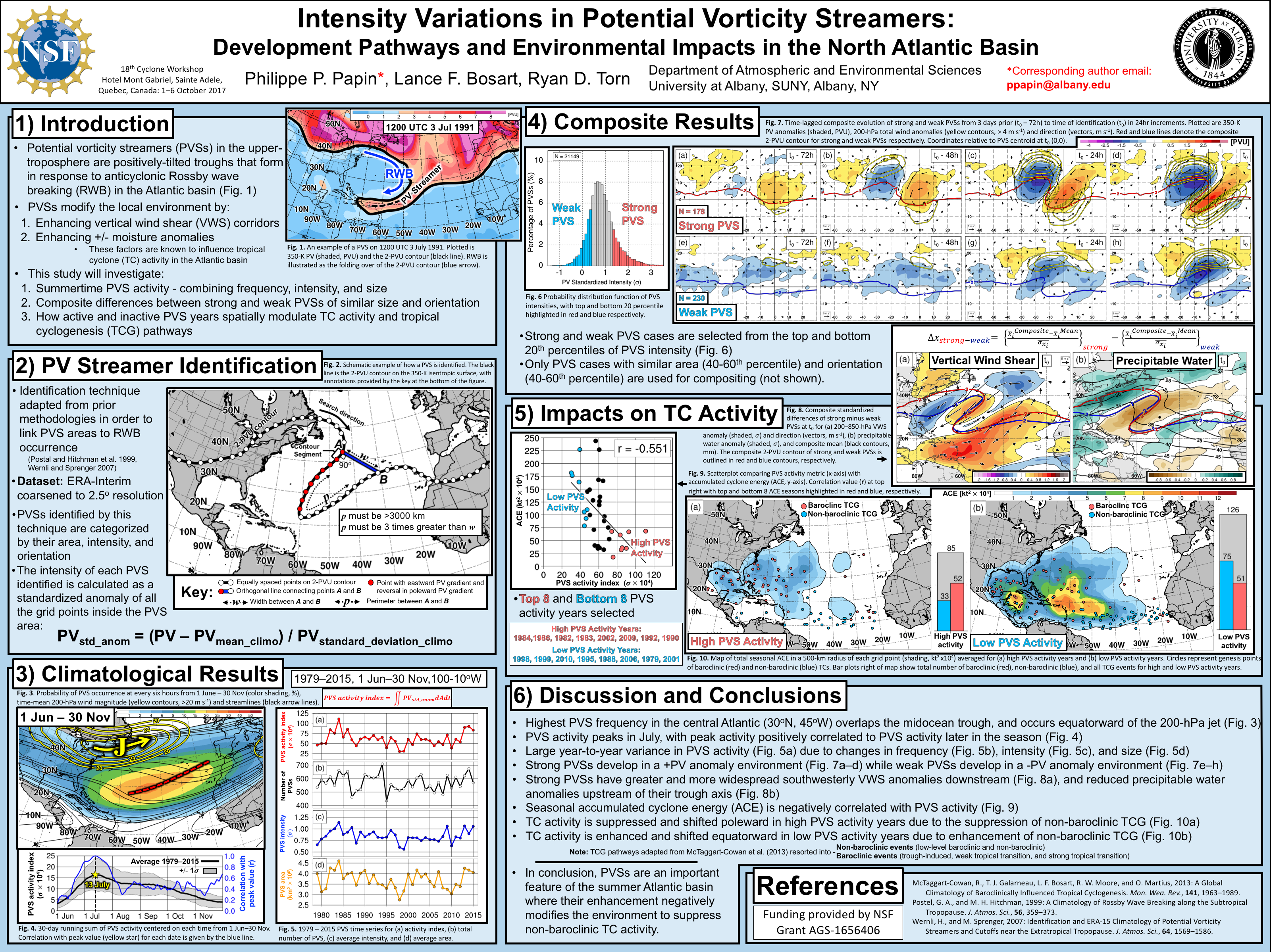
I also presented a poster related to this topic at the 18th Cyclone Workshop in Sainte Adele Quebec, Canada in October 2017. In this poster, I focus on intensity variations in PV streamer
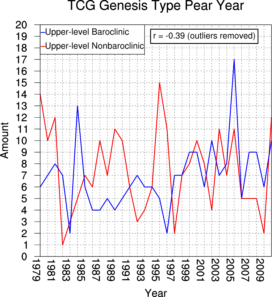
activity, focusing on their seasonal role in impacting tropical cyclone activity. In summary, there is a significant negative correlation between PV streamer activity in the Atlantic basin and
tropical cyclone (TC) activity, which in linked to a reduction in non-baroclinic type TCG pathways.
Abstract:[link]
This study investigates PVSs in the Atlantic basin using the CFSR and ERA-Interim reanalysis from 1979–2015. PVSs are identified using an algorithm from June–November on the 350-K isentropic surface bounded by the 2-PVU contour, where PVSs are identified as the high PV trough downstream of the AWB axis. PVSs are then sorted into strong and weak intensity cases using their standardized PV anomaly averaged within the PVS area. Before formation, strong PVSs possess stronger upstream ridge growth, while after formation strong PVSs have higher VWS anomalies and lower precipitable water anomalies compared to weak PVSs. To assess the impact PVSs intensity has on TC activity, a seasonal PVS activity metric is computed, which combines PVS size, intensity, and duration during the TC season. In general, seasons with larger and stronger PVSs are negatively correlated with TC activity, while seasons with more cases of weak PVSs are positively correlated with TC activity. These factors are likely attributed to environmental differences in VWS and moisture that occur between strong and weak PVSs.
Seminar Presentation given at National Hurricane Center
(April 2017)
(Click the image to view PDF presentation)
Poster Presentation given at the 32nd Conference on Hurricanes and Tropical Meteorology
(October 2017)
(Click the image to enlarge)

